
Are you looking for your next hiking adventure? The Pukaskwa Coastal Trail offers a unique and challenging trail alongside the spectacular Lake Superior. A hidden gem in Northern Ontario, the Pukaskwa Coastal Trail is a must-do for backcountry enthusiasts who want to get away from it all, with many kilometres of rugged coastline and pristine wilderness to explore. Sound like something you’d enjoy? As one of the best hikes in Ontario, Pukaskwa Coastal Trail deserves to be on your list!

Last Updated: January 7, 2026
I had been eyeing the Pukaskwa Coastal Trail for quite some time. Hiking along Lake Superior crossed my mind every time I drove cross-country through northern Ontario (eight times so far). About three and a half hours from Thunder Bay, getting to Pukaskwa National Park can be a challenge for those living far away. So when I decided to drive from New Brunswick to Alberta this past summer, I knew I had to carve out a week to finally see what the Pukaskwa Coastal Trail was all about.
This post includes affiliate links. If you make a purchase through one of the links, I may receive a percentage of the sale at no extra cost to you. Thanks for your support!
Pukaskwa Coastal Trail Map
Campsite locations are approximate and subject to change. Check in with Parks Canada for up-to-date campground location information.
About Pukaskwa Coastal Trail — Backcountry Hiking in Ontario
Location: Pukaskwa National Park (about 3.5 hours from Thunder Bay)
Distance: 60 km point-to-point
Difficulty: Difficult
Elevation: Elevation regularly increases / decreases.
Time: 4 – 7 days, depending on fitness level and hiking pace.
Dog-friendly: Yes, dogs are permitted but must be kept on a leash.
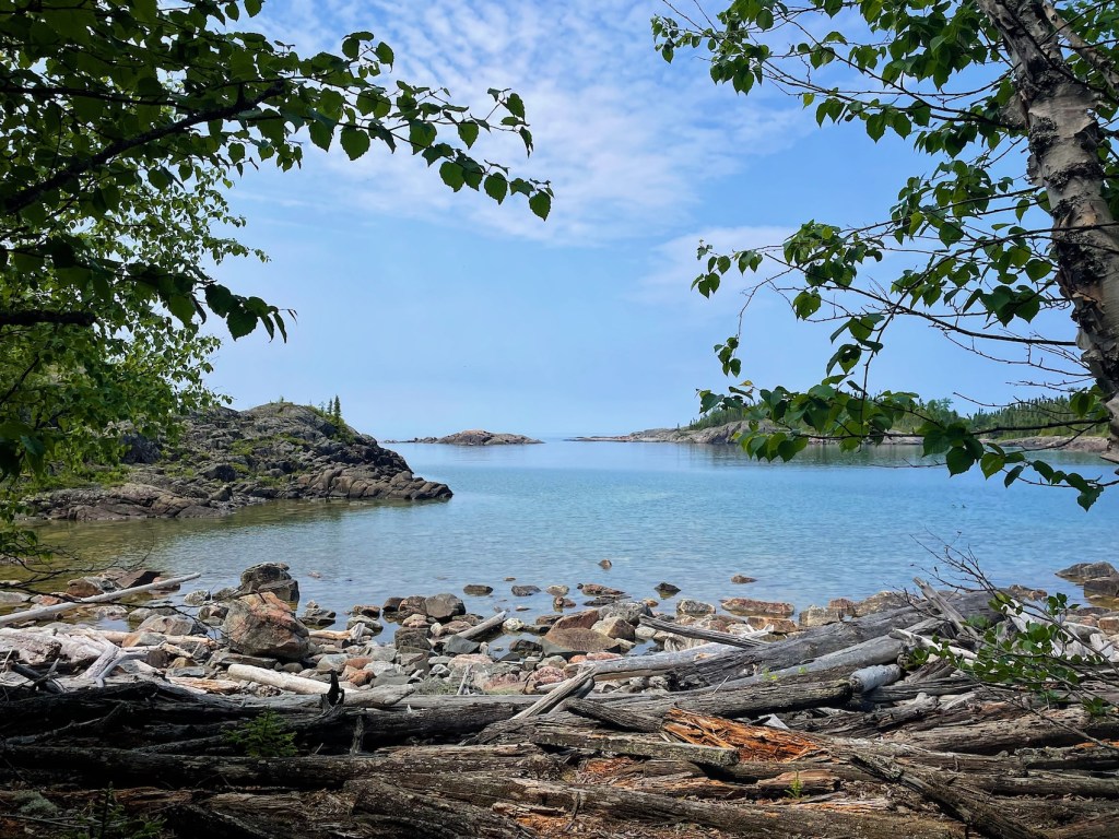
Features: A rugged wilderness adventure, Pukaskwa Coastal Trail is full of spectacular scenery with frequent views of Lake Superior in the Canadian Shield. Hikers will experience dense boreal forest and ancient granite bedrock on the shoreline, with several backcountry campsites along the way. This challenging coastal terrain can become more hazardous in the rain. Be prepared for slippery rocks and roots, steep inclines, and small river crossings. It’s these challenging yet rewarding features that make this one of the best hikes in Ontario!
UPDATE: Reservations for the 2026 season for Pukaskwa National Park, including the Pukaskwa Coastal Trail backcountry campsites, will launch on Monday, February 2, 2026 at 8am ET.
Pukaskwa Coastal Trail FAQs

Q. How do you pronounce Pukwaska National Park?
A. The correct pronunciation of “Pukaskwa National Park” is “Puk-a-saw.”
Q. Where is the Pukaskwa Coastal Trail located?
A. The Pukaskwa Coastal Trail is found in Pukaskwa National Park, on the northeastern shore of Lake Superior about 3.5 hours east of Thunder Bay.
Q. How difficult is the Pukaskwa Coastal Trail?
A. The Pukaskwa Coastal Trail is a rugged backcountry trail. Some sections of the trail are relatively easy, while other sections are more challenging. Overall, the full Pukaskwa Coastal Trail is considered a difficult route and hikers should be prepared and self-sufficient.
Q. What’s the best way to hike the full Pukaskwa Coastal Trail?
A. If you want to complete the whole coastal trail, I highly recommend booking the boat shuttle from Hattie Cove (Registration Centre) to North Swallow at the beginning of your backcountry adventure. Then hike back to Hattie Cove over a period of several days.
Q. Is there a boat shuttle option?
A. Yes, you can book a boat shuttle with North Shore Adventures. Remember, Lake Superior’s weather can change very quickly; be prepared for your shuttle to be delayed (or even cancelled) due to high winds and rough waters.
Q. I’m not ready for the Pukaskwa Coastal Trail. Are there shorter backpacking options?
A. Yes, Pukaskwa National Park offers shorter backpacking options to get you started. For example, you could plan to hike the Pukaskwa Coastal Trail from Hattie Cove to Oiseau Bay and then return. Or you could plan to hike the 20-km Mdaabii Miikna Trail either as a long day hike or spend a night (or two) in the backcountry. I didn’t have a chance to hike the Mdaabii Miikna loop, but it looks like a great introduction to backcountry hiking and camping.
Q. Do I need to book individual campsites or just reserve backcountry camping?
A. You need to reserve backcountry camping permits and book individual campsites. You will have designated campsites for each night of your backcountry trip.
Q. What wildlife might I see on the Pukaskwa Coastal Trail?
A. On the Pukaskwa Coastal Trail, you may encounter wildlife such as black bears, moose, wolves, and various bird species. I didn’t see much wildlife when I visited.
Q. Is there cell phone coverage on the Pukaskwa Coastal Trail?
A. Cell service is very limited or non-existent on most of the trail. I suggest carrying a satellite communications device, like Zoleo, in case of emergencies.
Q. What is the best time of year to hike Pukaskwa Coastal Trail?
A. Pukaskwa Coastal Trail is open from mid-May to mid-October. If I were to go back, I would plan to hike in early or late September instead of late June. Why do I say that? The bugs — black flies, mosquitoes, AND horse flies — were absolutely BRUTAL. Thankfully, I brought lots of bug spray and a bug jacket for camp!
Q. Can I swim in Lake Superior?
A. Lake Superior is typically very cold, with an average temperature of 4°C / 39°F year-round. While some might appreciate a quick dip after a hot hiking day, most hikers won’t spend much time in the lake. Remember, hypothermia can start within 5-10 minutes.
Q. What are “Pukaskwa Pits” and where do I find them?
A. Pukaskwa pits can be found in the cobble beaches along the coast. Local elder Proddy Goodchild says, “No one knows for sure what the Pukaskwa Pits were used for. We only know that some are very old, and some are not so old.” I didn’t actually find any of these pits, but keep an eye out. If you come across one, do not move or alter the rocks.
Q. How do I prepare to hike the Pukaskwa Coastal Trail?
A. Before you go, consider whether or not you’re ready for the rugged Pukaskwa Coastal Trail. Assess your physical condition and backcountry hiking experience. Then you’ll need to consider route planning and campsite reservations. Check out Parks Canada’s Backcountry Hiking Trip Planner.
Should You Hike the Pukaskwa Coastal Trail?

Are you considering the Pukaskwa Coastal Trail? If you’re an experienced backcountry hiker and have wilderness camping experience, this could be a great option. Backcountry hikers must be completely self-sufficient and ready for a remote wilderness experience. In an emergency situation, it could take over 24 hours for help to arrive, depending on weather conditions and other factors. Carefully consider and test out your gear, and plan ahead for various scenarios. If you love rugged wilderness and are ready for a challenge, I highly recommend this 60-km point-to-point trail.
Read next: Your Complete Guide to Hiking the West Coast Trail

When Should You Hike Pukaskwa Coastal Trail?
Are you deciding when to book Pukaskwa Coastal Trail? From my experience, hiking at the end of June meant dealing with swarms of mosquitoes, black flies, and horse flies every evening at camp (bring a bug jacket). The bugs didn’t seem as bad during the day when I was hiking; but as soon as I stopped for a little break, it was obvious that I was living in their world. If you hate dealing with bugs, I would wait until September or even October.
However, if you can handle the flies, there are some benefits to hiking in June. First, the days weren’t too hot and the evenings were pleasant temperature-wise. I only had one day of rain on the final stretch (If it’s going to rain, I say let it pour on the last day!). And if you’re looking for some solitude, I came across very few hikers during my trek and had a couple campgrounds entirely to myself.

How To Book the Pukaskwa Coastal Trail
Book your backcountry reservation and campsites on the Parks Canada reservation website or by calling 1-877-RESERVE (1-877-737-3783). I suggest making your reservation as early as possible, especially if you’re planning a trip during peak summer months. Campsites are limited and can book up quickly. When you go to make your reservation, you’ll need to specify trip dates and choose specific backcountry campsites for each night.
Remember, backcountry camping in Pukaskwa National Park requires a permit, which you’ll purchase through your campsite reservation. When you arrive in the park, pick up your backcountry permit and carry this with you for the duration of your hike.
Read next: Your Complete Guide to Hiking in Tombstone Territorial Park
How Much Does Pukaskwa Coastal Trail Cost?
Here are some of the costs associated with hiking Pukaskwa Coastal Trail. The boat shuttle from Hattie Cove to North Swallow is one of the most expensive items (if that’s the option you choose). If hiking solo or in a small group, consider joining another group’s shuttle, if possible, to keep the cost between $200-300 per person. North Shore Adventures has a minimum dollar amount per shuttle that must be met for each trip.
| Expense | Cost (Approx.) |
|---|---|
| Backcountry Camping Fee | $12.75 / person / night |
| Reservation Fee | $11.50 |
| Hattie Cove – Unserviced Site (First come, first served) | $30 |
| Boat Shuttle (Hattie Cove to North Swallow) | $250 (plus tax) per person. Contact North Shore Adventures for pricing. |
| Food and Supplies | Varies (personal preferences, trip duration) |
| Transportation | Varies |

Mandatory Orientation Session
Before I arrived in Pukaskwa National Park, I was required to attend a mandatory online orientation with Parks Canada staff. This orientation was an opportunity to learn more about the Pukaskwa Coastal Trail, including current trail conditions and updates, wildlife in the park, visitor safety, and general expectations. This past summer, virtual orientations were offered on Thursday, Saturday, and Sunday, and you could choose which session to attend. If Parks Canada continues in the same way, you will receive an email invitation to the virtual orientation after making your backcountry reservation.
Read next: Your Complete Guide to the Long Range Traverse in Newfoundland

How To Get To Pukaskwa National Park

If you’re travelling from Toronto, reaching the Pukaskwa Coastal Trail is a long but scenic drive north along Georgian Bay to Sudbury, then west on the Trans Canada Highway. Expect the journey to take roughly 12 to 13 hours, depending on conditions. If you’re coming from outside Ontario, flying into Thunder Bay and driving about 3.5 hours to Pukaskwa National Park is your best option. You’ll find several accommodation options in Thunder Bay if you need a place to stay before or after your hike. While Pukaskwa isn’t the easiest park to access, that remoteness is part of the appeal — and a big reason why this is some of the best hiking in Ontario!
Read next: The Grotto Hike in Bruce Peninsula National Park
Where to Stay Near Pukaskwa National Park (Before & After Your Hike)
Because the Pukaskwa Coastal Trail is a remote backcountry hike, most accommodation options are focused on where you’ll stay before and after your trip (instead of along the trail itself). Whether you’re camping at Hattie Cove Campground inside Pukaskwa National Park or staying in the nearby town of Marathon for a proper bed and hot shower, you’ll be surrounded by rugged Lake Superior coastline and northern landscapes. Wherever you stay, plan to arrive with enough time to pick up permits and catch the boat shuttle if needed.
Pukaskwa National Park Camping — Hattie Cove Campground

If you need a place to stay before starting the Coastal Trail, why not pitch a tent in Hattie Cove Campground in Pukaskwa National Park? Hattie Cove has first come, first served tent sites, with flush toilets and showers, potable water, and fire pits in the campground. Arrive early if you can during peak season, and register at the Parks Canada kiosk. Bring everything you need with you or head to Marathon to pick up last-minute supplies (30 minutes from the park). In case you’re wondering, I didn’t have any cell service in Pukaskwa National Park.

Boat Shuttle — North Shore Adventures
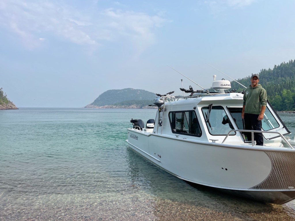
Are you planning to hike the entire Pukaskwa Coastal Trail? You can either a) Hike from Hattie Cove to North Swallow and back in a total of 120 km or b) Take the boat shuttle to North Swallow and hike back to Hattie Cove in 60 km. Given my time available, I opted for the boat shuttle to North Swallow which takes between 1 to 3 hours depending on weather.
North Shore Adventures offers boat shuttle services for backpackers in Pukaskwa National Park. To book your shuttle service, you can email Doug or call 1-807-228-0709. Last year, an individual shuttle cost $250 (plus tax) and the shuttle had a minimum cost of $750, regardless of the number of passengers on board. As a solo hiker, I booked with a group and paid $250 for the shuttle. Contact North Shore Adventures for up-to-date pricing and availability.
Note: Doug runs a tight ship to get you to the trailhead. Show up at least 15 minutes before your shuttle’s scheduled departure. Arrive early and don’t miss your boat!

4-Day Pukaskwa Coastal Trail Itinerary — One of the Best Hikes in Ontario

Day 1 — North Swallow to White Gravel River (Campsite #2) – 15 KM
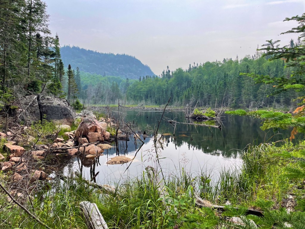
After an hour and a half on the boat shuttle, this leg of the journey takes you from the southern trailhead at North Swallow to the White Gravel River area. The trail heads through the forest, past Hideaway Lake (with a creek crossing) and White Spruce Harbour Campgrounds, and up and down the ancient bedrock on Lake Superior’s shoreline. White Gravel River Campground offers a scenic place to rest on the first night next to the rocky shore. Arrived after 6 hours of hiking.
Day 2 — White Gravel River to Oiseau Bay (Campsite #1) – 16 KM
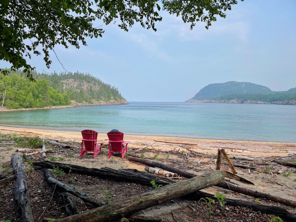
On the second day, I hiked from White Gravel River to Oiseau Bay. This section of the trail involved a creek crossing at the end of White Gravel River, followed by a long section of bedrock where you reach the highest point on the trail (310 metres above sea level). Then bedrock and forest hiking until reaching Fisherman’s Cove, with a sandy beach that made a nice lunch spot. Hiking on the granite bedrock between Fisherman’s Cove and Oiseau Bay was one of my favourite sections — Lake Superior popped with turquoise blue pulled out by the sun’s bright beam. Very scenic! Arrived at camp after 7 hours.
Day 3 — Oiseau Bay to Willow River (Campsite #3) – 18 KM
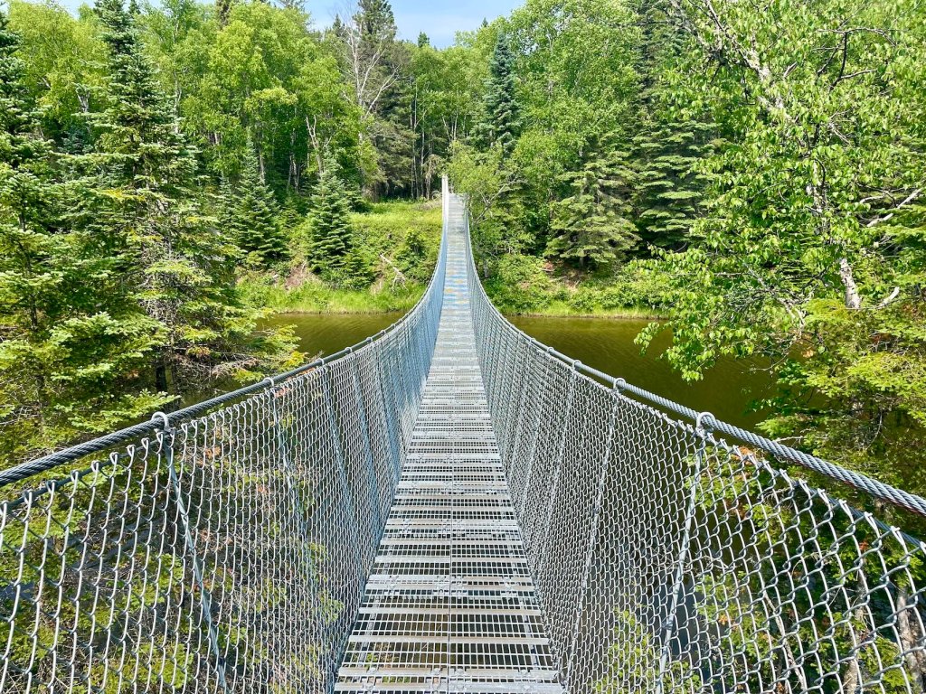
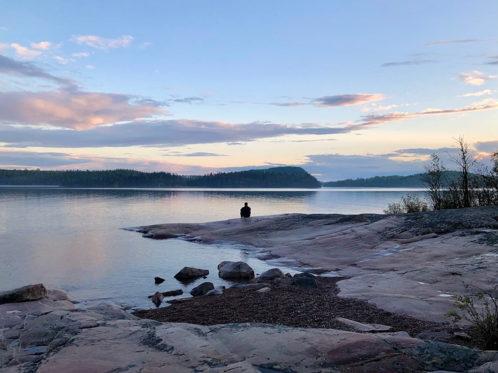
After leaving the stunning sand beach at Oiseau Bay, it was time to cross a creek and head into the forest. After about 5 km of forest walking, I found a small gorge-like entrance to the rocky shelf. Great spot for a bite to eat as I watch loons off the shore. I passed two boulder fields between Morrison Harbour and Shot Watch Cove and then passed over the Willow River Suspension Bridge. From there, it was a quick walk over to Willow River Campground. Day three views were also quite impressive, and I loved my tent site at Willow River. Arrived at camp after about 5.5 hours.
Day 4 — Willow River to Hattie Cove – 18 KM
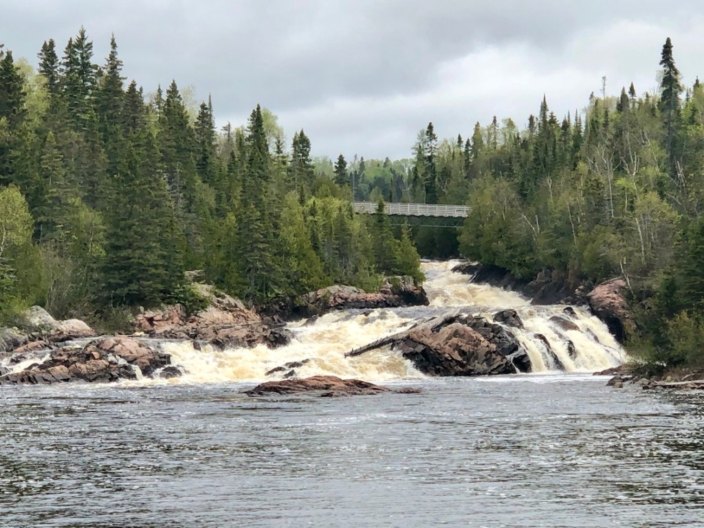
My final day started with a light sprinkle and eventually heavier rain. Hiking on the wet bedrock was particularly tricky, as I carefully walked on the slippery surfaces. Eventually, the trail darts into the rugged forest toward Hook Falls and, soon after, to the impressive Chigamiwinigum Falls. After admiring the rushing waters, I crossed over the White River Suspension Bridge for the final stretch (with lots of boardwalk) to Hattie Cove. Arrived after 5.5 hours.
Here are more trip options from Parks Canada:
10-Day Itinerary (No Shuttle; 120 KM)
Day 1 — Hattie Cove to Chigaamiwinigum Falls – 7.8 KM
Day 2 — Chigaamiwinigum Falls to Morrison Harbour – 14.2 KM
Day 3 — Morrison Harbour to Fisherman’s Cove – 15.7 KM
Day 4 — Fisherman’s Cove to White Spruce Harbour – 10.2 KM
Day 5 — White Spruce Harbour to North Swallow – 10.8 KM
Day 6 — North Swallow to White Gravel River – 13.9 KM
Day 7 — White Gravel River to Fisherman’s Cove – 7.1 KM
Day 8 — Fisherman’s Cove to Fish Harbour – 12.3 KM
Day 9 — Fish Harbour to Willow River – 9 KM
Day 10 — Willow River to Hattie Cove – 16.4 KM
5-Day Itinerary (Half Trail; 60 KM)
Day 1 — Hattie Cove to Chigaamiwinigum Falls – 7.8 KM
Day 2 — Chigaamiwinigum Falls to Morrison Harbour – 14.2 KM
Day 3 — Morrison Harbour to Oiseau Bay – 8.5 KM
Day 4 — Oiseau Bay to Willow River – 14.1 KM
Day 5 — Willow River to Hattie Cove – 16.4 KM
3-Day Itinerary (Mdaabii Miikna Trail)
Day 1 — Hattie Cove to Picture Rock Harbour South – 10.15 KM
Day 2 — Picture Rock Harbour South to Playter Harbour South – 4.25 KM
Day 3 — Playter Harbour South to Hattie Cove – 9.75 KM
Read next: Your Complete Guide to Hiking Cape Chignecto Trail in NS

Pukaskwa Coastal Trail Distances

Here are the campground names, distances, and descriptions on the Pukaskwa Coastal Trail. If you want to experience the best of Pukaskwa National Park camping, I highly recommend planning a backcountry wilderness adventure. With several campgrounds to choose from, you can create a trip that works for you!
| KM | Location | Description |
|---|---|---|
| 0 | North Swallow River Campground | 1 campsite (1-6 tents), 1 outhouse, 1 food storage locker. Located south of the North Swallow River, features sandy beachfront. |
| 4 | Hideaway Lake Campground | 1 campsite (1-4 tents), 1 outhouse, 1 food storage locker. Features pebble beach area, sandy tent pad. |
| 10.8 | White Spruce Harbour Campground | 1 campsite (1-6 tents), 1 outhouse, 1 food storage locker. Features large, sandy beach. |
| 13.9 | White Gravel River Campground | 3 campsites (1-6 tents), 3 outhouses, 3 food storage lockers. Features large, smooth pebble beach. |
| 21 | Fisherman’s Cove Campground | 2 campsites (1-6 tents), 1 outhouse, 1 food storage locker. Private sandy beach per site. |
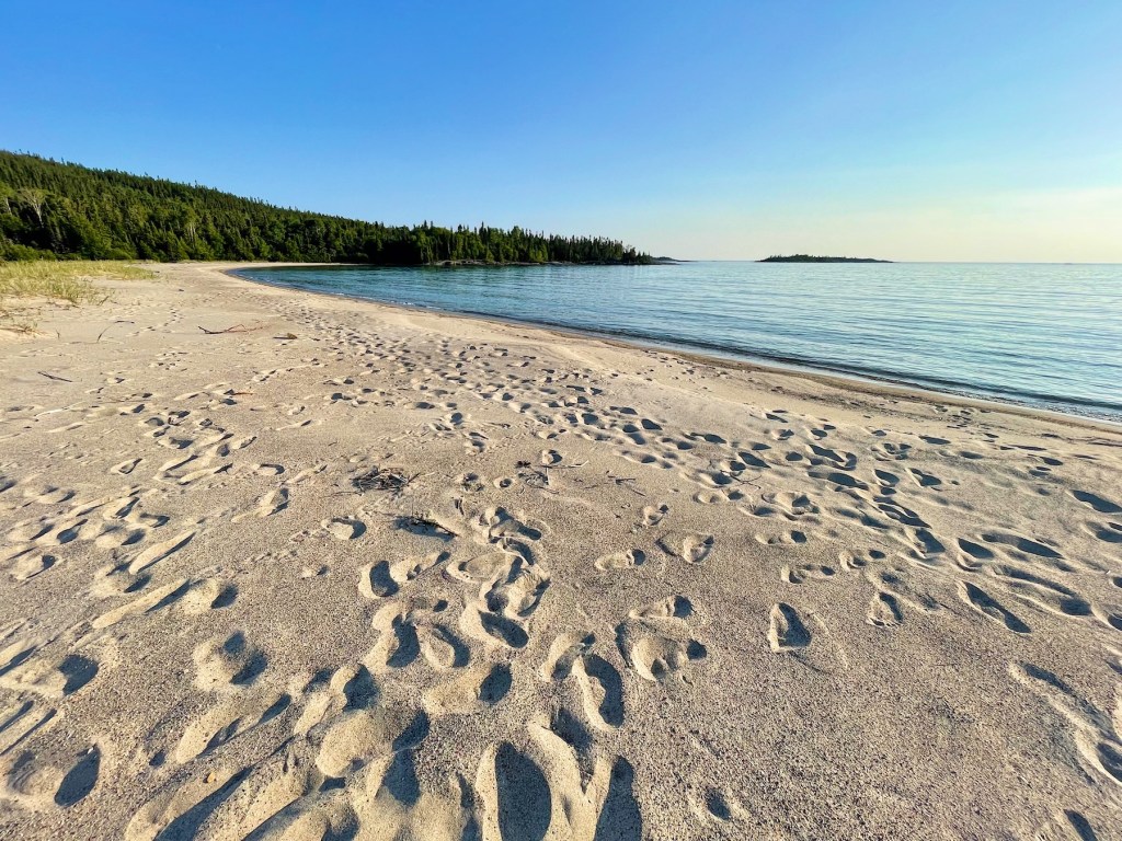
| 28.2 | Oiseau Bay Campground | 2 campsites (first 1-4 tents, second 1-6 tents), 1 outhouse, 1 food storage locker. Features longest sandy beach in the park and sheltered tent sites. |
| 33.3 | Fish Harbour Campground | 3 campsites (1-6 tents), 1 outhouse, 1 food storage locker. Features cobblestone beaches. |
| 36.7 | Morrison Harbour Campground | 2 campsites (first 1-4 tents, second 1-6 tents), 1 outhouse, 1 food storage locker. |
| 42.3 | Willow River Campground | 4 campsites (1-4 tents), 4 outhouses, 4 food storage lockers. Features beautiful sandy beach, Willow River Suspension Bridge nearby. |
| 49.9 | Hook Falls Campground | 3 campsites (1-4 tents), 1 outhouse, 1 food storage locker. Features Hook Falls and Chig Falls nearby, with views from the White River Suspension Bridge. |
| 50.9 | Chigaamiwinigum Falls Campground | 2 campsites (1-4 tents), 1 outhouse, 1 food storage locker. Features Chig Falls. |
| 54.2 | Playter Harbour North Campground | 1 campsite (1-4 tents), 1 outhouse, 1 food storage locker. |
| 58.7 | Hattie Cove |

Navigating Pukaskwa Coastal Trail

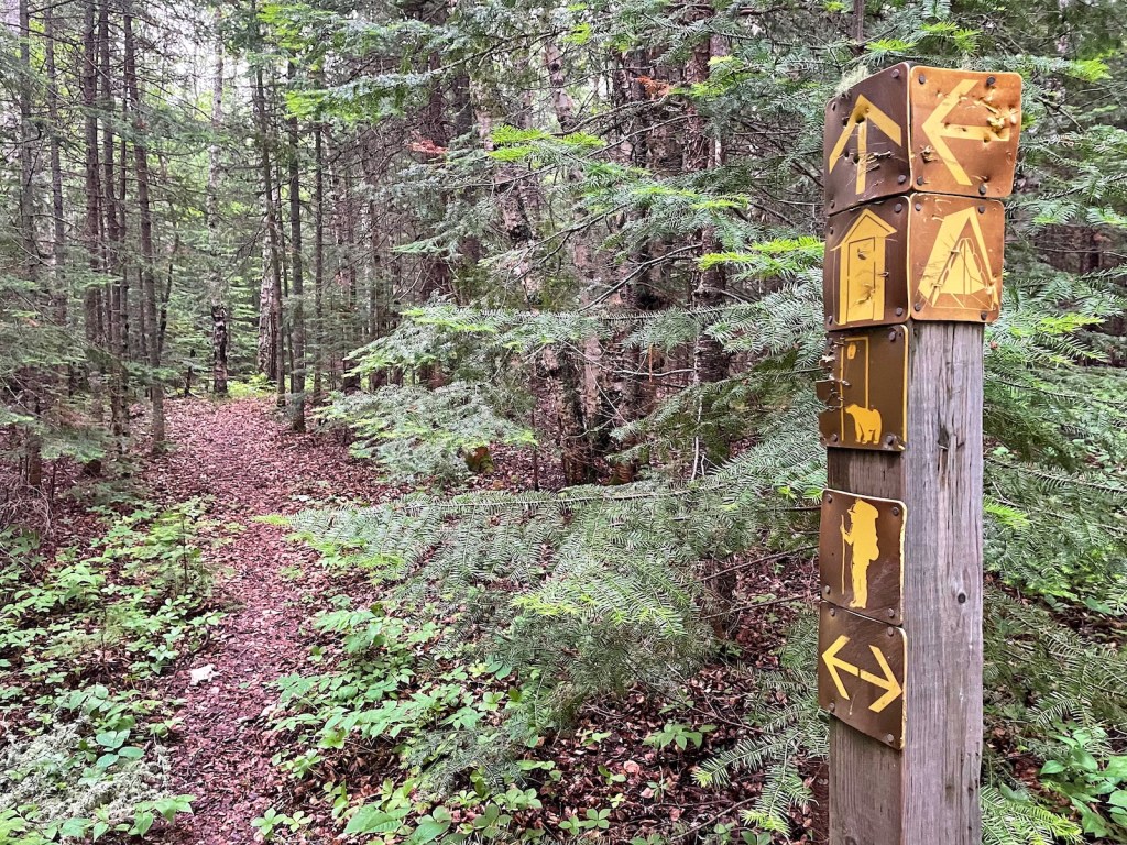
I always pack a detailed map and compass, and often a GPS as a backup when hiking the backcountry. Pukaskwa Coastal Trail is a rugged trail but fairly well maintained throughout. However, it’s not difficult to stray off trail, especially when starting out at North Swallow. Keep an eye out for rock cairns marking the way and signage to help you navigate this backcountry route.
Before you go, I highly suggest picking up a copy of Chrismar’s The Adventure Map — Pukaskwa National Park to support your navigation. You should be able to buy a copy at Pukaskwa’s Visitor Centre or kiosk, or email Parks Canada to order a copy. Not only will you have a detailed topographic map, but you’ll also find interesting facts to read in the evening. As a backup, I also found AllTrails to be useful for double-checking the route and determining campsite distances.
Read next: Lion’s Head Lookout: Beautiful Bruce Peninsula Hike in Ontario
Pukaskwa Coastal Trail Safety

Whenever you head into the backcountry, safety should be your number one priority. As a solo hiker, even a minor injury can have major consequences in the wilderness. Take your time to adequately prepare being heading out, including researching the trail and ensuring your own readiness to take on this challenging terrain. Check the weather beforehand and come prepared for what you might face. Additionally, make sure you know how to safely store food and handle bear and wildlife encounters, if necessary.
If you’re new to backcountry camping, consider hiking with a group. Make sure you inform someone you trust of your trip plan and expected return time (and what to do if you don’t return on time). Check out the AdventureSmart resource if you’re not sure what to include in your plan. Someone in your group should have formal wilderness first-aid training. Carry a basic first aid kit, adequate food and water (I brought my Osprey 2L Reservoir), and an emergency shelter in case of unexpected situations. I also recommend bringing Zoleo or another satellite communications device with an SOS function to signal for rescue in the event of a life-threatening emergency.

Meal Planning

You’ll need to carry all of your food on the Pukaskwa Coastal Trail, so plan to bring lightweight and non-perishable meals — that you enjoy! I love the convenience and easy preparation of freeze-dried meals for dinner (try Backpacker Pantry’s Lasagna – yum!). For breakfast, I tend to start each day with instant oatmeal or instant potatoes. When I stop for lunch, I typically eat something like a wrap with peanut butter and beef jerky (or something similar). To replenish energy during the day, I also like to bring snacks like nuts, trail mix, and energy chews to eat during my hike.
Hydration is another crucial aspect. Apart from carrying enough water, remember to pack a water filter or purification tablets to refill from natural streams or Lake Superior. You can either filter, purify, or boil water when preparing your meals.
Read next: Keji Southern Lakes: 4 Days of Canoeing in Nova Scotia

Toilets

What happens when you need to go “number two” on the Pukaskwa Coastal Trail? Good news: Basic outhouses are located near each designated campground. Remember, do not dispose of garbage, feminine hygiene products, or food waste in outhouses. Plan to carry these things out with you. When nature calls and you’re not near an outhouse, you gotta plan to bury your waste and carry a trowel with you. Dig a small hole about 6 to 8 inches deep, and at least 200 metres away from trails, campsites, and water sources.

Pukaskwa National Park Wildlife

On the Pukaskwa Coastal Trail, you can encounter various types of wildlife including black bears, moose, wolves, and diverse birdlife. Aside from loons offshore and a single grouse on the trail, I didn’t see much wildlife during my backcountry trip. That being said, Pukaskwa National Park is in bear country and it’s essential to prepare for a possible encounter. Whether you’re hiking alone or in a group, make noise to avoid startling animals (especially bears). Always keep a safe distance from wildlife and never feed wild animals in the park. Remember to store food and attractants (scented items like toothpaste) in the bear-proof lockers at camp. Carry bear spray and know how to use it.
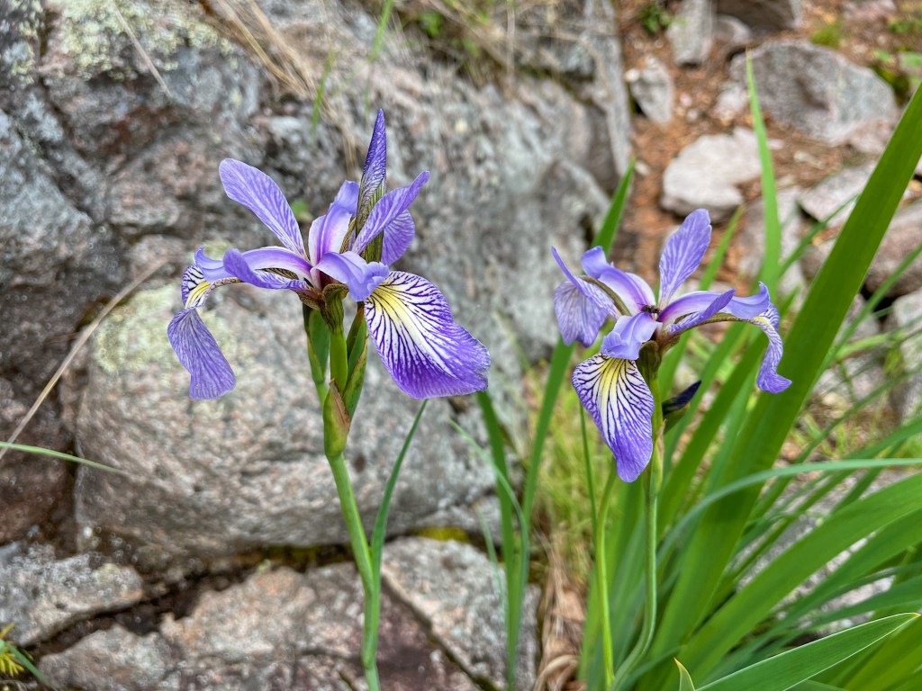
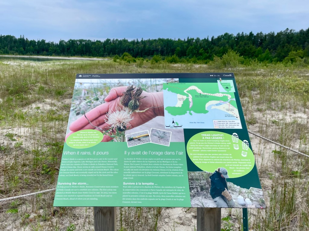
Trees and plants are wildlife, too! Next to Oiseau Bay Campground, Parks Canada is preserving the endangered picture thistle plant in a marked-off area. Do your part to help maintain the natural environment by sticking to the trail and following Leave No Trace principles to limit human impact on the area.
Read next: King Mountain Hike in Gatineau Park in Quebec
Pukaskwa Coastal Trail Packing List

Here is my packing list:
- Osprey Atmos 50L Pack
- Waterproof pack cover
- MSR Hubba Hubba
- MEC Talon sleeping bag
- Therm-a-rest NeoAir
- Sleeping bag liner
- Siltarp
- Camp shoes
- Scarpa hiking boots
- Arc’teryx Beta LT rain shell
- Rain pants
- Jetboil Flash
- Stove fuel
- Campsuds soap
- Osprey 2L reservoir
- Nalgene water bottle
- Komperdell hiking poles
- Lighter / matches
- GSI mug
- Spoon
- Sunscreen
- Sunglasses
- Bug spray
- Bug jacket
- Toilet paper
- Towel
- Toothbrush / toothpaste
- MSR TrailShot filter
- Headlamp
- Paracord
- Buff
- Mora Knife
- First aid kit
- Leukotape (for blisters)
- 2 merino wool t-shirts
- 1 long sleeve (love this Patagonia Capilene)
- 1 pair of pants
- 2 pairs of shorts (1 for hiking; 1 for camp)
- 1 merino leggings
- 3 pairs of merino underwear (1 for hiking; 1 for camp; 1 extra)
- 2-3 merino socks (1 for hiking; 1 for camp; 1 extra)
- Down jacket (love this Patagonia down sweater jacket)
- Warm hat and gloves
- Map / compass
- Satellite comms
- Powerbank
- Camera
- Food
- Bear spray

Pukaskwa National Park Rules and Regulations

Backcountry permit: You must obtain a backcountry permit before starting your trek.
Camping: There are no first come, first served campsites along the Pukaskwa Coastal Trail. Reserve your individual campsites before arriving in the park. No more than 8 people per campsite. Do not camp outside of designated campsites (except in the case of an emergency).
Fires: Use the fire pit provided in the campsite and follow fire ban restrictions when in place. Do not use material from live trees and plants (bark, twigs, or any type of green wood) for fires.
Dogs: You can bring your four-legged friend on the Pukaskwa Coastal Trail. However, remember that dogs must remain on leash at all times.
Wildlife: Do not feed, harass, or harm wildlife in Pukaskwa National Park.
Pack It Out: Do not leave any garbage or gear at campsites or along the trail or water routes.
Take Nothing But Photos: In Pukaskwa National Park, visitors are prohibited from collecting or disturbing plants, animals, rocks, shells, or artifacts.
Pukaskwa Pits: Pukaskwa pits can be found in the cobble beaches along the coast. Help protect these ancient structures. Do not move rocks or alter the pits.
Have you hiked the Pukaskwa Coastal Trail in Ontario? Are you planning your trip soon? Leave a comment below!
Save this for later? Hover over the image to add to Pinterest 👇

Thomas Coldwell has always been fond of the outdoors. He loves hiking, paddling, and camping, and thoroughly enjoys creating outdoor adventure resources for people like you. Originally from Nova Scotia, Thomas has lived in four Canadian provinces (NS, NB, ON, AB) and has travelled in 20 countries and counting.


My friend and I are looking at doing this trail next summer. I really enjoyed the info here. Thanks for posting!
Thanks, Grace! It’s an incredible trip.