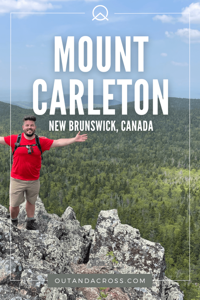
Do you want an off-the-beaten-path adventure? Check out the Mount Carleton hike in New Brunswick! Named after the highest peak in the Maritimes, Mount Carleton Provincial Park is a hidden gem for outdoor lovers, with well-maintained hiking trails and lots to explore. Don’t miss the awe-inspiring views from the ridge. Keep reading to see what I mean.
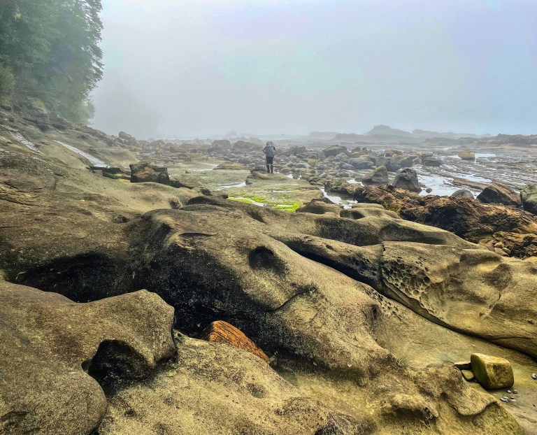
At 820 metres above sea level, Mt Carleton is the tallest mountain in New Brunswick and the Maritime provinces. Last weekend, I made my way to Mount Carleton Provincial Park to explore a new-to-me part of the province. With decent June weather, I was able to hike Mt Bailey, Mt Sagamook, and Mt Carleton — plus some shorter trails like William Falls and Pine Point. I could’ve easily spent a few more days here.
This post includes affiliate links. If you make a purchase through one of the links, I may receive a percentage of the sale at no extra cost to you. Thanks for your support!
About the Mount Carleton Hike

Location: Mount Carleton Provincial Park
Distance: 10 km loop
Difficulty: Difficult
Elevation: 420-metre elevation gain
Time: 3 – 4 hours
Dog-friendly: Yes, dogs are permitted but should remain on leash.
Features: The Mt Carleton hike features forest trails, boulders and mild scrambling, and panoramic mountain views from the summit. An old fire tower rests at the summit, where watchers used to keep an eye on the forests below.
Mount Carleton Hike Map
Mount Carleton Provincial Park

I have to say, I was surprised by Mt Carleton Park. For starters, did you know about the brand-new lodge? I sure didn’t. I loved the log-cabin vibe, cafe, wifi access, and the view of Nictau Lake. A pleasant place to sip my morning latte while waiting out the rain. I was also impressed by the variety of hiking trails, with rugged paths and gentler walking trails for everyone to enjoy.
To get the full experience, consider staying overnight in the park. I spent a couple of nights at Franklin Campground beside Nictau Lake. My campsite (F3) was equipped with a wooden tent platform, picnic table, and fire pit. Firewood was available for purchase at the lodge for $10. It’s considered a ‘hike-in’ site but only about 30 steps or so. Book your campsite online.
Read next: Split Rock Trail: One of the Best New Brunswick Hikes

Directions to the Trailhead

From Moncton, head north until reaching the small city of Bathurst — a northern hub of about 15,000 people. Follow Hwy 180 west for about 110 km and finally turn left onto Hwy 385 and continue straight for 8 km to the park. Prepare to spend about 3.5 hours in your vehicle. From Saint John, the fast route goes north through Woodstock and Perth Andover and takes just over 4 hours. Whatever route you choose, reaching Mt Carleton will require a few road trip snacks!
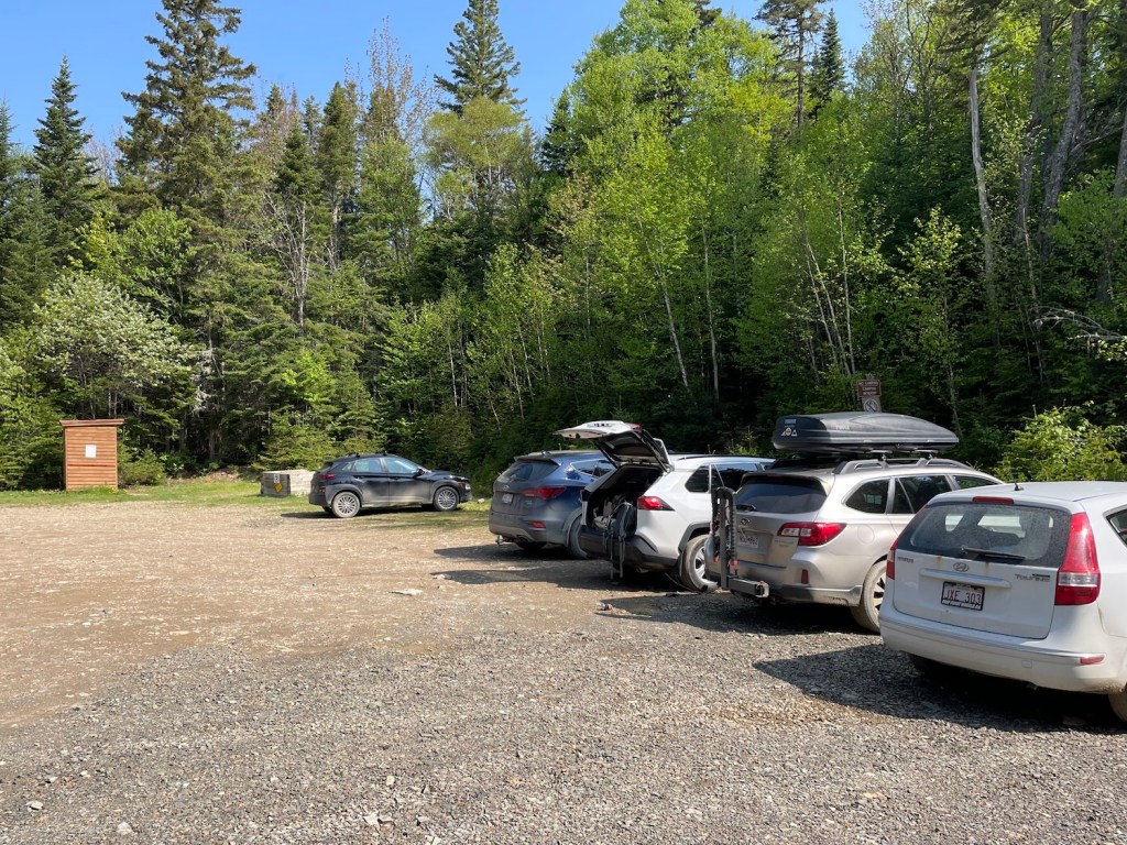
From the lodge, reaching the Mount Carleton trailhead will take at least 20 minutes. Follow the dirt road along the south side of Nictau Lake for about 3 km, then turn right and continue until reaching the parking lot. There’s some helpful signage and you can ask for a map from the park staff.
Mount Carleton Hike — One of the Top New Brunswick Trails!

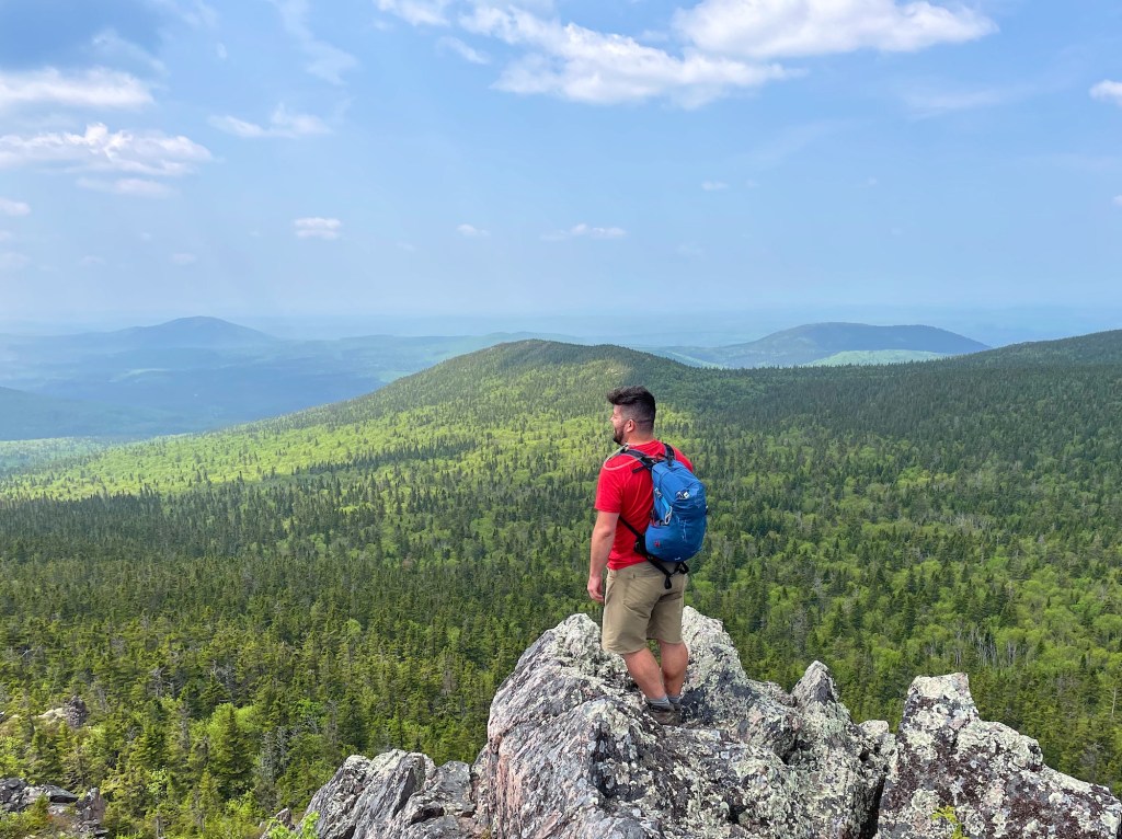
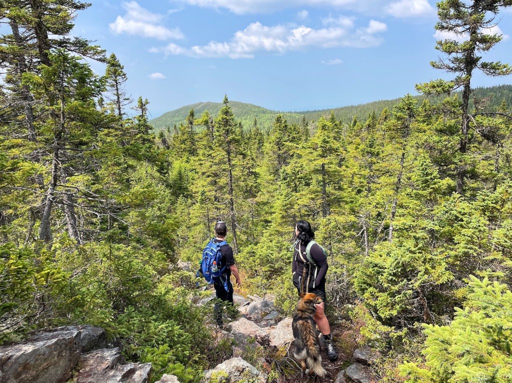
After a couple days in the park, I was more than ready to hike up Mount Carleton. I was also happy to be joined by Matt, Megan, and Winnie (Megan’s pup). At 820 metres, Mount Carleton offers an exciting destination as the highest peak in New Brunswick and in the Maritimes. You won’t find a Rocky Mountain style peak, but Mt Carleton is impressive in its own right.
The Mount Carleton hike is a 10 km loop with about 420 metres in elevation gain. At first, we ventured clockwise along the forest path following Mamozekal Brook. Sturdy footwear (like this) is recommended for this somewhat rugged forest trail, especially with rocks and roots to watch out for. After passing Headwaters Campground (with an outhouse), you’ll soon approach the base of the rocky ridge. Either scramble up to the ridge or follow the established trail around. Be sure to pause for a minute to admire the vistas. Seriously….
It doesn’t take long to reach the Fire Lookout Tower. From the trailhead, we took about 2.5 hours to make the summit. After a nice break (with celebratory shots), we continued down the ridge and stumbled upon the cabin once used by fire watchers. The remainder of the hike follows a well-maintained dirt road. Our start-to-finish hike took about 4 hours (including breaks).
Read next: Turtle Mountain Hike Near Saint John, New Brunswick


What To Bring Hiking

Mt Carleton is not an easy hike. Given the nature of this rugged terrain, I suggest bringing a day pack (I brought this one) with hiking essentials such as water, snacks, sun protection, and rain gear. I always carry my rain jacket just in case. Check out my list of the 10 hiking essentials to find suggestions. Wear supportive footwear to protect your feet. I also suggest bringing enough water for the day (I use this 2-litre bladder bag). Some hikers might find trekking poles useful, especially on the descent.
Read next: 10 Day Hiking Essentials: What to Bring on a Hike

Know Before You Go

Parking: You’ll find the parking area at the Mt Carleton trailhead.
Cost: If you’re staying in the park, there’s no additional cost to hike Mt Carleton. However, day visitors must pay about $13 plus tax to access the trailhead. Bring cash as the gate does not accept credit or debit cards.
Rain gear: This is the Maritimes. It’s always a good idea to bring a rain jacket along, like my Arc’teryx Beta LT. You won’t regret it if the weather shifts.
Toilets: Find an outhouse at the trailhead and an old outhouse at the Headwaters Campsite. Alternatively, there are flush toilets in the brand-new rustic lodge.
Leave No Trace: Remember, if you pack it in, don’t forget to pack it out. Practice Leave No Trace Principles to help keep the environment and wildlife healthy.

Have you hiked Mount Carleton Trail or another trail in Mt Carleton Provincial Park? Let me know about your visit in the comments below!
Save this for later? Hover over the image to add to Pinterest!
Thomas Coldwell has always been fond of the outdoors. He loves hiking, paddling, and camping, and thoroughly enjoys creating outdoor adventure resources for people like you. Originally from Nova Scotia, Thomas has lived in four Canadian provinces (NS, NB, ON, AB) and has travelled in 20 countries and counting.