Are you looking for a challenging and remote coastal hike in Nova Scotia? The proposed Seawall Trail offers an incredible experience, if you’re willing to work for it! Traverse through rugged and untouched terrain of Cape Breton’s northern coastline, through old-growth forests, over rocky headlands, and along dramatic sea cliffs. It’s a multi-day trek that brings the breathtaking views and rivals any other backcountry adventure in the Maritimes!
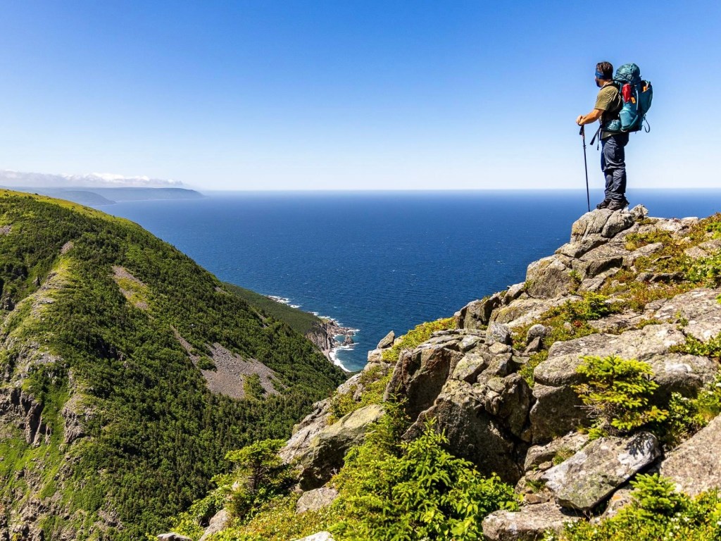
Summer 2024 was all about the East Coast for me. I had the chance to explore so much more of Atlantic Canada — from backpacking the Fundy Footpath, to hiking the entire East Coast Trail over 14 days, to taking on the rugged and spectacular Seawall Trail.
The Seawall Trail is still an undeveloped, proposed route, with construction expected to begin soon. The federal government has committed $3 million, and the Government of Nova Scotia has pledged $6.4 million toward bringing this trail to life. While I’m excited to see this backcountry experience become more accessible, there was something special about bushwhacking through one of Nova Scotia’s nearly untouched and pristine wilderness areas.
This post includes affiliate links. If you make a purchase through one of the links, I may receive a percentage of the sale at no extra cost to you. Thanks for your support!
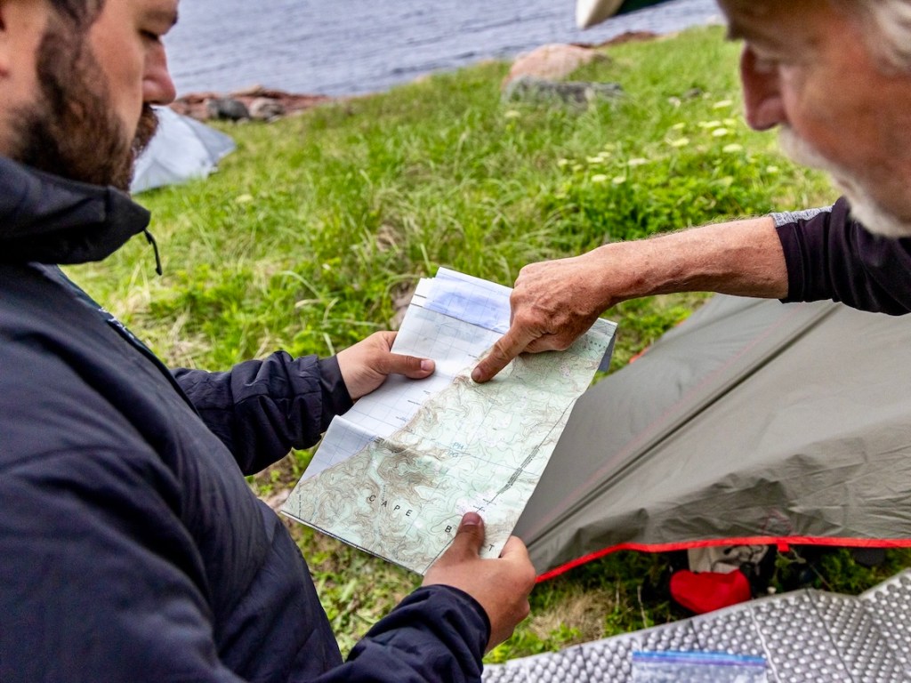
Seawall Trail Route Map
A proposed route map is available through the Seawall Trail Society’s website, though it’s worth noting that the route we hiked didn’t follow the proposed path exactly.
About the Seawall Trail — A Spectacular Cape Breton Hike
Location: Cape Breton Island, Nova Scotia
Distance: Approx. 40 km point-to-point
Difficulty: Difficult to strenuous
Elevation: Significant elevation gain (450 to 500 metres is biggest single ascent)
Time: 4–5 days depending on fitness level and hiking experience
Dog-Friendly: Yes, dogs are permitted on the Seawall Trail, but I would not recommend given the remote and rugged nature of the route.
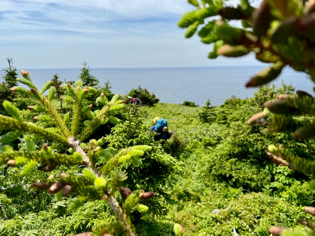
Features: The Seawall Trail is a remote, backcountry coastal route through the Pollett’s Cove–Aspy Fault Wilderness Area. Hikers can expect dramatic sea cliffs, exposed headlands, old-growth forest, river crossings, and wild ocean views — with no crowds, limited cell service, and no formal campsites. At this point, Seawall Trail is an undeveloped route for experienced backpackers and guided adventurers.
The Seawall Trail is located on the traditional, unceded territory of the Mi’kmaq people. This land is part of Mi’kma’ki, governed by the Treaties of Peace and Friendship, which affirm Mi’kmaq rights and title without ceding land.
Seawall Trail FAQs
Q. Where is the Seawall Trail located?
A. Seawall Trail is located on the remote, rugged coastline of northern Cape Breton, within the Pollett’s Cove–Aspy Fault Wilderness Area. The proposed full route stretches from Meat Cove to Pleasant Bay.
Q: Is the Seawall Trail currently open to the public?
A: As of now, the Seawall Trail is still under development and not officially open. That being said, anyone can explore Pollett’s Cove–Aspy Fault Wilderness Area but please follow Leave No Trace principles to preserve this pristine wilderness.
Q. How difficult is the Seawall Trail?
A. Seawall Trail is not for beginners. It’s a multi-day, backcountry trek through remote and rugged terrain. Hikers can expect steep climbs, slippery rocks, high winds and exposure, and no established campsites or facilities. You’ll need solid backcountry experience to attempt without a guide, plus strong navigation skills and a high level of fitness.
Q. What’s the elevation gain on the Seawall Trail?
A. While exact elevation numbers aren’t published yet, hikers can expect significant elevation changes through steep ravines and valleys. Based on my GPS, I suggest that the biggest single ascent (hiking Meat Cove to Pollett’s Cove) is around 450 to 500 metres.
Q. I’m new to hiking. Should I attempt the Seawall Trail?
A. I wouldn’t recommend it. This trail is remote, undeveloped, and lacks clear markings. Even with a guide, you’re rolling the dice on whether you will have a good experience (most first-time backpackers would not). If you’re new to multi-day hiking, start with something like Cape Chignecto or even the Fundy Footpath.
Q. Can I do a shorter hike on the Seawall Trail?
A. Yes, absolutely. You can hike into Lowlands Cove via the Cape St. Lawrence Trail starting from Meat Cove and spend the night, or head into Pollett’s Cove for a night or two. If you’re out for a couple of nights, consider hiking up Bald Mountain for a better sense of what the Seawall Trail is really like — not much “trail”!
Q. What’s the best direction to hike the Seawall Trail?
A. The full route runs between Meat Cove and Pleasant Bay, and you can hike it in either direction. We hiked north to south (from Meat Cove to Pollett’s Cove), and I’d recommend that simply because I had a great experience. Though to be fair, I haven’t done the reverse for comparison. That being said, I’ve heard from reliable sources that hiking south to north is much easier, so it depends what you’re after!
Q. Is there a hiker shuttle for the Seawall Trail?
A. Yes, if you book a guided hike with Live Life In Tents, shuttle transportation is included. Otherwise, arrange transportation or a shuttle with friends.
Q. Do I need to reserve the Seawall Trail?
A. There’s no reservation system for the trail right now, as it’s still under development.
Q: Are there any facilities along the trail?
A: Currently, there are no facilities along the trail or at either of the trailheads. Hikers must practice Leave No Trace principles and be self-sufficient.
Q. Is there cell phone coverage on the Seawall Trail?
A. Cell service ranges from limited to nonexistent. Bring a satellite communicator for emergencies. Let someone know your full route and expected return date.
Q. What’s the best time of year to hike the Seawall Trail?
A. I suggest between late June and early October, though I know some folks who have explored Seawall in the winter!
Q. Where can I book a guided tour?
A. Yes, check out Live Life In Tents for guided Seawall treks, including meals, transport, and logistics.
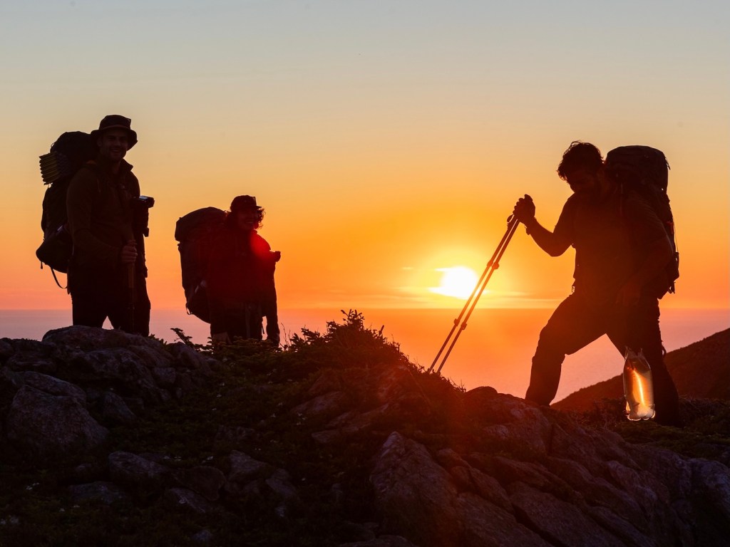
Who Should Hike the Seawall Trail?
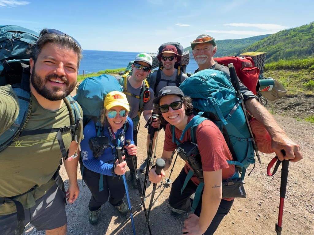
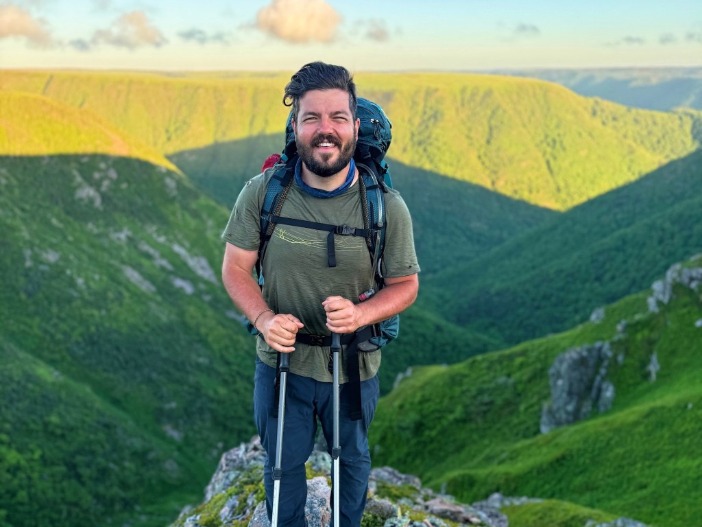
If you’re looking for a wild and challenging backcountry adventure, the Seawall Trail might be exactly what you’re after. I was absolutely thrilled to head out with a new group of friends (thanks for the invite, Ash Mac!). This rugged coastal route isn’t for the faint of heart — but for experienced backpackers, it’s an unforgettable experience!
Ask yourself a few honest questions before heading out: Have you done a multi-day backpacking trip before? Are you confident navigating unmarked routes? Are you prepared for unpredictable and harsh coastal weather? If not, no sweat — we all start somewhere. Novice hikers can find great options nearby, like Fishing Cove Trail or Franey Trail in Cape Breton Highlands National Park.
NOTE: Seawall Trail is about as raw and remote as it gets in the Maritimes, and that’s part of the charm. But it also means the stakes are higher. Do the prep, respect the land, and give yourself the best shot at a safe and successful adventure!

When To Hike the Seawall Trail

I suggest hiking Seawall Trail between late June and early October, when conditions are most stable and daylight hours are longer. Earlier in the season, route conditions can be boggy and wet (though that can happen anytime!), and later in the fall, there’s a higher potential for strong winds and coastal storms.
Read next: Your Complete Guide to the Long Range Traverse in Newfoundland
Do You Need To Reserve Seawall Trail?

You don’t need a reservation to hike Seawall Trail (at least not at this stage). As I mentioned earlier, the trail is in development and doesn’t have formal campsites or a booking system. It’s all backcountry camping, so you’ll need to follow Leave No Trace principles. If you’re planning a guided trip, you should book as early as possible.
Read next: Your Complete Guide to Fishing Cove Trail in Cape Breton

How Much Does the Seawall Trail Cost?
Here are the typical expenses for the Seawall Trail:
| Expense | Cost (Approx.) |
|---|---|
| Reservation | N/A (no booking system in place) |
| Guided Trip (optional) | ~$1,500 / person (4-day all-inclusive with guide, meals, shuttle) |
| Shuttle | Varies — may be included in guided trips or arranged privately |
| Food and Supplies | Varies depending on preferences and trip length |
At this point, there aren’t many expenses associated with a self-guided Seawall excursion. I’ll update this section as the trail develops and additional expenses (such as registration fees) become known.

Seawall Trail Guided Trip

If you’re not ready to take on the Seawall Trail solo, hiring a local guide is a great option. This trail is still mostly undeveloped, with steep terrain, no official signage, and no infrastructure. The best option is Live Life In Tents, a Cape Breton-based outfitter offering a 4-day, 3-night guided Seawall hike. Trips include meals, group gear, transportation, and experienced guides who know the land and its stories. At around $1,500 CAD per person, it’s not cheap — but it’s a solid investment if you’re newer to backpacking or just want to enjoy the experience without the stress of planning.
Read next: Your Complete Guide to Hiking the West Coast Trail

Directions to The Seawall Trail
If you’re hiking Seawall Trail, your starting point will be either Pleasant Bay or Meat Cove, depending on your direction. Both are remote communities on northern Cape Breton Island, accessible via the Cabot Trail. From Sydney, it’s about a 2.5–3 hour drive to either trailhead. Be sure to fuel up and stock up on supplies before heading north (and services are limited beyond Ingonish or Chéticamp).
📍 Pleasant Bay Trailhead – 46.873111, -60.743181
📍 Meat Cove Trailhead – 47.026291, -60.560182

Where To Stay Near The Seawall Trail (Before & After Your Trek)
If you’re looking for a simple base before or after your hike, Ingonish is one of the most convenient places to stay near the Seawall Trail. It’s just over an hour from Meat Cove with a small mix of campgrounds, inns, cabins, and places to eat. Chéticamp is another good option if you don’t mind a bit of driving, especially if you’re looking for more choice when it comes to food and shopping. Chéticamp has a really nice vibe, too. I stayed in one of the tiny homes in Margaree Harbour (a nice complimentary stay), which was farther out but absolutely worth it!

Seawall Trail Hiker Shuttle

Because the Seawall Trail is a point-to-point route, you’ll need to figure out how to get from one end to the other. There’s no official shuttle service yet, but transportation is included for guided trips. That takes a lot of pressure off, especially in an area with limited cell service and few taxi options. We left a couple of vehicles at Pollett’s Cove Trailhead before heading over to Meat Cove to start our trek.
Read next: Your Complete Guide to Pukaskwa Coastal Trail in Ontario

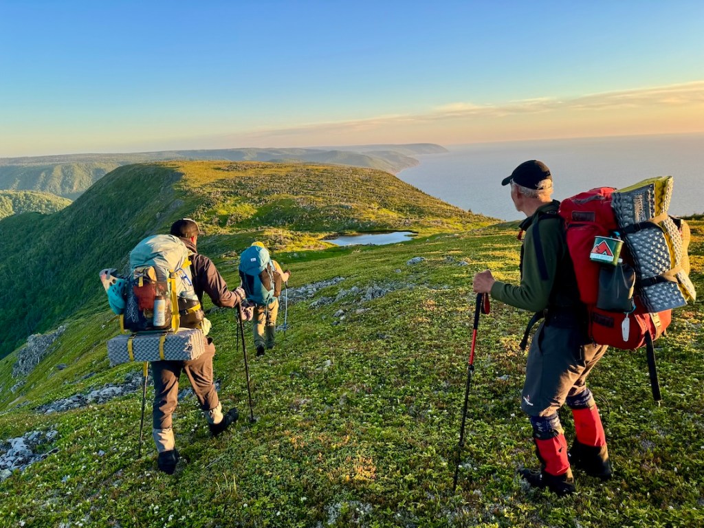
4-Day Seawall Trail Itinerary — One of the Best East Coast Hikes

Day 1 — Meat Cove to Sailor Cove – 12.5 KM
We started the day with a shuttle from the Pollett’s Cove trailhead to Meat Cove, getting on trail around 11:00am. The hike begins with a steady climb through forest before opening up into beautiful meadows scattered with wildflowers and sandstone outcrops. We followed the Cape St. Lawrence / Lowlands Cove Trail for about 8 km, with plenty of stops to soak in the scenery — including a large patch of purple iris near Lowlands Cove. Then it was time for a rest stop at French Brook, where I dropped my sunglasses in the water (but found them!).
We passed through Lowlands and continued on to Sailor Cove, where we set up camp for the night. It turned out to be one of the best campsites of the trip — clear ocean views, excellent water source (including a natural pool and cascading waterfalls). Sam and I enjoyed a pre-supper soak. Total distance was just over 13 km, and a great warm-up for what was to come.
Day 2 — Sailor Cove to Delaneys Brook Meadow – 8 KM
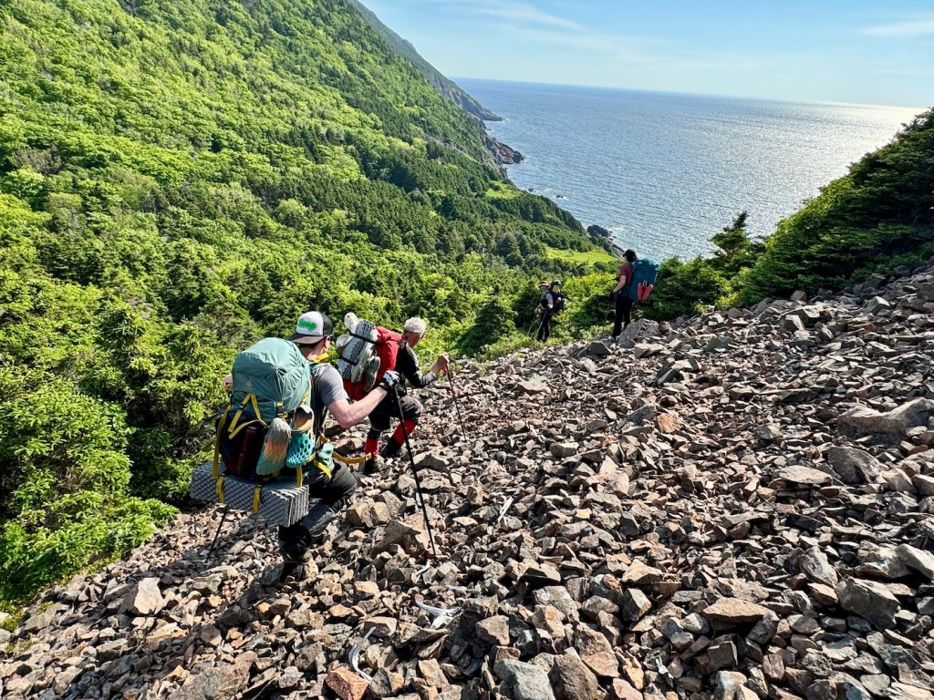
We hit the trail at 8:15am, and Day 2 started off with what we lovingly called “Shit Mountain” (Sailor Cove Mountain) — a steep, bushy climb straight up from the beach. This section follows the coastal route and is full of sharp branches, sketchy scree, and lost flagging tape. A tip: don’t go up the loose rock scree. Enter the bush and follow what flagging you can find.
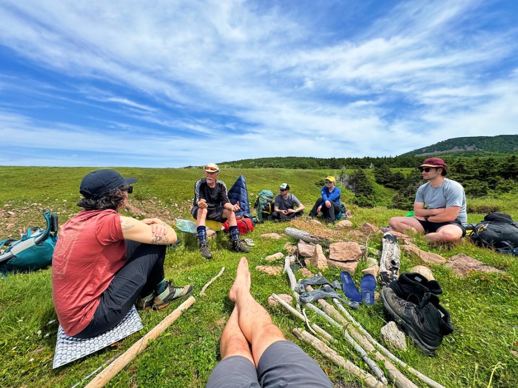
It took us around 2.5 hours to reach the top, though we lost time searching for the best route. We stopped for lunch on a bluff around noon, then dropped back into spruce forest. We passed through a meadow with lady slippers, followed Lower Delaneys Brook and pushed through thick alders to reach our meadow campsite perched above the brook valley. It was about 400 metres to the nearest water source. We all tucked into our tents (since it was raining), ate some supper, and crashed after a hard day.
Day 3 — Delaneys Brook to Bald Mountain – 9.5 KM
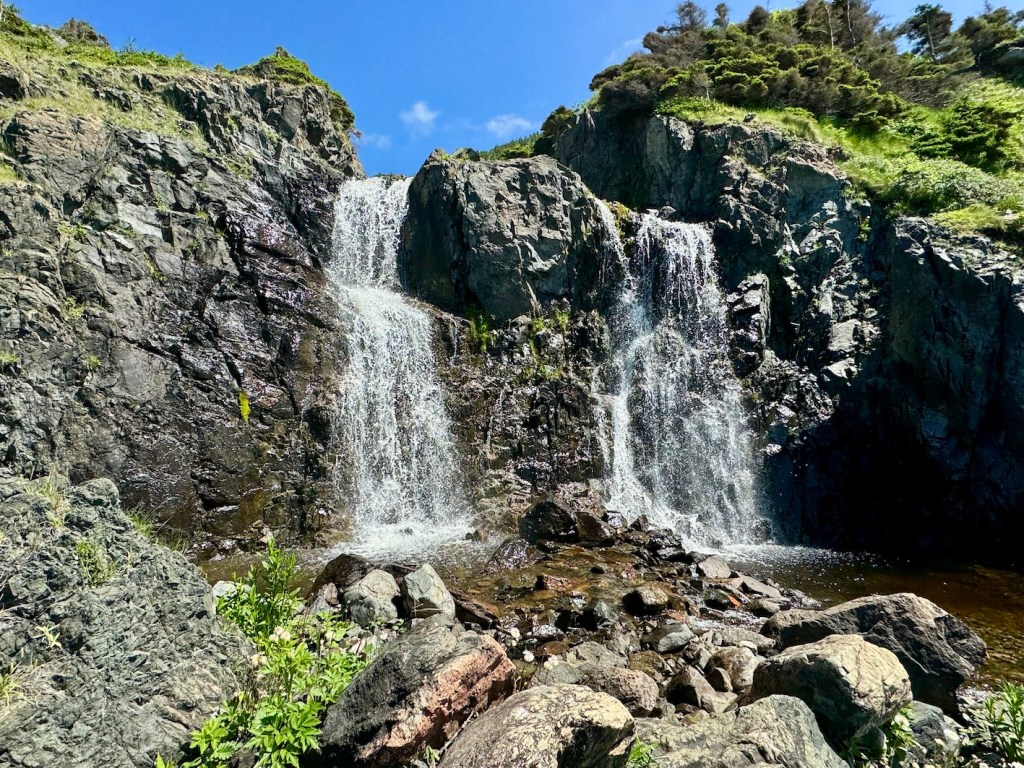
Started hiking at 10:45am and the day opened up fast. It was about 1.3 km to the Seawall Summit, which offered some of the most spectacular views. From there, we dropped down steep scree slopes, passed two waterfalls, and followed a mix of forest and boulder terrain toward the next climb. After crossing another brook (where I slipped and managed to lose my sunnies — permanently!), we began a solid 170-metre climb through mostly open meadow and forest. At the top, we had our first glimpse of Bald Mountain’s backside. The total elevation was about 300 metres before the plateau on Bald Mountain.
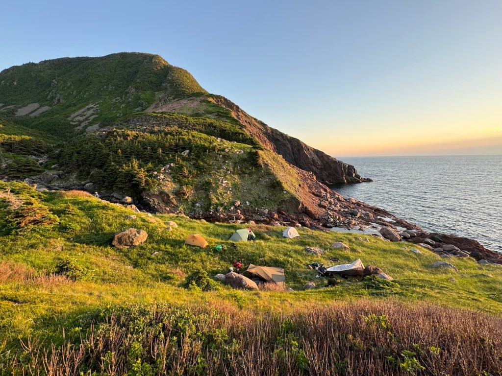
The final 2.5 km brought us across a marshy meadow with dead spruce and tuckamore before reaching camp on a ridgeline beside Blair River Valley. We didn’t roll into camp until around 9:15 pm, but the views and late golden light made it the most memorable night.
Day 4 — Bald Mountain to Pollett’s Cove Trailhead – 10.5 KM
We left camp around 9:00am and enjoyed the views of Blair River Valley before our descent toward Pollett’s Cove. We hit Otter Brook by 10:10 am, then reached Pollett’s Cove an hour later. Horses were grazing in the meadows, the surf was rolling in — classic, Cape Breton.
After a break and some final snacks, Ashley, Sam and I hoofed it out of Pollett’s Cove and waited for the rest of our crew. We reached the parking lot by 2:10 pm. The hike out is straightforward compared to the rest of the trail — a great end to an incredible four-day journey!
Navigating the Seawall Trail
Navigating the Seawall requires a solid dose of backcountry know-how. Unlike more established routes, Seawall Trail is under development and trail markings are minimal to nonexistent. You’ll need to come equipped with navigation tools — map, compass, and offline GPS files to keep us on course. If you lose the route, backtrack to your last known point and reassess.
This is not a route where you want to wing it. Make sure you’ve become familiar ahead of time and download your maps for offline use. The wildness of this place is part of what makes it special, but it also means you need to take your navigation seriously.
Read next: Your Complete Guide to the Fundy Footpath in New Brunswick
Camping on the Seawall Trail
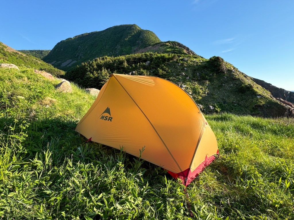
Camping on the Seawall Trail is completely backcountry and undeveloped — no tent pads, no fire rings, no outhouses, and definitely no reservations. That being said, there are preferred meadows, ridgelines, and valleys where groups have camped in the past, like Sailor Cove and Bald Mountain. You’ll often camp near a water source, but not always. Bring everything you need to be self-sufficient, and expect wind, fog, and rough weather (even in the summer months).

Seawall Trail Safety

When I’m hiking solo or in small groups, I’m tuned in to the potential risks: injury, weather, wildlife, or simply getting off-route. Leave a trip plan with someone you trust, including your route, expected return, and check-in timeline. If you’re not sure what to include, AdventureSmart is a great resource.
I brought a first aid kit with essentials like antihistamines, anti-inflammatories, blister care, and wraps. It doesn’t need to be fancy. I also carry a satellite communications device with SOS capability. There’s limited cell service out here, and having a way to call for help (or just check in) is essential.
There are no formal evacuation routes on the Seawall, so you’ll want to be confident in your navigation and self-reliance. In a life-threatening emergency, dial 9-1-1 if you have signal — otherwise, that satellite device becomes your lifeline. Prepare well, respect the terrain, and the Seawall will give you one of the best experiences out there!
Note: Keep an eye out for cow parsnip… especially in overgrown sections. It’s a native plant, but its sap can cause skin irritation or burns when exposed to sunlight (speaking from experience… it’s nasty stuff!). Long sleeves and pants are recommended, and be sure to wash up if you come into contact with it.

Meal Preparation

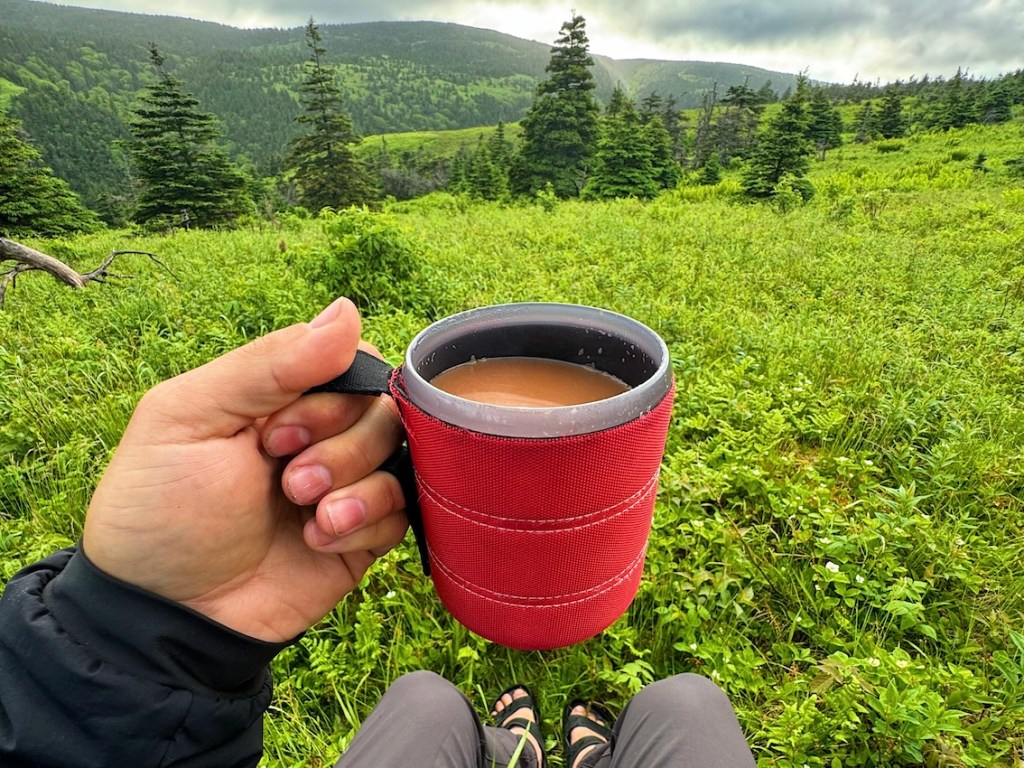
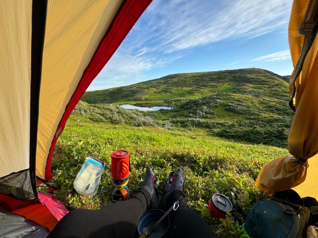
When it comes to backcountry eats, I’m a big fan of freeze-dried meals — lightweight, easy to pack, and fast to prepare with my Jetboil. Whatever you bring, make sure it’s high-calorie. The Seawall is no joke, and running low on energy out here can lead to poor decision-making — or worse. I once heard about a guy who tried to hike a multi-day trail with just apples… please don’t be that person.
Typically, I start my day with instant oatmeal or instant mashed potatoes (IYKYK 😋), then have a wrap with peanut butter and jerky (or something equally salty and filling) for lunch. I keep it simple for snacks: energy chews or dried fruit — quick fuel I can eat on the move. Oh, and where would I be without jolly ranchers?
There are plenty of freshwater sources along Seawall, but you’ll definitely want a water filter or purification tablets to stay safe. Don’t count on water being close to camp either — we had a night where we hauled water 400 metres to our site. Plan ahead, eat well, and your body will thank you!!

Toilets

There are no outhouses along the Seawall Trail — this is full-on backcountry camping, and that means you’ll need to take care of business the Leave No Trace way. It might not be glamorous, but it’s part of hiking responsibly in wild places.
If you’re not familiar: bring a trowel and dig a cat hole about 6–8 inches deep and at least 200 metres away from campsites, water sources, and the route itself. Do your thing, cover it up, and pack out all toilet paper and hygiene products. That includes food waste, wrappers, and anything that doesn’t decompose naturally (which is basically everything).
Read next: Your Complete Guide to Hiking in Tombstone Territorial Park

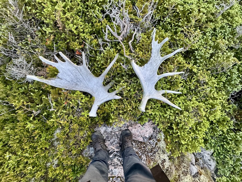
Wildlife on the Seawall Trail

Cape Breton is home to a variety of wildlife — including moose, coyotes, and black bears. Whether you’re hiking solo or in a group, try to avoid surprising wild animals nearby. Make noise while you hike (i.e. talking), especially in thick brush or wooded areas. I didn’t carry bear spray on this trip, but it’s not a bad idea if you’re hiking solo. Remember, keep your distance from wildlife and never attempt to feed them.
We saw a cluster of Canadian Tiger Swallowtail butterflies fluttering beside Sailor Brook, but otherwise, wildlife sightings were minimal. As always, follow Leave No Trace principles to help preserve this pristine coastline for future hikers and the animals who live here.
Seawall Trail Packing List

Here’s my packing list:
- Osprey Atmos 50
- Waterproof pack cover
- MSR Hubba Hubba
- MEC Talon sleeping bag
- Therm-a-rest NeoAir
- Sleeping bag liner
- Siltarp
- Camp shoes
- Scarpa hiking boots
- Arc’teryx Beta LT rain shell
- Rain pants
- Jetboil Flash
- Stove fuel
- Campsuds soap
- Osprey 2L reservoir
- Nalgene water bottle
- Komperdell hiking poles
- Lighter / matches
- GSI mug
- Spoon
- Sunscreen
- Sunglasses
- Bug spray
- Bug jacket
- Toilet paper
- Towel
- Toothbrush / toothpaste
- MSR TrailShot filter
- Headlamp
- Paracord
- Buff
- Mora Knife
- First aid kit
- Leukotape (for blisters)
- 2 merino wool t-shirts
- 1 long sleeve (love this Patagonia Capilene)
- 1 pair of pants
- 2 pairs of shorts (1 for hiking; 1 for camp)
- 1 pair of merino leggings (like these)
- 3 pairs of merino underwear (1 for hiking; 1 for camp; 1 extra)
- 2-3 pairs of merino socks (1 for hiking; 1 for camp; 1 extra)
- Down jacket (love this Patagonia down sweater jacket)
- Warm hat and gloves
- Map / compass
- Satellite comms (Zoleo)
- Powerbank
- Camera
- Food
Seawall Trail Video
Have you added the proposed Seawall Trail to your list? Are you planning an adventure someday soon? Leave a comment below!
Save this for later? Hover over the image to add to Pinterest 👇

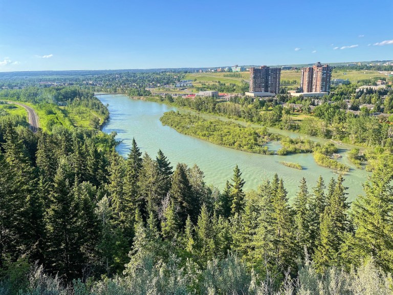
Thomas Coldwell has always been fond of the outdoors. He loves hiking, paddling, and camping, and thoroughly enjoys creating outdoor adventure resources for people like you. Originally from Nova Scotia, Thomas has lived in four Canadian provinces (NS, NB, ON, AB) and has travelled in 20 countries and counting.