
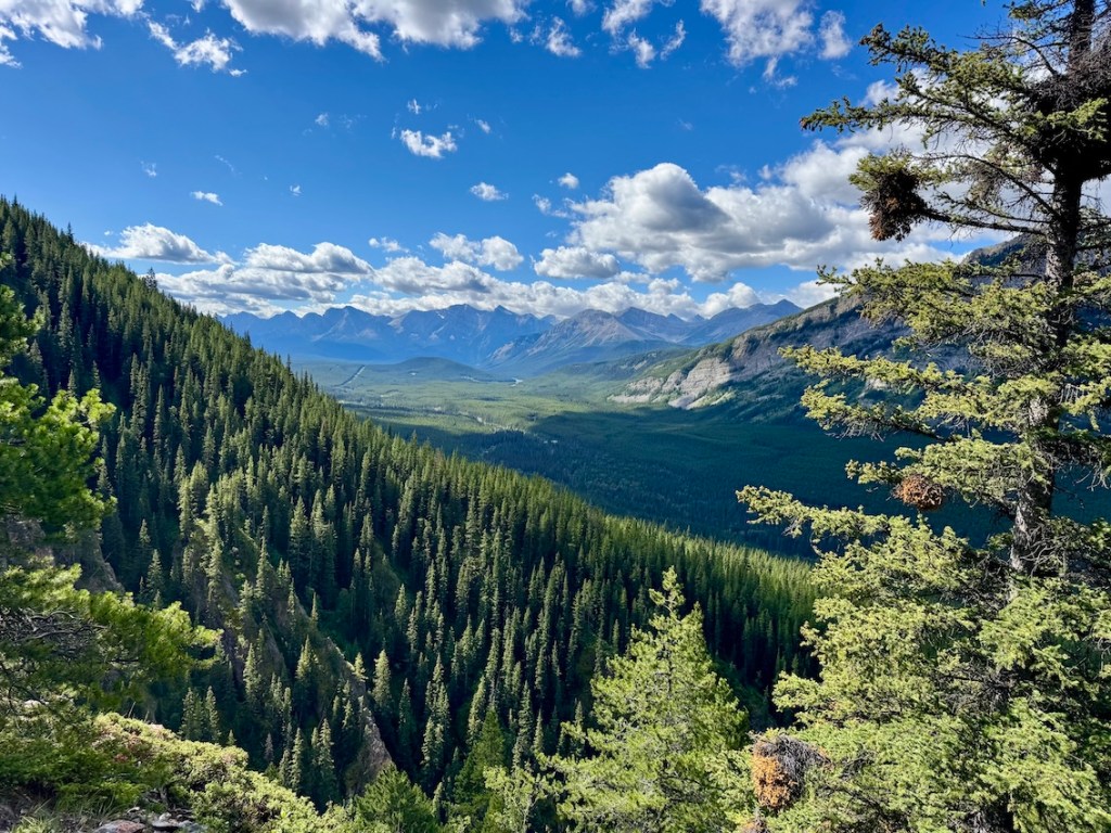
Packenham Junior Peak may not be the tallest summit in Kananaskis, but don’t let the name fool you — this hike delivers big rewards! The trail wastes no time gaining elevation, pulling you above the treeline where jagged ridges stretch across the horizon. It’s a shorter outing compared to some of its neighbours, which makes it perfect if you’re chasing alpine views without a full-day grind.

I hadn’t even heard of the Packenham Junior Peak hike until recently. Last week, I was searching for something on the shorter side; a Kananaskis hike that wouldn’t take all day but would still get me into those alpine views. That’s how I ended up giving this one a try, and let me tell you — it turned out to be a fantastic choice!
This post includes affiliate links. If you make a purchase through one of the links, I may receive a percentage of the sale at no extra cost to you.
Packenham Junior Peak Trail Map (Kananaskis Country)
About the Packenham Junior Peak Hike
Location: Peter Lougheed Provincial Park, Kananaskis, Alberta
Distance: 5.5 km out and back
Elevation: 630 metre gain
Time Required: 2.5 hours
Difficulty: Moderate. Steep and uneven terrain with light scrambling.
Dog-Friendly: Yes, but dogs must remain leashed
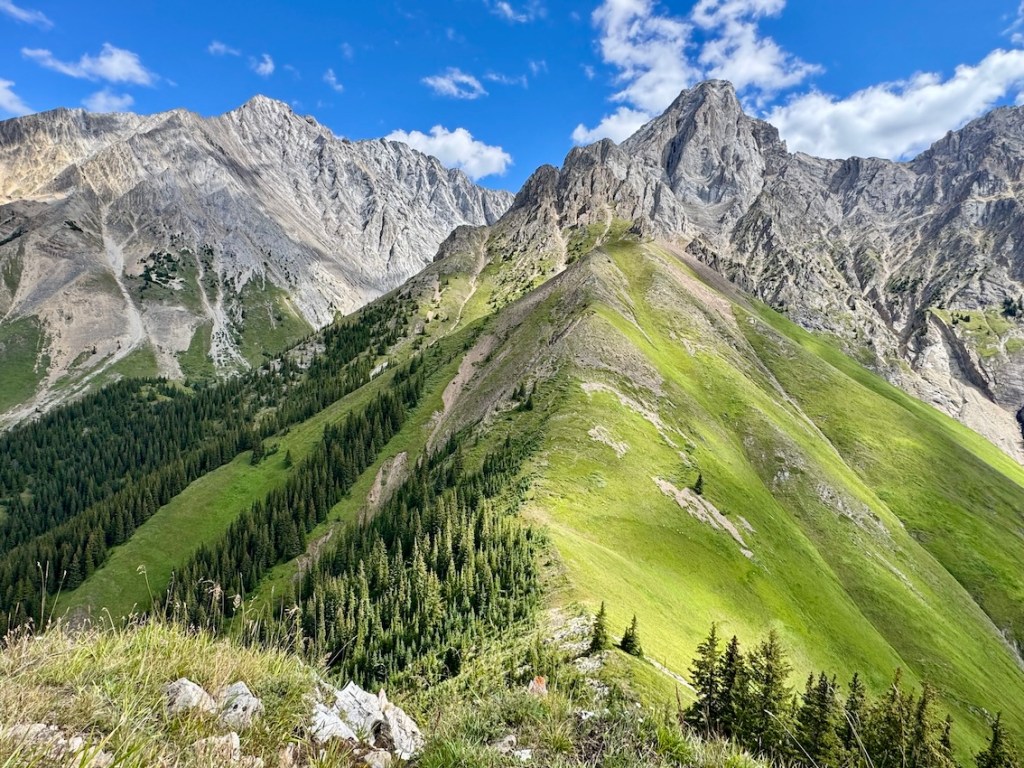
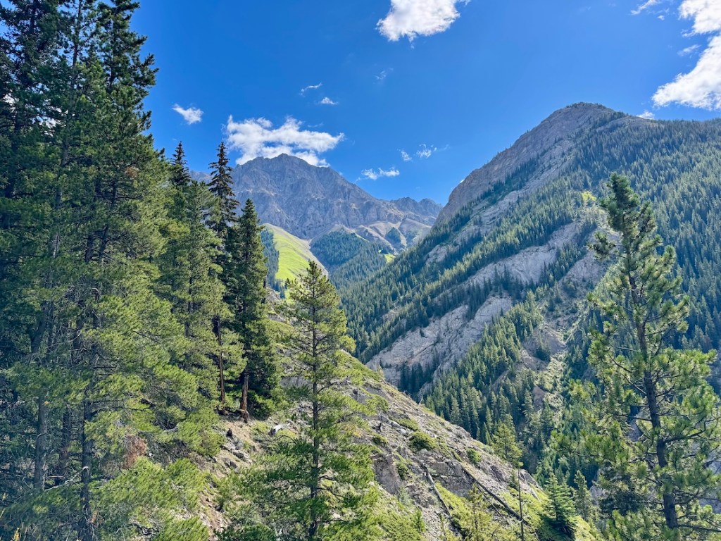
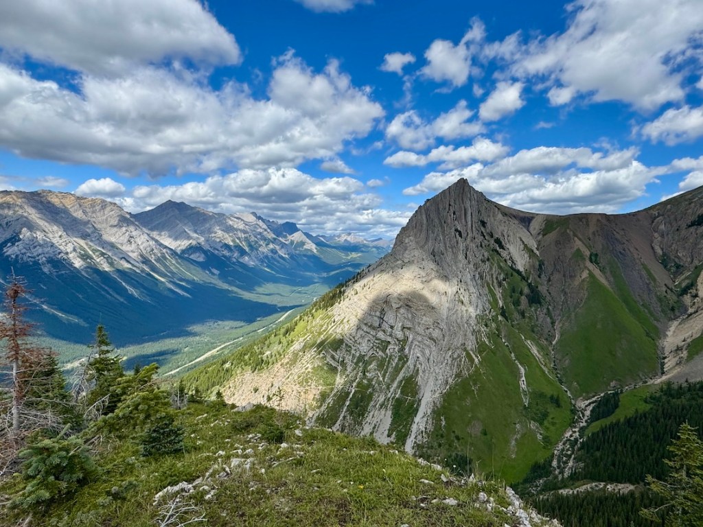
Features: The Packenham Junior Peak hike involves steady elevation through shaded forest before opening into alpine terrain with impressive ridgeline views. Near the summit, hikers encounter short sections of light scrambling on loose rock. From the top, wide views stretch across Peter Lougheed Provincial Park, including Opal Ridge.
How To Get To the Packenham Junior Peak Trailhead
From Calgary, take Highway 1 (Trans-Canada Highway) west and turn south onto Highway 40 (Kananaskis Trail). Drive about 50 km into Peter Lougheed Provincial Park. The Packenham Peak Trailhead is located a few minutes before the turnoff onto Highway 742.
Parking isn’t in a formal lot. Hikers pull over and park on the gravel shoulder along Highway 40 near the trailhead. Space is limited, so arrive early if you’re hiking on a busy weekend, and make sure your vehicle is completely off the road.
Read next: King Creek Ridge Hike in Kananaskis Country
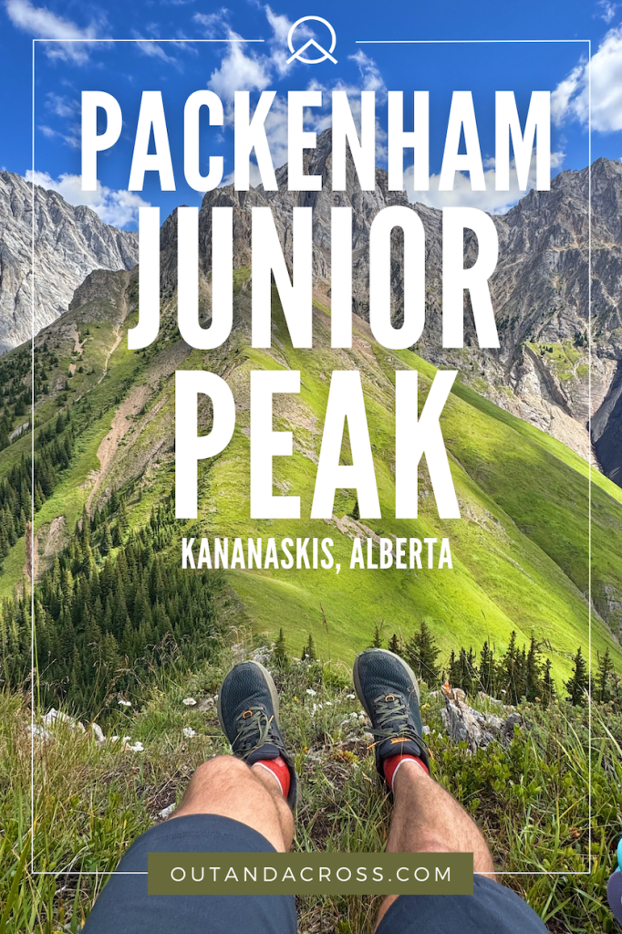
Packenham Junior Peak — A Short & Steep Kananaskis Hike
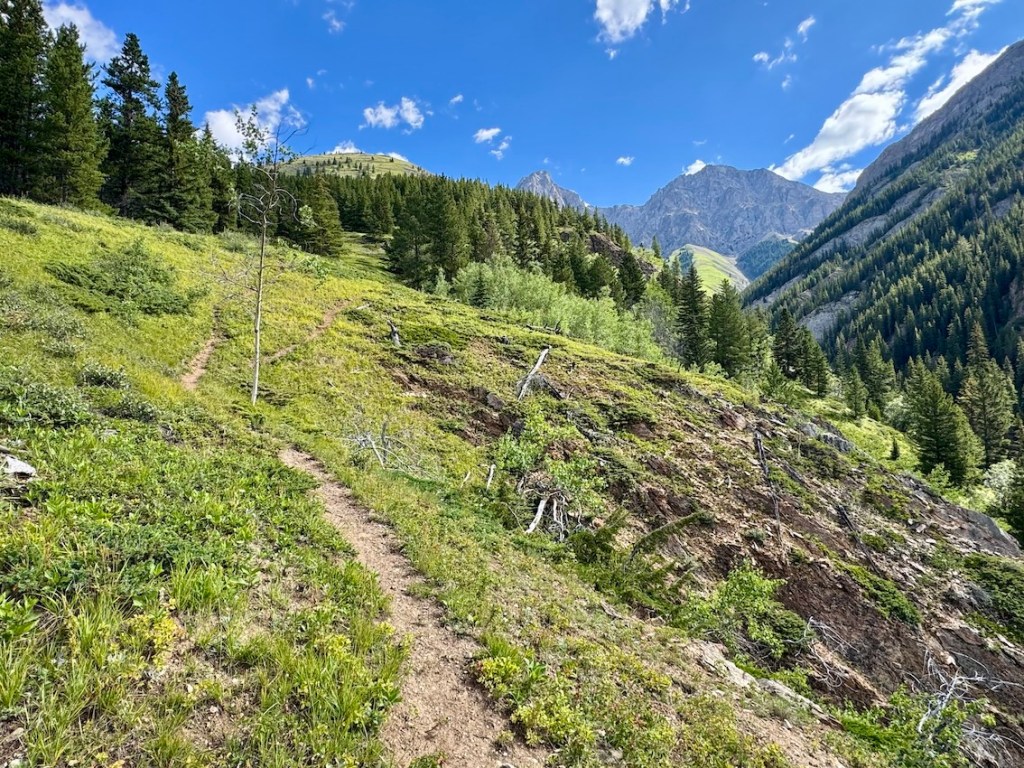
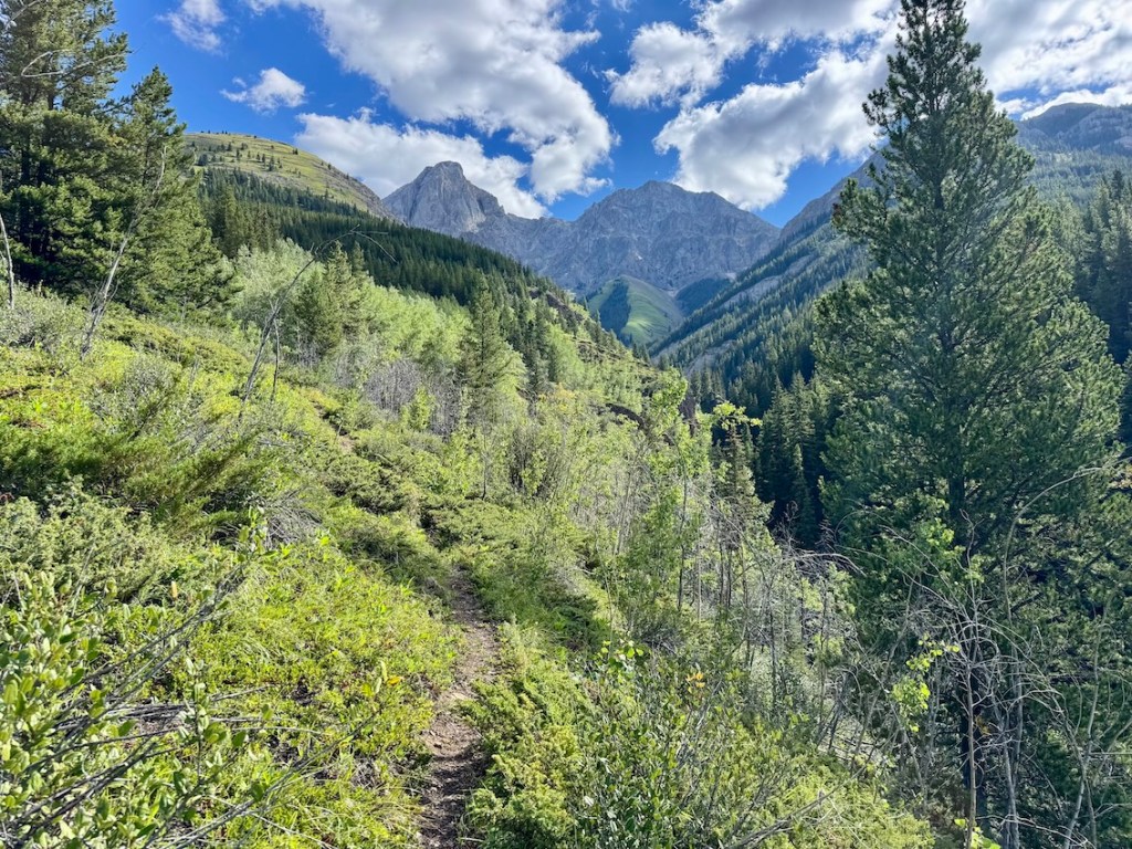
The hike begins on a gradual incline through an overgrown forest, where you’ll step over the occasional deadfall and weave along a trail that isn’t always obvious. Game trails braid in and out, so keeping the AllTrails map handy is helpful. As the trees thinned out, the views started to open up as I crossed paths with a herd of bighorn sheep.
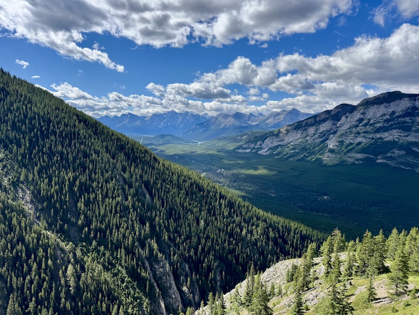
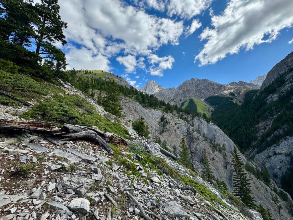
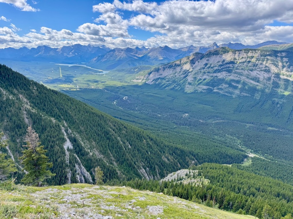
Above the treeline, the trail becomes steeper with sections of loose shale and grassy meadows leading to the ridge. This upper section includes a bit of light scrambling, where you’ll use your hands briefly to move over rock. It’s a quick ascent, but it will get your legs working. At the summit, I stopped to take in the Kananaskis views and watched mountain goats (or tiny white dots) grazing far across the mountainside. A pair of binoculars would’ve made these sightings even better. Short, steep, and rewarding, Packenham Junior Peak delivers the summit experience in a half-day hike. Overall, give yourself at least 2 to 2.5 hours for the 5.5-km out and back hike.
Read next: King Creek Ridge Hike in Kananaskis Country


Know Before You Go
Park Pass: A Kananaskis Conservation Pass is required to park anywhere in Kananaskis Country. You can purchase a daily or annual pass online in advance.
Parking: There is no formal lot for this trail. Hikers park on the gravel shoulder along Highway 40 near the trailhead. Make sure your vehicle is fully off the road.
Toilet: There are no facilities at the trailhead, but you can find flush toilets at the Kananaskis Visitor Centre or outhouses at various other trailheads.
Difficulty: This is a moderate hike with steady forested climbing, loose shale, and some steeper sections above the treeline. It’s best for hikers with a bit of experience.
Safety: The trail can be hard to follow in places, especially in the lower forest where game trails braid in and out. Using a GPS track or AllTrails map is recommended. Watch for loose footing on the upper slopes, and carry layers as weather changes quickly at higher elevations (I was glad to have my Arc’teryx Beta LT as a windbreaker).
Wildlife: Bighorn sheep and mountain goats frequent this area. Always keep your distance, never feed wildlife, and store food securely. This is also bear country — carry bear spray and know how to use it.
Leave No Trace: Stay on the established route as much as possible, pack out everything you bring in, and respect this sensitive alpine environment. Learn more about Leave No Trace Principles before hitting the trail.
Read next: 10 Day Hiking Essentials: What to Bring on a Hike

More Kananaskis Country Hikes
If Packenham Jr Peak left you craving more mountain adventures, here are some standout hikes nearby that deliver serious alpine vibes:
- Highwood Ridge Hike in Kananaskis Country
- Kent Ridge Hike in Kananaskis Country
- Ptarmigan Cirque Trail: Family-Friendly Kananaskis Hike
- Tent Ridge Hike: One of the Best Hikes in Kananaskis
- South Lawson Peak Hike in Kananaskis Country
- Yates Mountain via Prairie View Trail in Kananaskis
- Ribbon Falls Hike in Kananaskis, Alberta
- Galatea Lakes Hike in Kananaskis Country, Alberta
Have you hiked Packenham Junior Peak in Kananaskis? How was your experience on the trail? Share your thoughts in the comments below!
Save this for later? Hover over the image to add to Pinterest 👇
Thomas Coldwell has always been fond of the outdoors. He loves hiking, paddling, and camping, and thoroughly enjoys creating outdoor adventure resources for people like you. Originally from Nova Scotia, Thomas has lived in four Canadian provinces (NS, NB, ON, AB) and has travelled in 20 countries and counting.

I’ve never Packenham Junior Peak. Looks like a good hike when you’re short of time. Maggie
Absolutely, it’s a nice hike!