Have you heard about the Mount Bowman hike in British Columbia? I hadn’t either, until my aunt suggested we check it out during my visit to 100 Mile House. So at the end of June, with our day packs and adventurous spirits, we drove over to Marble Range Provincial Park to see what it was all about. Spoiler alert: it was absolutely worth the trip!
I don’t often get the chance to hike with family, but when I do, it’s a memorable time (like exploring the Bouctouche Dunes in New Brunswick with my sister). At the end of June, my aunt and I set out to explore Mount Bowman, about an hour and a half drive from 100 Mile House, BC. We didn’t know exactly what the Marble Range had in store, but after seeing a few photos, I knew it was a spot I needed to visit. Keep reading to see what I mean.
This post includes affiliate links. If you make a purchase through one of the links, I may receive a percentage of the sale at no extra cost to you.
About Mount Bowman Trail
Location: Marble Range Provincial Park, British Columbia
Distance: 16 km out and back
Difficulty: Difficult
Elevation: 900 metre gain
Time Required: 5 to 6 hours
Dog-Friendly: Yes, but dogs should remain on a leash.
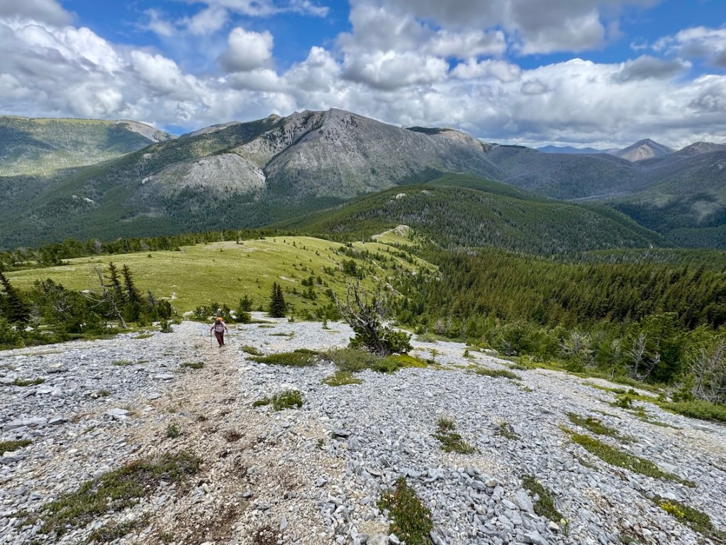
Features: The Mount Bowman hike is a fairly rugged trail that winds through forest (with several downed trees!) before opening into rolling meadows with wildflowers and expansive views. Higher up, grassy slopes give way to limestone ridges, leading to a wide-open summit with panoramic views of the Cariboo Plateau. Expect a bit of route-finding and a backcountry feel — this isn’t a totally polished path, and that’s part of the charm.

Mount Bowman Trail Map
Directions to the Trailhead
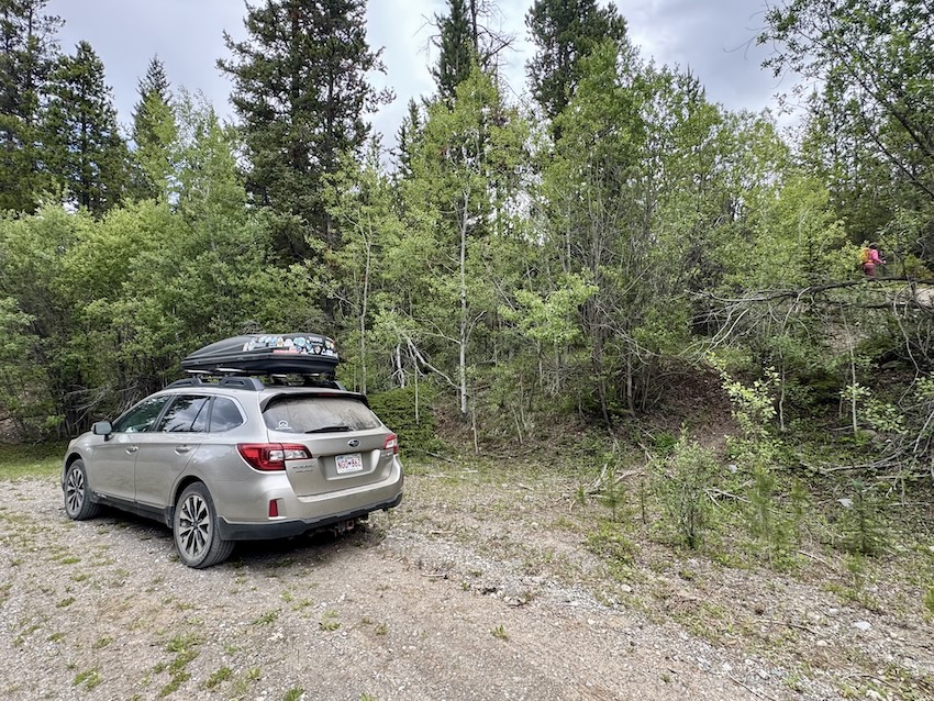
From 100 Mile House, head south on the Cariboo Highway (Hwy 97) for about 72 km until you reach Clinton. Turn right onto Kelly Lake Road and follow west for roughly 16 km. From there, turn right onto Jesmond Road and continue another 24 km toward Marble Range Provincial Park. As you continue on, the road narrows and becomes rougher as you get closer to the Mount Bowman access point (a high-clearance vehicle is recommended). Look for a small pullout area to park near the trailhead.

Mount Bowman Hike — Hiking in BC’s Interior
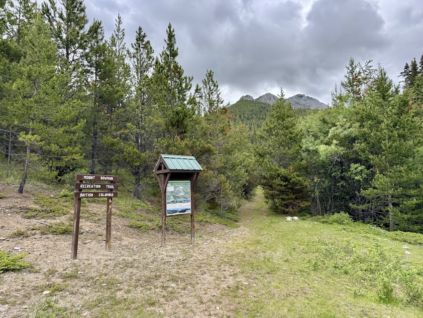
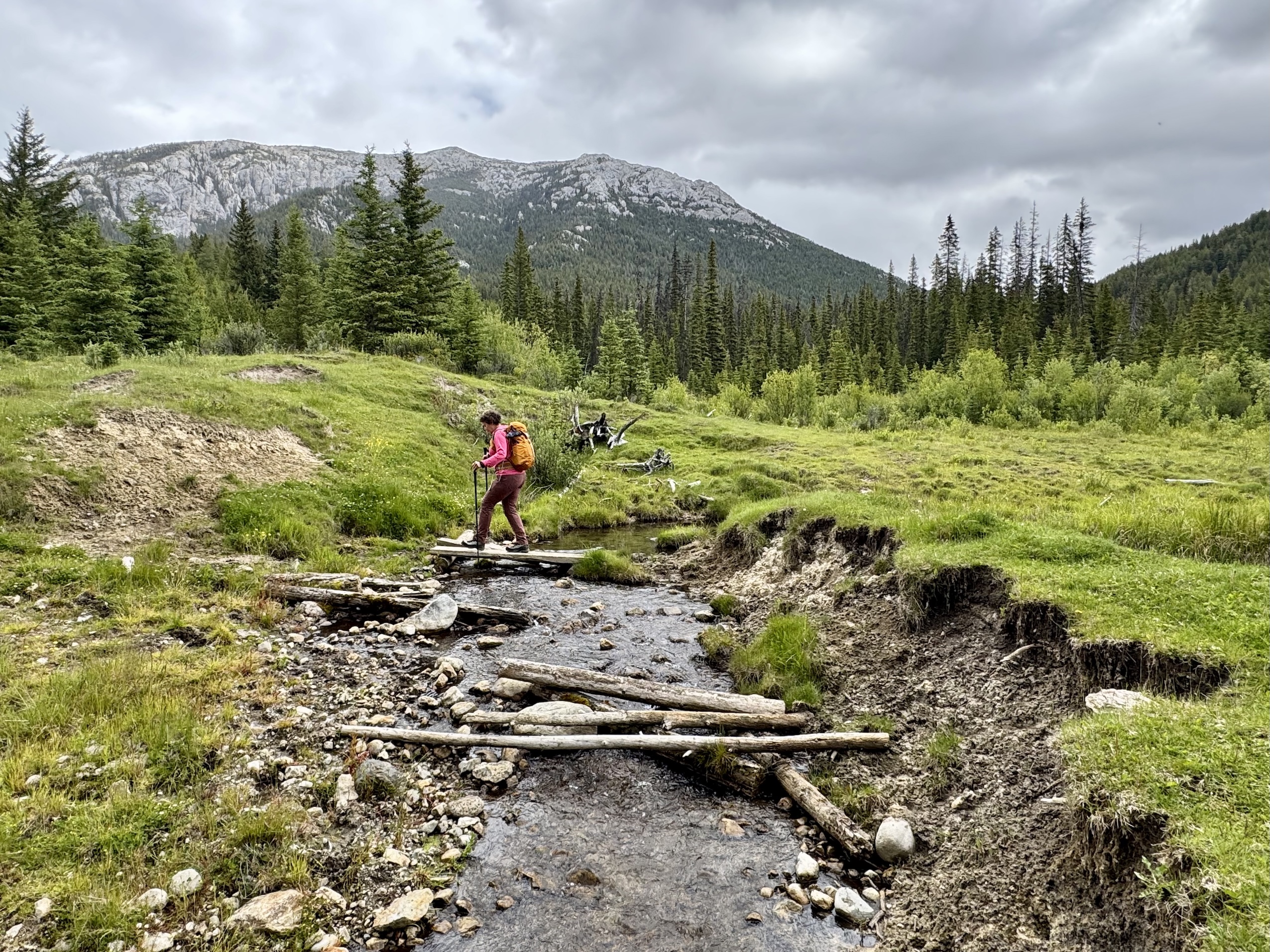
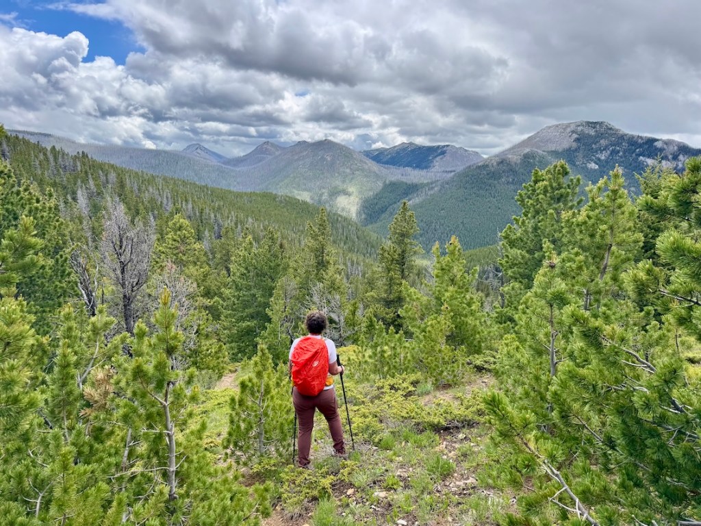
If you do what we did and park on Jesmond Road, you’ll be about a kilometre from the official Mount Bowman trailhead. We hiked through the forest and I was glad to have the AllTrails map downloaded on my phone. From the marked trailhead, the first stretch is fairly gentle as it winds through forest for the first few kilometres. There’s an obvious rest stop with a few logs that make a good spot to take the weight off your legs. From there, the hike quickly turns rugged. We navigated at least a dozen downed trees: crawling under, climbing over, or skirting around where we could. Past the obstacles, the forest gave way to open mountain meadows, where the views grew bigger with every step. Bring a warm layer and wind breaker, as the temperature can change quickly.
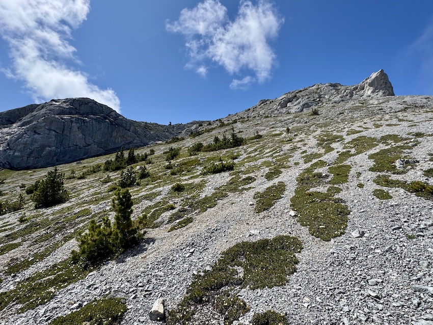
Above the meadows, the trail steepened sharply on loose limestone scree, where careful route-finding became pretty essential. It would be easy to get off track, or onto terrain that felt too steep, so caution is important. My aunt decided to wait on the scree while I pushed on toward the summit, picking my way carefully across the rock. The final climb was tough but manageable, and standing at the top with the Cariboo Plateau below made it worthwhile. By the time we returned to the trailhead, the 16-km out-and-back hike had taken us just over six hours — and we were both glad to see the car!
Read next: Best Places to SUP in BC’s Cariboo Region


What To Bring

For a rugged hike like Mount Bowman, sturdy hiking boots are a must — the steep limestone and downed trees call for good traction and ankle support. I wore my Salomon boots and they’ve always done the trick. I also found trekking poles helpful, especially on the scree and for the long descent back to the trailhead. Because the upper ridge requires some route-finding, it’s worth carrying a GPS or offline map app so you don’t get off track. A comfortable day pack big enough for layers, food, and safety gear makes the climb more enjoyable. I’ve been using the Osprey Hikelite 18 for years. And don’t forget bear spray in an easily accessible holster, as the Marble Range is home to both black bears and grizzlies. With no reliable water sources on the trail, bring plenty to drink (I brought my Osprey 2-litre bladder), plus enough snacks to fuel a six-hour day (try these oat bars, they’re tasty!).
Read next: 10 Day Hiking Essentials: What to Bring on a Hike

Know Before You Go
Parking: There’s a small gravel pullout near the trailhead with space for a few vehicles. No fees or permits are required.
Toilet: No facilities at the trailhead or along the trail.
Pets: Dogs are allowed but should be kept on a leash. The rugged trail, downed trees, and scree slopes may be challenging for some dogs.
Wildlife: Marble Range is home to both black bears and grizzlies. Carry bear spray, make noise, and give wildlife plenty of space.
Safety: This is a difficult hike with steep climbs and exposed scree. Wear sturdy footwear, bring trekking poles, and carry plenty of water. I suggest bringing a first-aid kit for backcountry emergencies, and be sure someone knows where you are.
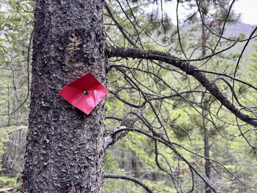
Navigation: Signage is minimal. Download an offline map or carry a GPS — we used AllTrails, which worked well.

Have you hiked Mount Bowman in BC’s Marble Range? How was your experience? Let me know in the comments.
Save this for later? Hover over the image to add to Pinterest 👇

Thomas Coldwell has always been fond of the outdoors. He loves hiking, paddling, and camping, and thoroughly enjoys creating outdoor adventure resources for people like you. Originally from Nova Scotia, Thomas has lived in four Canadian provinces (NS, NB, ON, AB) and has travelled in 20 countries and counting.