
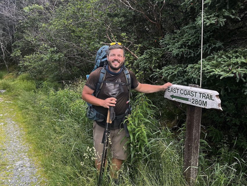
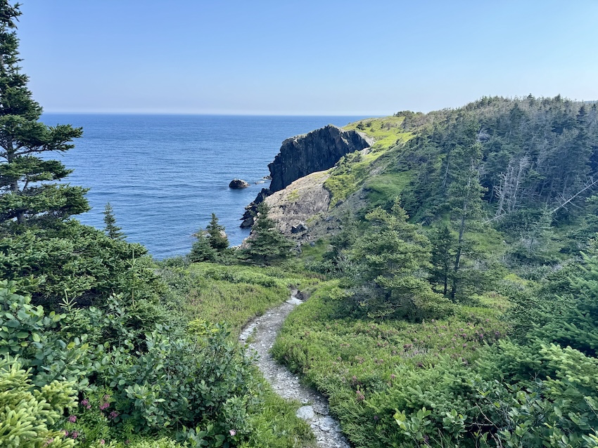
Looking for a multi-day hike that captures wild coastline, small outport charm, and that unmistakable Newfoundland spirit? The East Coast Trail delivers all of it… and then some! Stretching over 300 km along the Avalon Peninsula, this rugged route weaves through sea cliffs, quiet coves, and thick boreal forest, with the Atlantic Ocean never far from sight. It’s not the hardest adventure out there, but don’t be fooled: the long distances, exposed headlands, and ever-changing weather can make it a real challenge. If you’re ready to take it on, the ECT is one of the most rewarding backpacking adventures around!

I was ready. Mostly.
Back in July 2024, I finally set off to thru-hike the entire East Coast Trail, over 300 km of coastline along Newfoundland’s Avalon Peninsula. It was my first time (like, ever) on the east coast of Newfoundland, and after booking a plane ticket to St. John’s, I knew I was in for the adventure of a lifetime. And now, more than a year later, I finally created this comprehensive guide to make thru-hike planning as easy and realistic as possible. Here you’ll find my thru-hiking itinerary, a detailed Google map, and practical tips for backpacking the ECT.
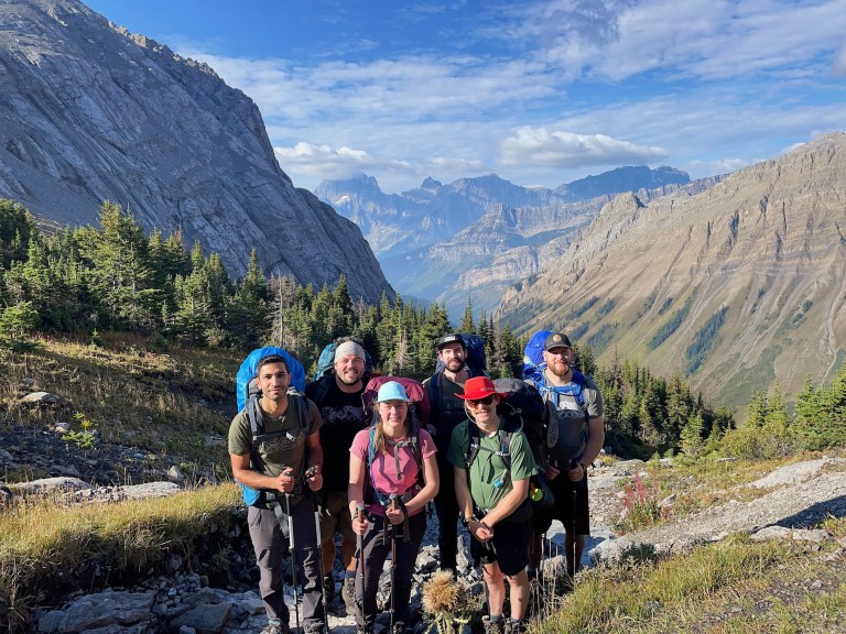
If you’re dreaming about a true East Coast adventure, this guide has everything you need to plan your thru-hike. Hopefully you’re feeling inspired to take those first steps. Before we jump in, I have to say a huge thanks to my friend Caroline (Adventure with Car, look her up!) for joining for part of the hike and helping me with logistics along the way.
This post includes affiliate links. If you make a purchase through one of the links, I may receive a percentage of the sale at no extra cost to you.
East Coast Trail Map
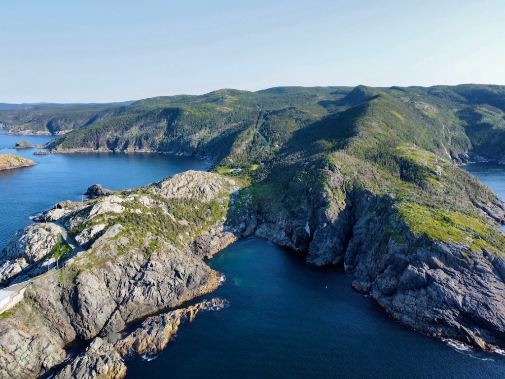
About the East Coast Trail

Location: Avalon Peninsula, Newfoundland and Labrador
Distance: 336 km point-to-point
Difficulty: Moderate to challenging
Elevation: Rolling terrain with short, steep climbs and descents
Time: 14 to 20 days for a full thru-hike, depending on fitness… and grit!
Dog-Friendly: Paths are dog-friendly, but I wouldn’t recommend thru-hiking with a doggo.
Family-Friendly: Several day hikes are great for families, but the full route is best for experienced hikers.
Trails: The East Coast Trail is made up of 25 official wilderness paths, including Long Shore, Piccos Ridge, White Horse, Biscan Cove, Stiles Cove, Father Troys, Silver Mine Head, Cobblers, Sugarloaf, Deadmans Bay, Cape Spear, Motion, Spout, Mickeleens, Beaches, Tinkers Point, La Manche Village, Flamber Head, Brigus Head, Cape Broyle Head, Caplin Bay, Sounding Hills, Spurwink Island, Bear Cove Point, and Island Meadow.
Community Walks: nine additional routes totalling roughly 50 km, connecting the wilderness paths through coastal towns and small communities.
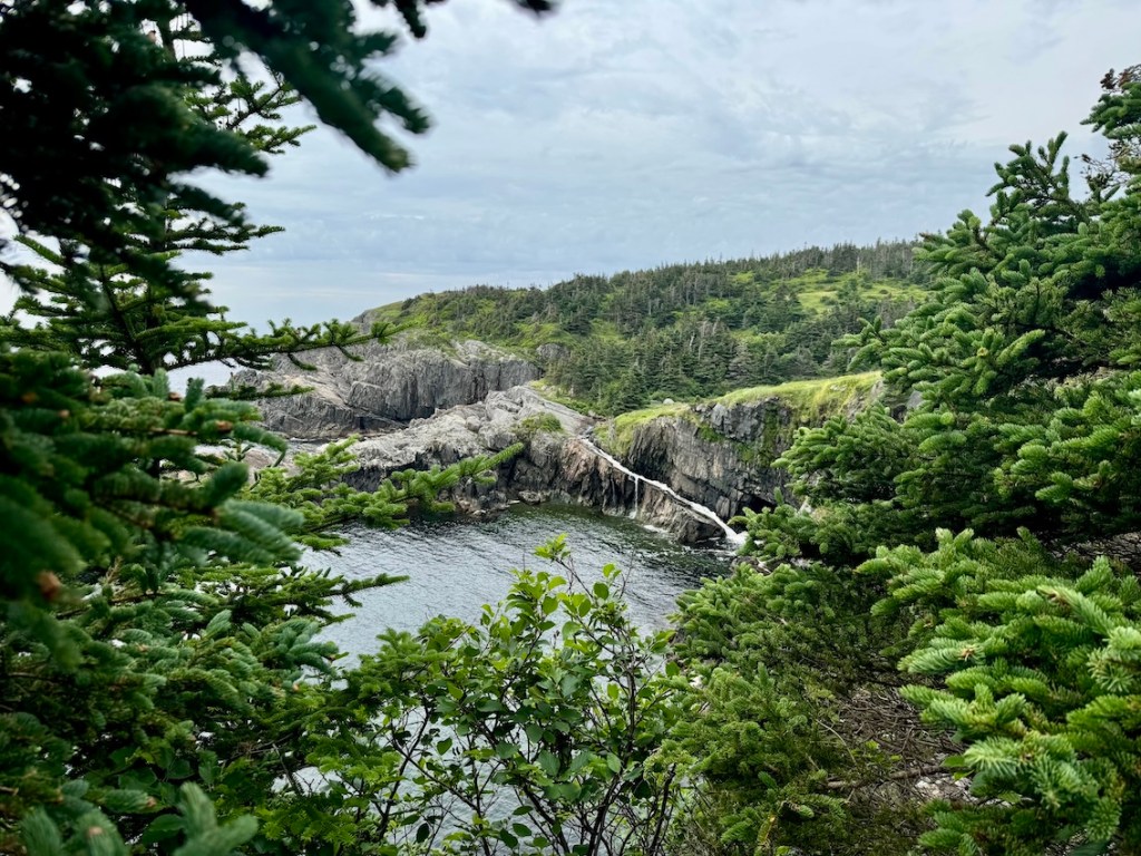
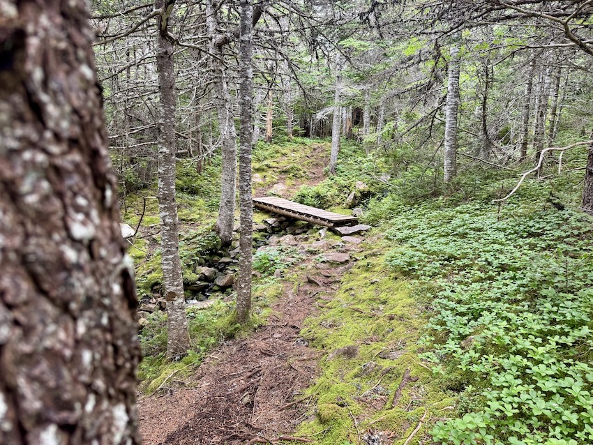
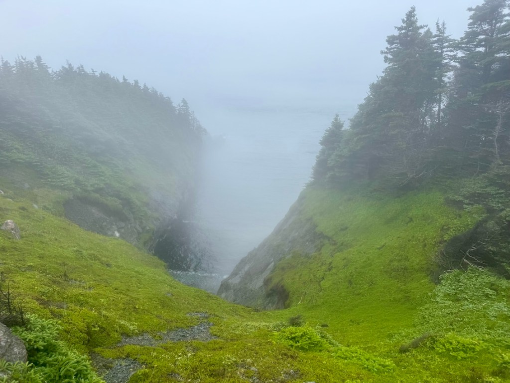
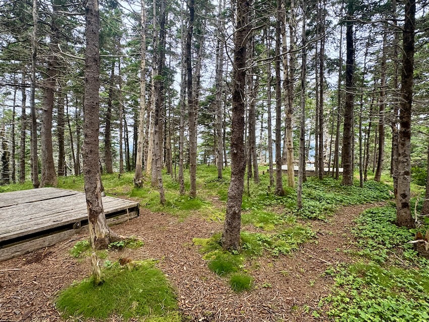
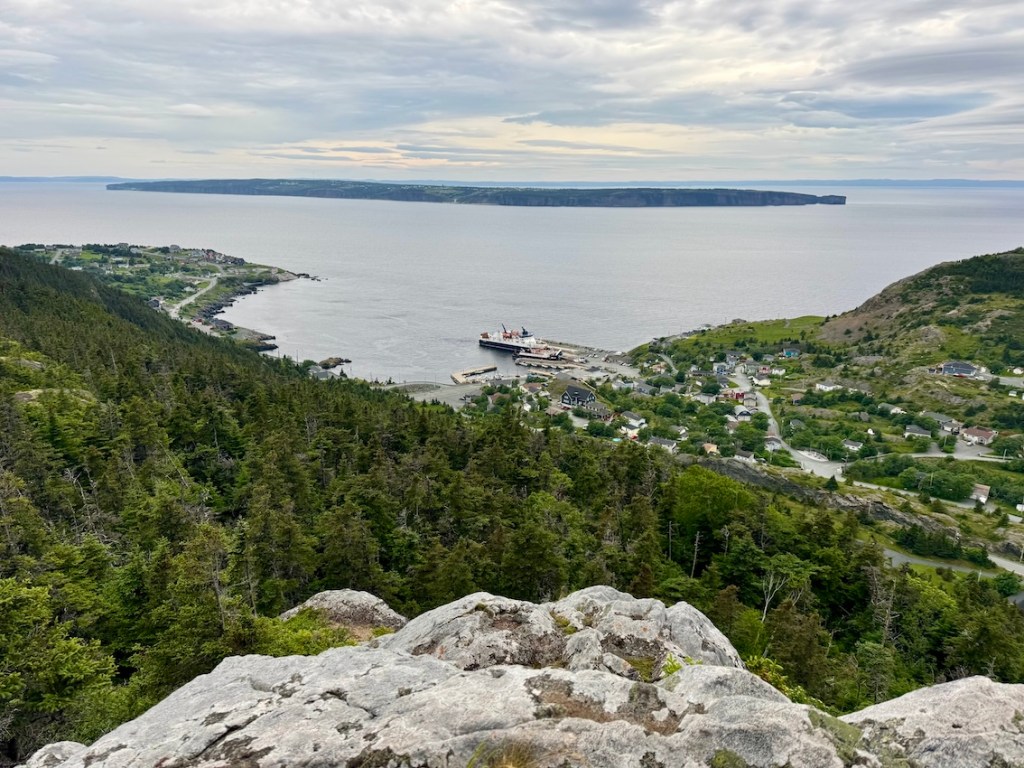
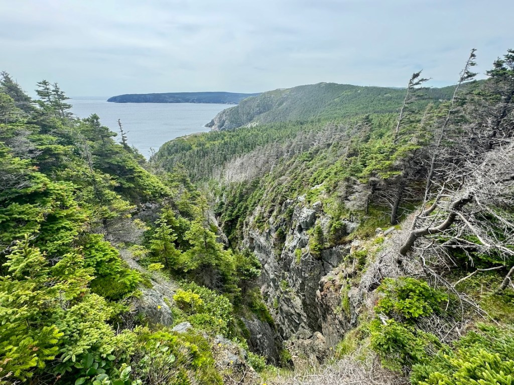
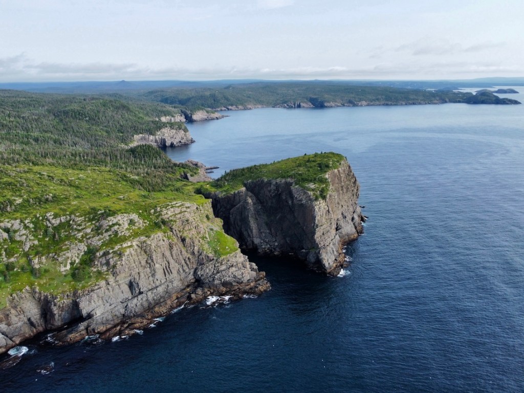
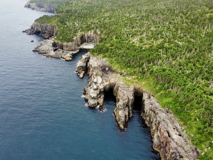
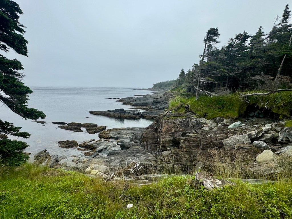
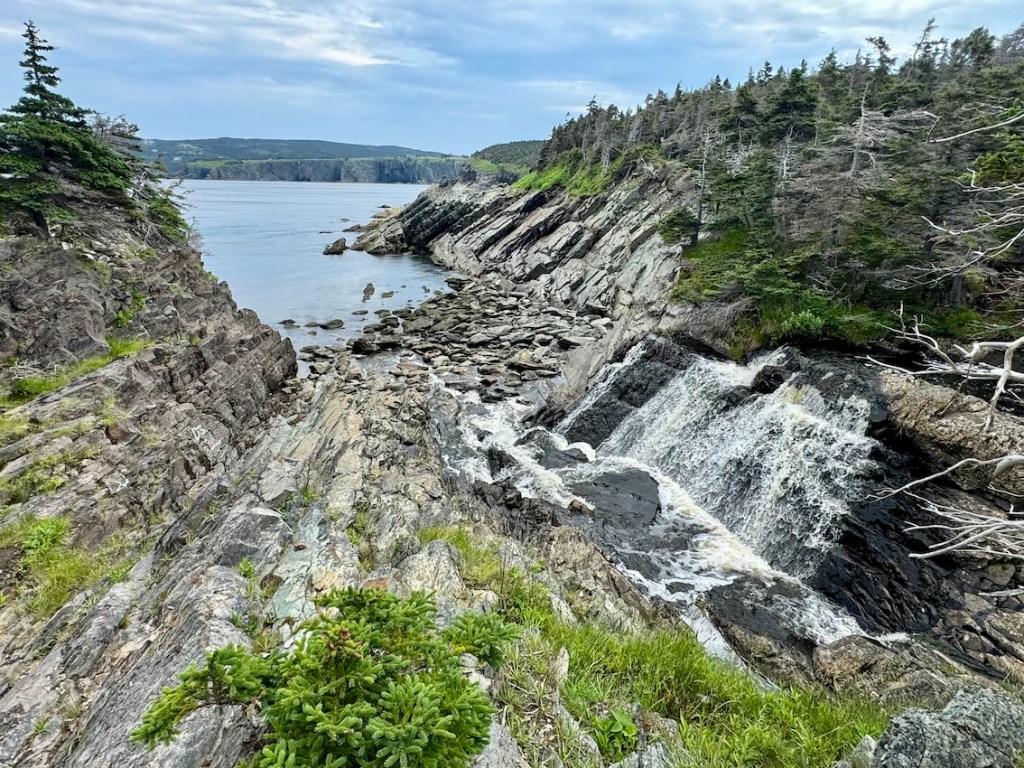
Features: The ECT is one of the most rugged and rewarding long-distance hikes in Canada, tracing Newfoundland’s dramatic coastline through a mix of wilderness routes and small communities (including the capital city of St. John’s). You can spend one day wandering foggy headlands, feeling like you’re completely off the map, then wake up the next morning and stroll into a colourful village for a hot meal or a pint of beer. Along the way, you’ll pass sea cliffs, sheltered coves, suspension bridges, waterfalls, and lighthouses. The weather shifts quickly, and the terrain ranges from easy boardwalk to steep climbs, but if you’re ready to take it on, the ECT is an unforgettable coastal journey!
East Coast Trail FAQs

Q. Where is the East Coast Trail located?
A. The ECT is on the eastern edge of Newfoundland’s Avalon Peninsula in Canada. It stretches from the town of Renews-Cappahayden in the south to Topsail Beach in the north, following a rugged coastline and weaving through over a dozen small communities
Q. How long is the East Coast Trail?
A. The ECT is approximately 336 km, combining 25 wilderness paths and 9 community walks. Most hikers choose to complete sections over time, but the full thru-hike typically takes anywhere from 12 to 20 days.
Q. How difficult is the East Coast Trail?
A. The ECT is considered moderate to challenging, depending on the section. While some trails are short and well-marked, others involve long distances, exposed terrain, muddy paths, and significant elevation changes. Thru-hiking the full trail requires solid backpacking experience and a high level of physical endurance (you’ll need some grit!).
Q. Is the East Coast Trail suitable for beginners?
A. Certain shorter sections (like Cape Spear or Tinkers Point, to name a couple) are great for beginner hikers or families. However, the full route is best suited for experienced backpackers due to the length, logistics, terrain, and unpredictable circumstances.
Q. How long does it take to thru-hike the ECT?
A. Most hikers take between 12 and 20 days to complete the entire route, depending on their pace, rest days, and weather. Some experienced hikers finish in less time, but it’s a good idea to give yourself some buffer. I completed the ECT in 14 days.
Q. Do I need a permit to hike the East Coast Trail?
A. No, permits are not required to hike or camp along the ECT. However, donations to the East Coast Trail Association (ECTA) are encouraged to help maintain the trail.
Q. Where can I camp on the East Coast Trail?
A. While the ECT doesn’t have designated campsites on every section, there are a number of unofficial tenting areas along the route, often near water sources or viewpoints. Check out my map below to find campsites and photos. Some sections pass near towns where accommodations are available, so you can have a nice B&B break (I recommend!).
Q. Are there resupply options along the trail?
A. Yes, one of the benefits of the ECT is its proximity to communities. You can resupply in towns like Bay Bulls, Witless Bay, Petty Harbour, and Pouch Cove, among others. Planning your food drops or resupply points in advance is recommended.
Q. What’s the best time of year to hike the East Coast Trail?
A. Late June to early October. July and August generally have the best weather and longest daylight hours (I thru-hiked in July). No matter when you visit, be prepared for fog, wind, and sudden rainstorms.
Q. Are there guided hikes available on the East Coast Trail?
A. Yes, several companies and local guides offer day hikes and multi-day trips on the ECT. Check with local outfitters or the ECTA for recommendations.
Q. What kind of wildlife might I see on the East Coast Trail?
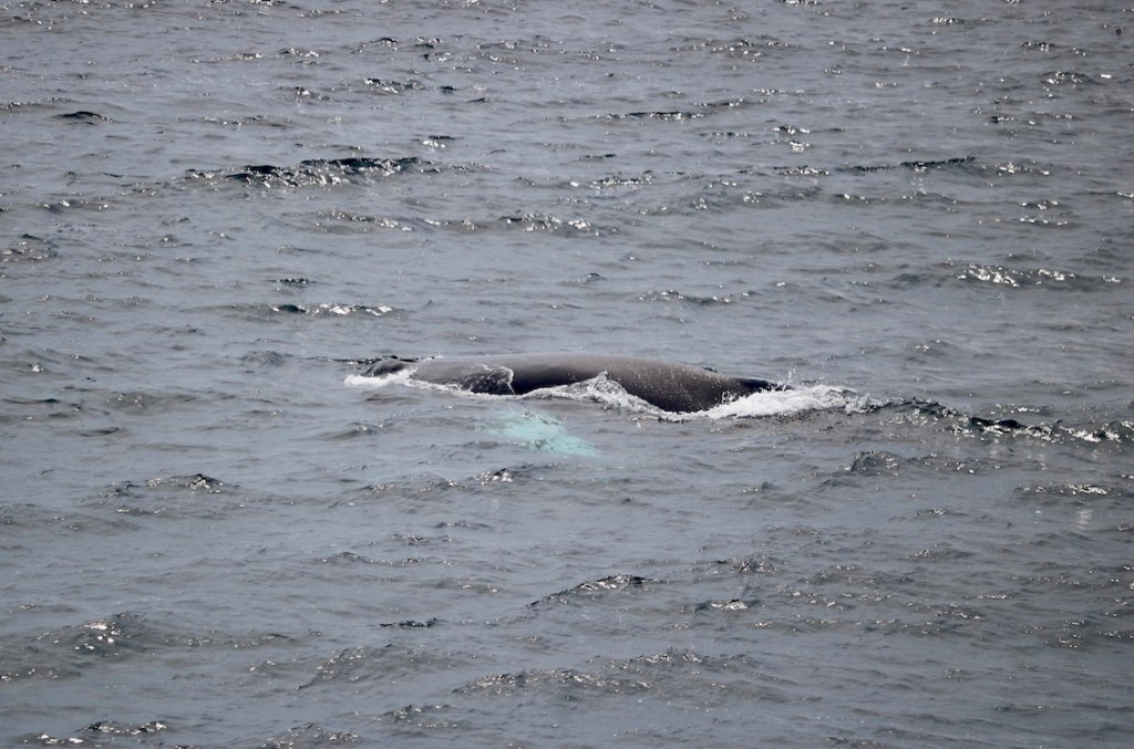
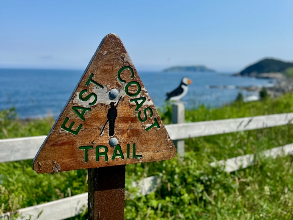
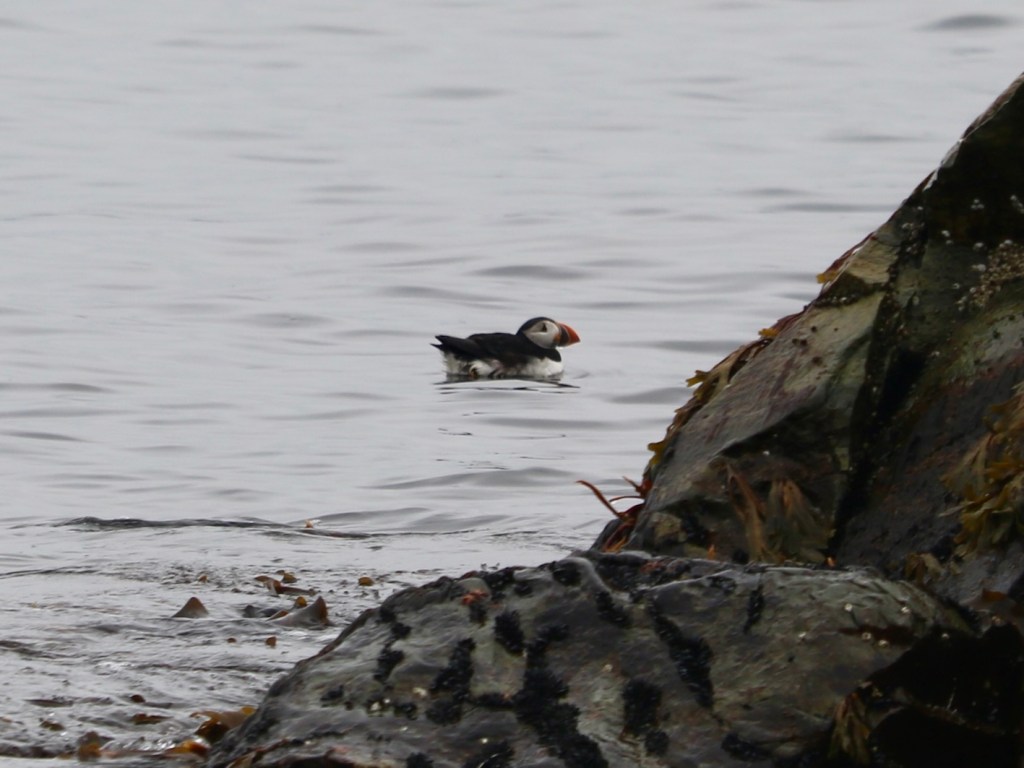
A. Common sightings include whales (especially humpbacks), seabirds (like puffins), foxes, and occasionally moose. The trail is also rich in wildflowers and coastal ecosystems.
Q. Is the East Coast Trail marked and maintained?
A. Yes, the ECT is fairly well-marked with signage and maintained by the ECTA, though conditions can vary. Some paths may be overgrown, muddy, or affected by coastal erosion.
Q. Are local communities supportive of hikers on the East Coast Trail?
Absolutely — Newfoundland hospitality is alive and well! In my experience, locals are often happy to help with directions, water, or even a lift through town. On my thru-hike, one community member in Torbay (thanks, Sam!) even offered me a rest stop complete with drinks and snacks. For more tips, updates, and connections with other hikers, check out the ECT Thru Hike – End to End on the East Coast Trail Facebook group. It’s a great resource before and during your hike.
Q. Is the East Coast Trail a true wilderness experience?
A. Parts of it definitely are. While the trail connects coastal communities, many sections feel remote and rugged, with dense forest, exposed headlands, and little to no cell service. It’s a unique mix of accessibility and wild, which in my opinion, is perfect for beginner backpackers or solo thru-hikers who want to meet people along the way!
Why Hike the East Coast Trail

So, why hike the East Coast Trail anyway? The ECT is a great fit for hikers seeking a thru-hike that strikes a balance between challenge and accessibility. It’s a rare kind of route that offers tons of flexibility — you can resupply in small coastal communities, enjoy a meal or zero day in St. John’s, and even sleep in a cozy B&B (if you’re not into that tenting thing…). But don’t be fooled into thinking it’s easy: The ECT has plenty of rugged and remote stretches. Whether you’re easing into your first long-distance hiking adventure or looking to grind out long days to test your endurance, there’s something here for everyone. In my humble opinion, it’s that mix of grit and grace that makes the ECT such a cool experience.
Read next: Your Complete Guide to the Long Range Traverse in Newfoundland
Should You Thru-Hike or Section Hike the East Coast Trail?
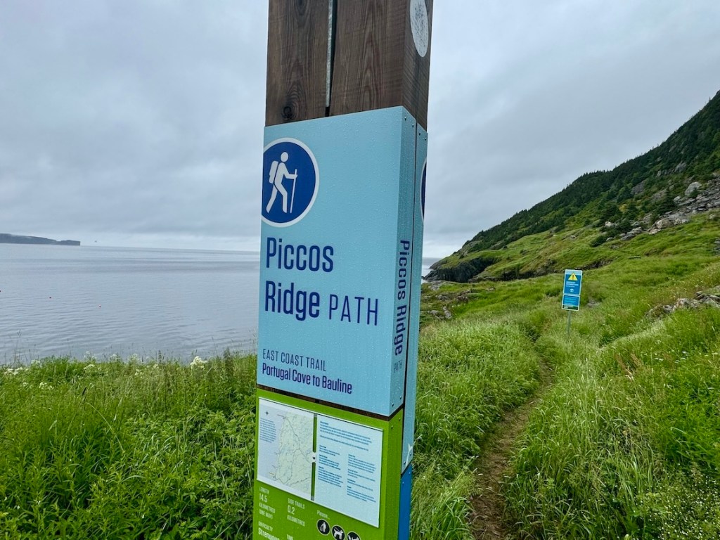
Still not sure if a full thru-hike is for you? That’s totally fair. One of the great things about the East Coast Trail is how easily it can be hiked in sections. It seems like many (most) people complete the ECT over several years, tackling one or two wilderness paths at a time. It’s a great way to get to know the trail and build up your confidence and endurance. I was definitely surprised by how tough some sections were — White Horse and Piccos Ridge come to mind, with their steep climbs and deep ravines. Even Cape Broyle Head. But let’s be clear, The Spout is not the toughest hike on the ECT 😉 If you want to start with the tough stuff, I suggest hiking north to south like I did.
If you’re looking for a long-distance hike that blends wild coastline with small-town charm, the ECT could be exactly what you’re after. It’s challenging but fairly accessible (as far as backcountry goes), with the option to rough it or take breaks in cozy B&Bs and cafés. You’ll face rugged terrain, unpredictable weather, and some long days, but also quiet forests, dramatic views, and the Atlantic Ocean beside you. If that experience speaks to you, then why not consider thru-hiking the ECT? The choice is yours!
When Is the Best Time to Hike the ECT?
You can thru-hike the East Coast Trail from late June through early October. But if you’re looking for the best conditions, I suggest tripping in July or August for the warmest weather and the longest days (perfect for big pushes or slow rambles). By then, the mud has mostly dried up (maybe…), and the whales often put on their show offshore. September cools things down but dials back the bugs. That being said, this is Newfoundland — so fog, wind, and sideways rain can roll in anytime of the year. Come prepared, pack layers (including a waterproof shell), and embrace the moody vibes.
Read next: Your Guide to Seawall Trail on Cape Breton Island
How to Get to St. John’s, Newfoundland
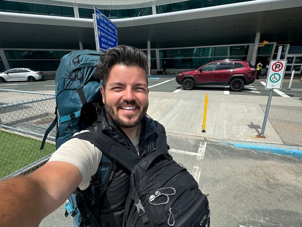
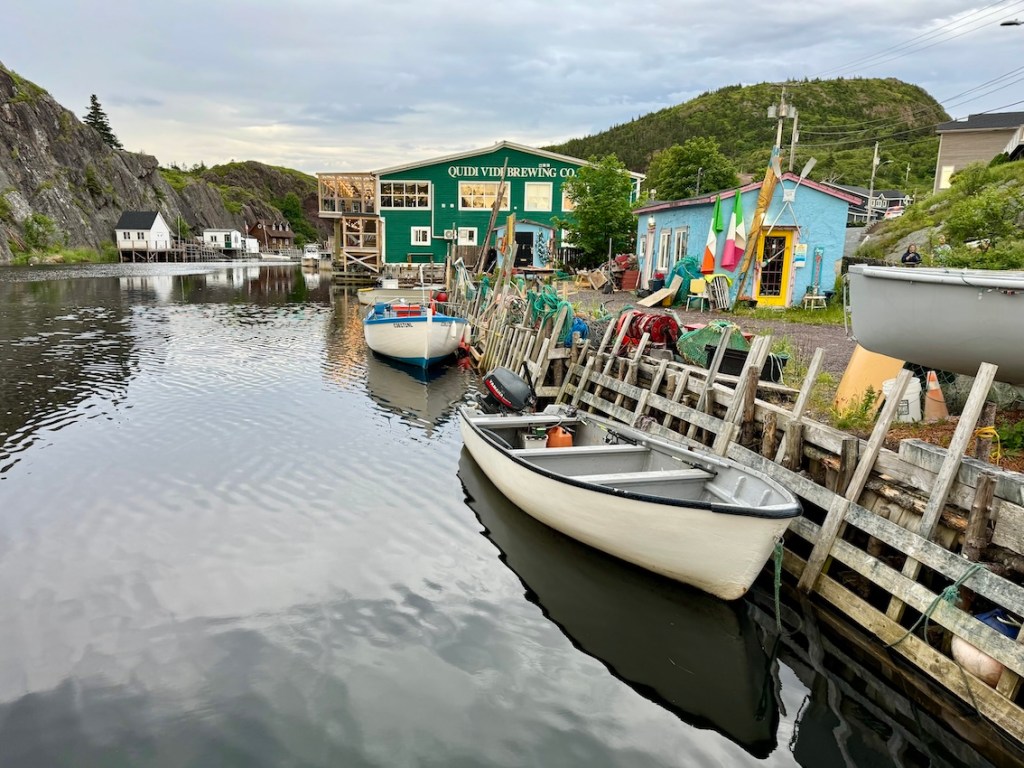
Depending on where you’re travelling from, getting to St. John’s is a bit of a trek. But don’t worry, the journey is worth the reward. I flew into St. John’s International Airport (YYT), which has reliable year-round connections (just don’t accidentally book for Saint John, New Brunswick… though the Fundy Footpath is a nice hike, too 😉 You laugh, but it happens). Or you can take the Marine Atlantic ferry from Sydney, Nova Scotia, if you’re arriving with a vehicle or prefer to travel by sea. After landing, I was lucky enough to have a car waiting for me (thanks, Caroline!), so I grabbed some last-minute supplies and then settled into my cozy Quidi Vidi cottage for the night. Soon the adventure would begin.
Note: I forgot to bring a pair of hiking shorts (I know, right…) and had to find some in St. John’s before heading out. If you need any last-minute supplies, I suggest heading over to The Outfitters outdoor store downtown.

Where to Stay in St. John’s (Before & After Your Hike)
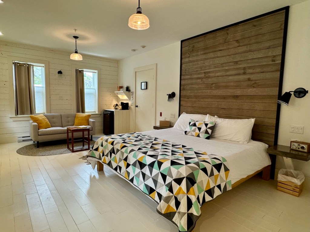
If you’re like me, you may want to spend a night or two in St. John’s before starting your ECT adventure. It’s worth choosing a place that’s comfortable and close to what you want. There are several hotels and cozy B&Bs downtown, along with quieter options just outside the core if you prefer a calmer start. I stayed at The Inn by Mallard Cottage in Quidi Vidi and absolutely loved it — warm, beautifully designed, spacious, and complete with an ensuite bathroom. Being tucked into the harbour was perfect for a quiet evening, with an easy walk to Quidi Vidi Brewery. How could I resist fish and chips and a pint of craft beer?
Sponsored: Thank you to The Inn by Mallard Cottage for hosting my first-ever night in St. John’s! It was such a beautiful location, comfortable and chic accommodation, and the perfect place to get settled before starting the ECT. I really couldn’t have asked for a better base before heading out. Check it out!
Do You Need to Reserve Campsites or Permits on the ECT?

You don’t need to reserve campsites to hike the East Coast Trail — no permits, no fees, no formal bookings (no struggling to book your dates… like, ahem, the West Coast Trail). That’s one of the best things about this place. Also, the ECT is open year-round, which means you can plan your trip with a lot of flexibility. Though if you’re hoping to stay in B&Bs or other accommodations, you should absolutely book ahead (especially in the summer months). There are a handful of designated campsites along the route, but they’re first-come, first-served. So, while you don’t have to reserve anything, a bit of planning goes a long way.
Read next: Rockcut Twillingate Trails: Coastal Hiking in Newfoundland

How Much Does It Cost to Hike the East Coast Trail?

Here are a few costs you might expect when planning your ECT adventure:
| Item | Estimated Cost | Notes |
|---|
| Trail Access | Free | No permits or fees required |
| Camping | Free | Informal sites; first-come, first-served |
| Accommodations | $80–$200+ per night | B&Bs, inns, and motels in nearby communities |
| Food & Resupply | Varies | You can mail parcels ahead, and stop at local grocery stores along the way Available in towns along the trail |
| Transportation (Flights) | Varies ($500–$800 roundtrip) | Depends on origin and destination (flying into St. John’s) |
| Transportation (Ferry) | Approx. $160 roundtrip | Departing North Sydney and arriving in Argentia. |
| Local Transit/Shuttles | $20–$100 per ride | Taxis or private shuttles between trailheads or towns (ask locals or B&B hosts) |
| Gear & Supplies | Varies | Upgrades, maps, or emergency gear |
| ECTA Donation (Optional) | Suggested: $25+ | Supports trail maintenance via the East Coast Trail Association. They’ll appreciate it! |
If you’re flying in, most hikers start or finish in St. John’s. From there, local taxis or pre-arranged shuttles can help connect you to trailheads. I always suggest speaking with locals or B&B hosts who might be able to offer suggestions. While hiking the full trail on a tight budget is absolutely doable, many people mix in B&B stays, meals out, and the occasional town day (which can add up). Plan accordingly, and have the hike that’s right for you.
How to Navigate the East Coast Trail
Navigating the East Coast Trail is straightforward as long as you come prepared. For the most part, wilderness paths are well-marked with signage and trail markers, and have clear entry points. Although some areas feel a bit more remote and require a closer eye on the route. I used the ECT route on AllTrails to track distance and check elevation, which helped with pacing and planning water breaks. I recommend downloading offline maps before heading out, since cell service can be spotty. I’d also suggest downloading individual paths from AllTrails, or a comparable GPX route. Organic Maps is another useful app.
The ECTA publishes official maps and route descriptions, and these are so helpful for understanding terrain and informing your hike. With a combination of trail signage and offline maps, you’ll have everything you need to stay on track.
Read next: Green Gardens Trail: Hiking in Gros Morne National Park
Safety Tips for the East Coast Trail
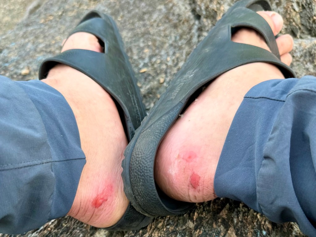
If you don’t have a few blisters, did you even hike the East Coast Trail? 😉 Thru-hiking is worth every step, but it’s important to start off on the right foot (see what I did there?). Break in your hiking boots before you arrive to help prevent blisters, and carry a small foot-care kit just in case (I swear by Luekotape, seriously!). And Newfoundland’s weather can change fast, so pack warm layers (like a fleece) and waterproof gear even if the forecast looks clear. Always stay well back from cliff edges because the coastal winds can be unpredictable, and the ground can be loose or slippery.
Keep your phone on airplane mode to save battery and download offline maps before you start. Bring enough water (carry at least two litres), snacks, and a basic first-aid kit, and let someone know your daily plan if you are hiking alone (check out AdventureSmart for more resources — it’s great!). With some preparation and good judgment, the ECT is a safe and unforgettable adventure.
Wildlife on the East Coast Trail
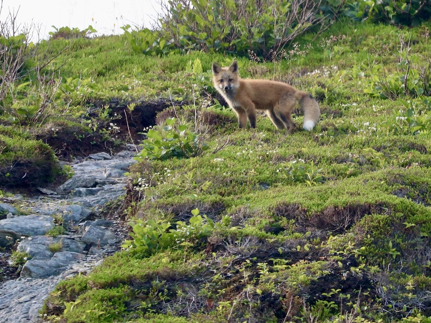
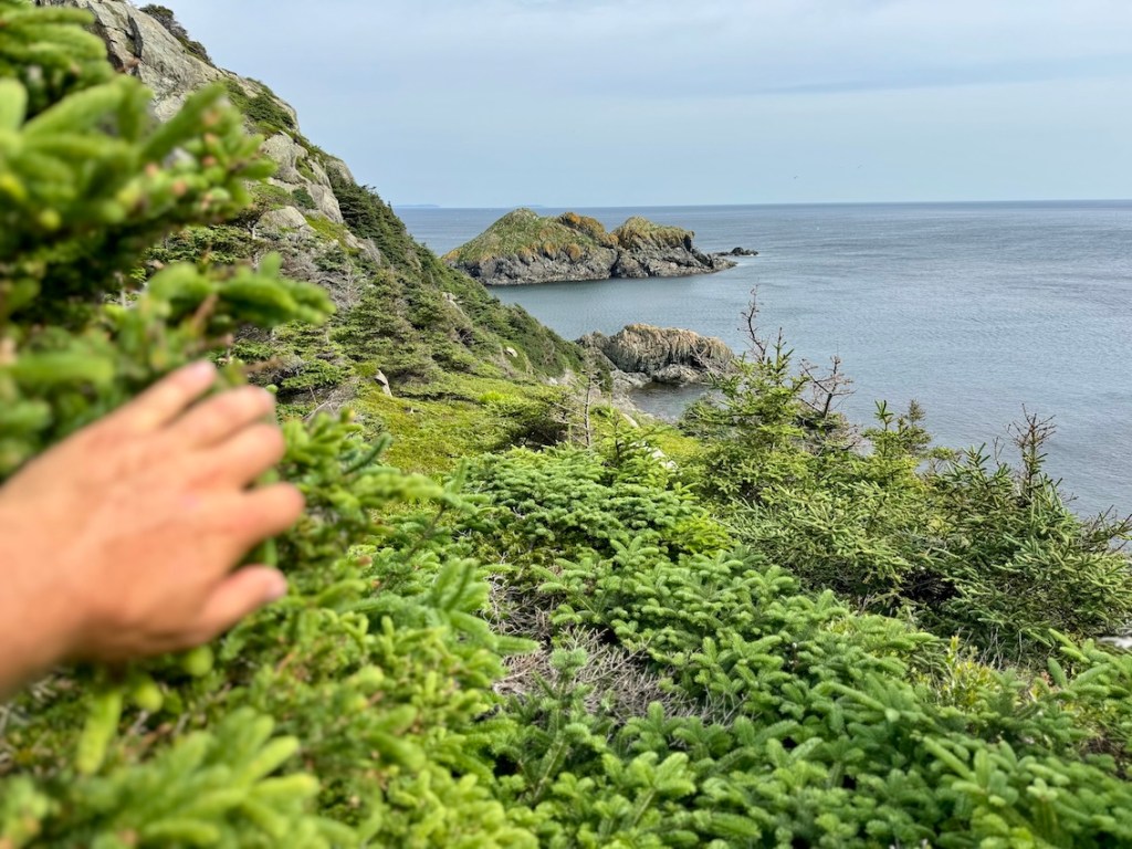
You’re going to cross paths with wildlife, from curious red foxes trotting along to humpback whales feeding close to shore. I saw at least 30 whales during my thru-hike, along with puffins, seabirds, and the occasional woodland creature. The best way to experience wildlife here is to watch quietly and keep your distance. Follow Leave No Trace principles by staying on the trail, packing out all food waste, and please, don’t feed wildlife (even if the fox looks friendly…). Keep your snacks out of reach and use a zoom lens instead of getting closer for a photo. Respecting wildlife not only keeps you safe, it also protects the animals and ensures future hikers get to enjoy the same wild moments you do.
Read next: Your Complete Guide to the Fundy Footpath in New Brunswick
Toilets on the East Coast Trail
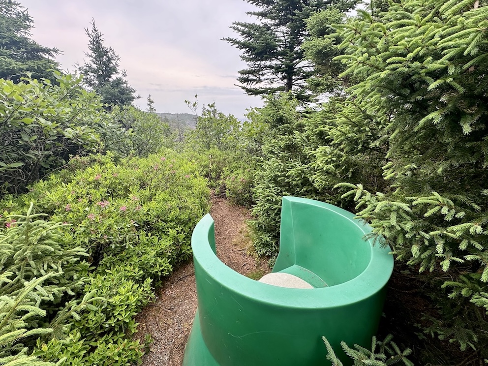
You will come across a few outhouses or thunder-box-style toilets along the East Coast Trail. When the route passes through communities, you can sometimes use public restrooms. But many hiking sections have no facilities at all. If you need to go and there is no toilet nearby, step well off the trail and away from water and dig a small cathole. Here are some tips for poopin’ in the woods without leaving a trace. With a little preparation, dealing with bathroom needs in the backcountry can be simple and low-impact.
Water Sources on the East Coast Trail

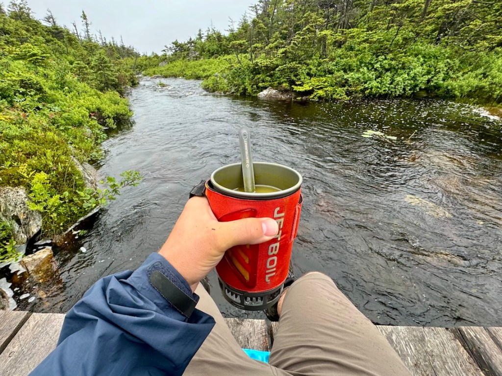
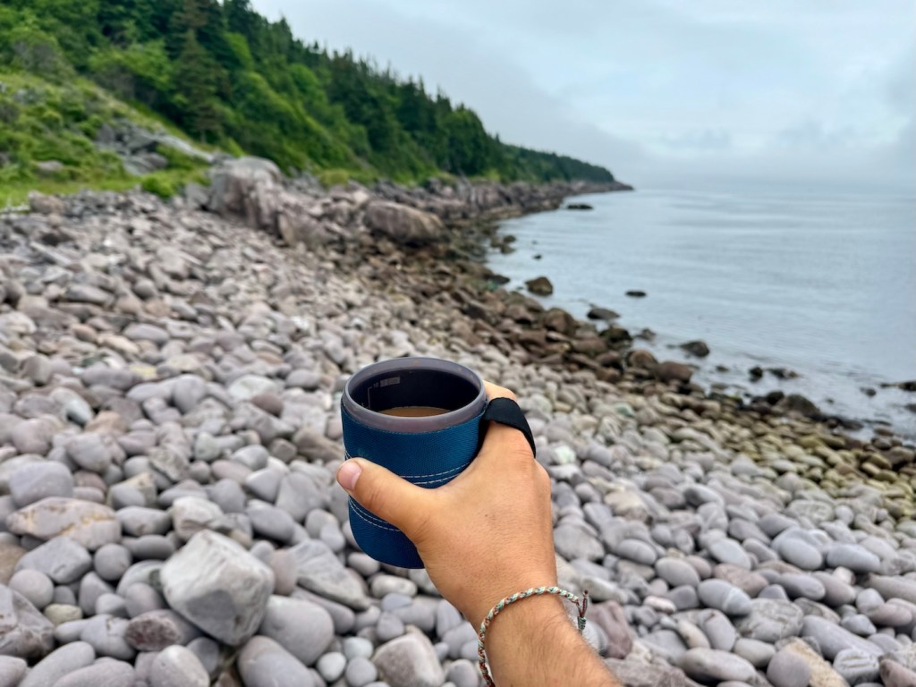
The East Coast Trail had no shortage of water sources when I visited. Streams and brooks appear regularly on most sections of the trail, but water levels can change with the seasons. Smaller sources may dry up in late summer or during a warm stretch. Cary a water filter or purifying tablets to treat any water you collect (no matter how clear it looks… trust me, you don’t want beaver fever!). Keep an eye on your remaining water and top up whenever you have a reliable source. Planning ahead and filling up consistently will keep you hydrated and comfortable during your thru-hike.
Read next: Your Complete Guide to Hiking in Tombstone Territorial Park
Meal Planning and Resupply Options
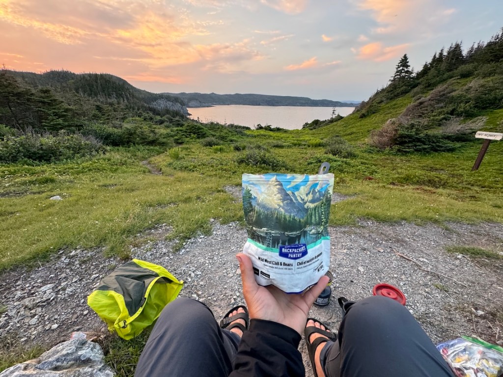
Sponsored: A big thank you to MEC Moncton for providing enough meals for the entire duration of my East Coast Trail adventure. If you’re looking for the widest selection of camping meals, or need some hiking and camping gear, MEC has been my go-to place for years, and I was thrilled to work with them. They made this trip very tasty!
Most hikers pack most or all of their food before starting the East Coast Trail, though you can mail yourself a resupply box to pick up halfway if that works better for your setup. I carried enough food (mostly freeze-dried meals from MEC) for about half my trip and left the rest with my friend Caroline, meeting up to grab more when I needed it (thanks, Caroline!). I had to do the same with my power banks — between keeping my phone charged for navigation and photos, and running the drone, I rotated battery packs a few times.
While there are a few convenience stores and cafés along the route, they’re not frequent enough for full resupply. Plan to be mostly self-sufficient between towns and bring enough food and snacks to keep your energy up.
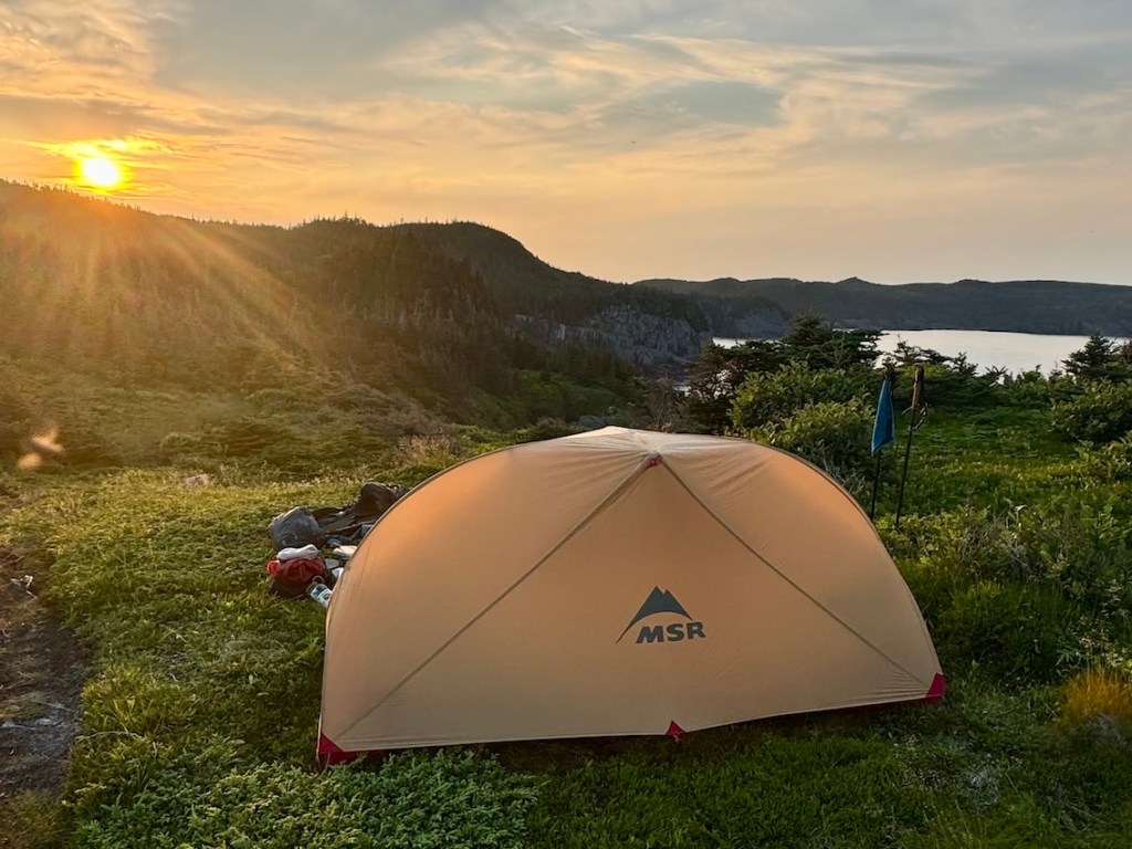
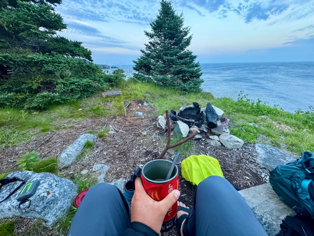
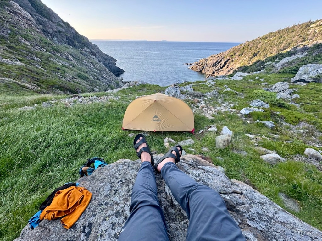
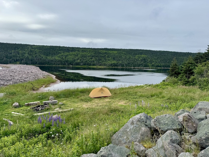
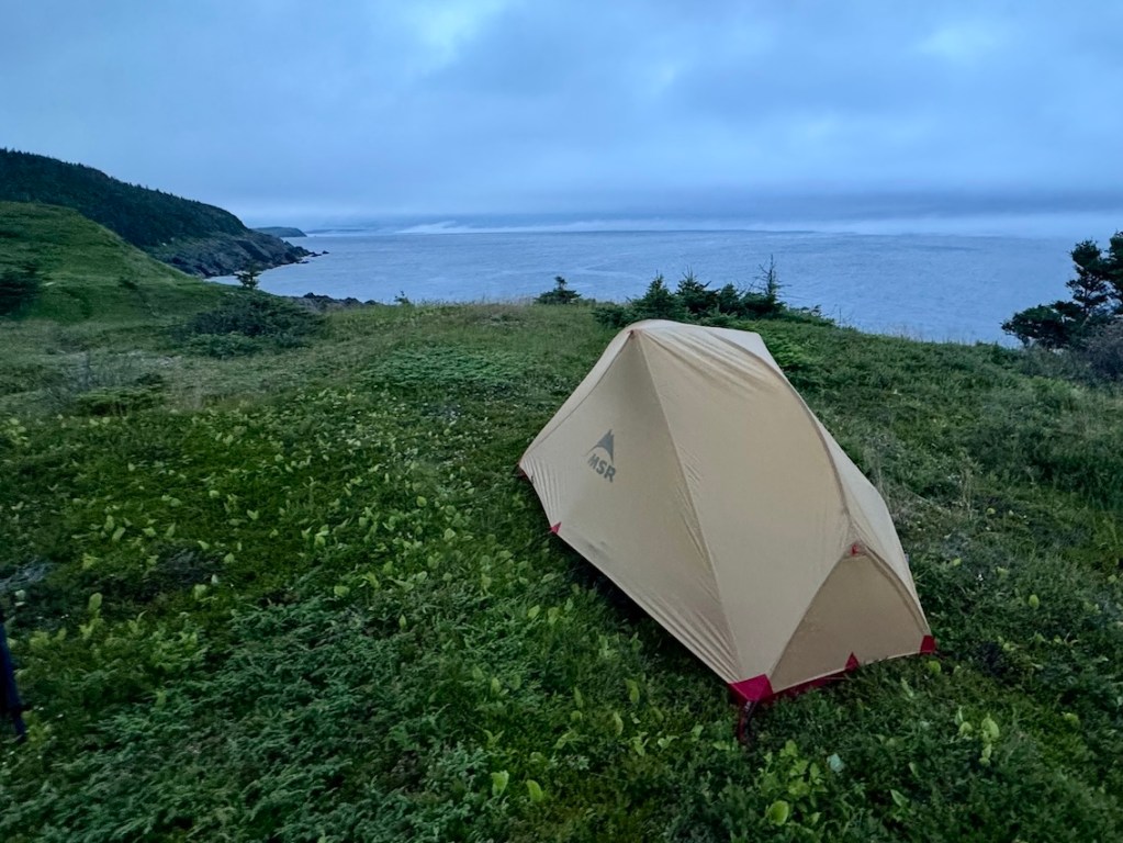
Camping on the East Coast Trail
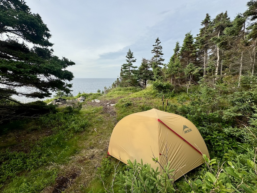
Camping on the East Coast Trail is a mix of official ECTA campsites, a few community campgrounds, and some carefully chosen wild spots, depending on the section you’re hiking. Many paths have designated tent pads or cleared areas near water sources, while others require you to find a tucked-away, low-impact place to spend the night. I used a combination of established sites, sheltered coves, and a couple of exposed headlands with incredible sunrise views. Water is usually available from streams, brooks, or ponds (but it’s essential to filter everything). Some sites can be windy or foggy, so be prepared for coastal weather and always follow Leave No Trace principles when choosing where to camp.
Read next: Your Complete Guide to Hiking Cape Chignecto Trail in NS

B&Bs and Accommodations Along the ECT

Looking for more creature comforts? There are plenty of cozy B&Bs along the East Coast Trail, perfect for resting tired legs after long hiking days. I was hosted by the Inn on Capelin Bay in Calvert (Thanks again, Kevin!), and it was one of the highlights of my trip. Perched above the water with ocean views, this beautiful spot has very comfortable rooms, tasty breakfasts (so good…), and that incredible Newfoundland hospitality that makes you feel right at home. I loved recharging in The West Wing mini-cottage suite, and that hot shower was amazing!
Local B&Bs offer warm hospitality and hearty meals, with helpful amenities like laundry, shuttle assistance, and trail knowledge from hosts. Near both the northern and southern ends of the route, you’ll find welcoming spots that work well for starting or finishing a thru-hike. No matter where you stay, local accommodations add a special sense of connection to the people and communities. It’s a great option.

East Coast Trail Guided Hikes

You definitely don’t need a guide to hike the East Coast Trail, but for some folks, it can be a great way to ease into the adventure. Maybe it’s your first time on the trail, you’re short on time, or you just want someone else to handle the logistics. After all, a good guide can give you insight and help take the stress out of planning. It can also be a solid option if you’re hiking solo and want a bit more structure or company on the trail. You can find guided day hikes available on the ECTA website and supported thru-hikes from companies like Great Canadian Trails (no affiliation). If you have other recommendations for guided thru-hikes, I’d love to hear from you!

East Coast Trail Shuttle and Transportation Options

Getting to the trailheads of the East Coast Trail can be straightforward or a little complicated, depending on whether you’re starting from the northern end at Topsail Beach or the southern end at Cappahayden. Topsail Beach is about a 30-minute drive from downtown St. John’s, and there’s a parking area at Topsail Beach Rotary Park. From there, it’s a short walk to the trailhead sign. If you don’t have access to a vehicle, you can book a ride with the East Coast Trail Shuttle, which services this trailhead by request. There are also local taxi companies like Jiffy Cabs (709-722-2222) and City Wide (709-722-7777) that also operate in the area.
If you’re starting from the south, the small community of Cappahayden is about a 2-hour drive from St. John’s. The trailhead is accessible by vehicle, and parking is near the start of the Island Meadow Path. Public transit doesn’t run this far, so arranging a ride in advance is key. If you’re staying at a B&B or local accommodations, check with your host to figure out the best option for transportation.

East Coast Trail Packing List
Here’s my packing list:
- Osprey Atmos 50
- Waterproof pack cover
- MSR Hubba Hubba
- MEC Talon sleeping bag
- Therm-a-rest NeoAir
- Sleeping bag liner
- Siltarp
- Plastic Birkenstocks
- Salomon hiking boots
- Arc’teryx Beta LT rain shell
- Rain pants
- Jetboil Flash
- Stove fuel
- Campsuds soap
- Osprey 2L reservoir
- Nalgene water bottle
- Komperdell hiking poles
- Lighter / matches
- GSI mug
- Spoon
- Sunscreen
- Sunglasses
- Bug spray
- Bug jacket
- Toilet paper
- PackTowel
- Toothbrush / toothpaste
- MSR TrailShot filter
- Petzl headlamp
- Paracord
- Buff
- Mora Knife
- First aid kit
- Leukotape (for blisters)
- 2 merino wool t-shirts (like this Icebreaker tee)
- 1 long sleeve (love this Patagonia Capilene)
- 1 pair of pants
- 2 pairs of shorts (1 for hiking; 1 for camp)
- 3 pairs of merino underwear (1 for hiking; 1 for camp; 1 extra)
- 2-3 pairs of merino socks (1 for hiking; 1 for camp; 1 extra)
- Down jacket (love this Patagonia down sweater jacket)
- Warm hat and gloves
- Map / compass
- Satellite comms (Zoleo)
- Powerbank (Anker)
- Food
Solo Hiking the East Coast Trail

Solo hiking the East Coast Trail is completely doable and can be incredibly rewarding, as long as you’re prepared and comfortable spending long stretches on your own. While you’ll meet people here and there, there are several hours where it’s just you and the coastline. I loved the freedom of setting my own pace, choosing my own campsites, and taking breaks whenever something caught my attention — like that hour-long break watching humpback whales offshore. Cell service is decent in some sections and nonexistent in others, so it’s important to carry a map or offline GPS, and let someone know your general plan. With good preparation, solo hiking the ECT can be an awesome experience.

14-Day East Coast Trail Trail Itinerary – North to South
Day 1 — Trailhead to Brocks Pond (KM 0–16.5KM)
Path(s): Long Shore
Distance: 16.5 km
Camp: 📍 47.62481, -52.84764 / Prince’s Lookout (Portugal Cove)
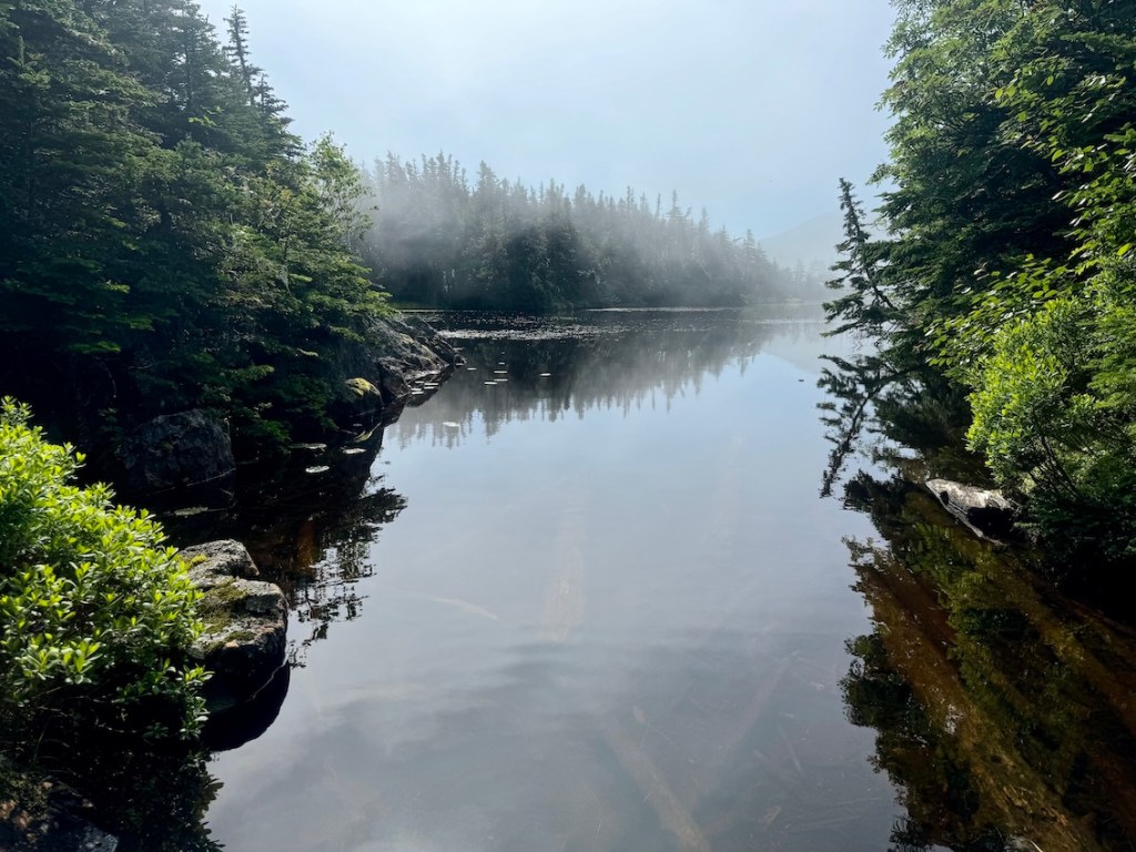
Field Notes: I left Topsail Beach around 12:45 under overcast skies and followed Long Shore Path with a short break during the community road walk through, eventually back on the path to reach Prince’s Lookout before 7:00pm. No water available at the campsite—thankfully, I had filled up earlier at Beechy Cove. Prince’s Lookout was an excellent first campsite with plenty of room and a nice view, looking over Portugal Cove and Bell Island. After a comfortable, cool day with no rain, I ate supper on the rocks and turned in around 10pm.

Day 2 — Prince’s Lookout to Bauline (KM 16.5–33)
Path(s): Long Shore, Piccos Ridge
Distance: 16.5 km
Campsite:📍 47.72127, -52.83512 / Bauline
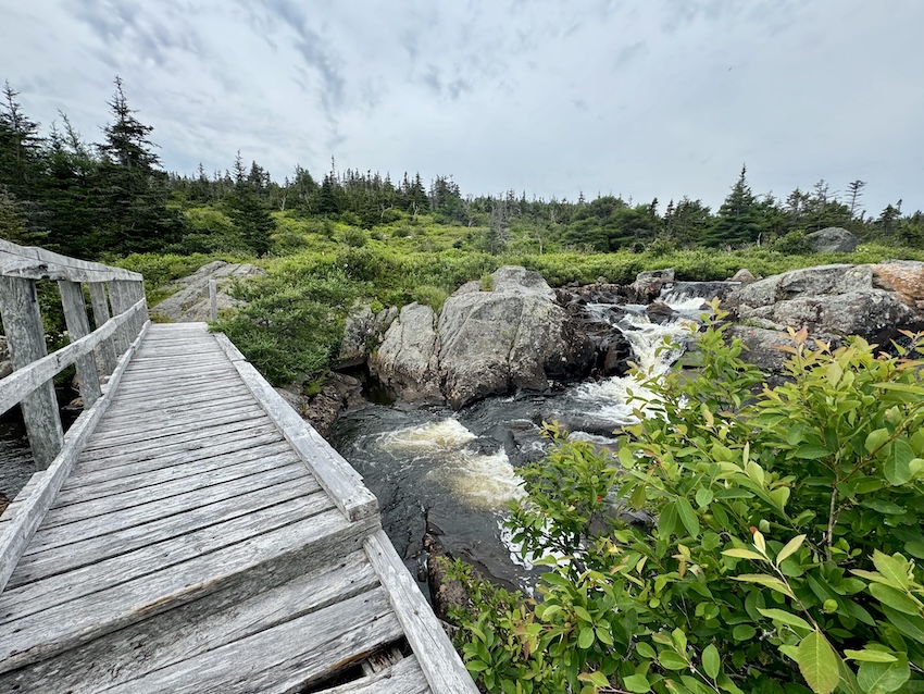
Field Notes: A light morning rain was falling when I left Prince’s Lookout at 9:25am, reaching the Long Shore Path trailhead 15 minutes later and starting the community walk at 9:40am. I filled my water in Portugal Cove and started Piccos Ridge Path at 10:10am. The bluffs were slick in the rain, and I took a short side trip to view a small waterfall before descending into Brock’s Pond for lunch around 12:15, where I enjoyed the bridge, the falls, and a drone session until 1:40pm. After reaching the top of Piccos Ridge around 3pm, I made the steep but quick descent to Cove Pond Brook (another good water source) around 4pm, and arrived in Bauline by 5pm after a foggy, wet day with only a handful of other hikers on the path. Thanks to the kind woman who gave me a chocolate bar in Bauline 🙂
Day 3 — Bauline to Back Cove (KM 33–50.1)
Path(s): White Horse
Distance: 17.1 km
Camp: 📍 47.80621, -52.78881 / Back Cove
Field Notes: I left camp at 8:30am and walked through Bauline before started the White Horse Path — climbing a muddy, bouldery, boggy kilometre to start the day, reaching a good water source 1.5 km in. After topping up again at the 7.3 km mark and taking a short break, I reached Patch Brook around 12:18 at the 10 km point, where two tent pads sit tucked in the trees. I stopped for lunch overlooking Cripple Cove at 2 pm and was back on the trail after an hour, making steady progress until reaching White Horse Path Trailhead around 5pm. I camped in Back Cove that evening, very peaceful aside from one very persistent raven. I escaped the hot sun in the shade of a large boulder. Beauty day!
Day 4 — Back Cove to The Swirly (Flatrock) (KM 50.1–77.5)
Path(s): Biscan Cove, Stiles Cove
Distance: 27.4 km
Camp: 📍 47.70764, -52.70885 / The Swirly (Flatrock)
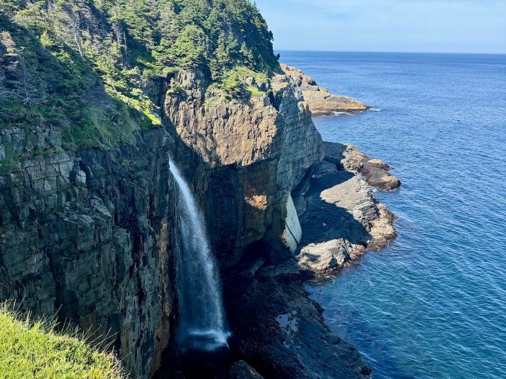
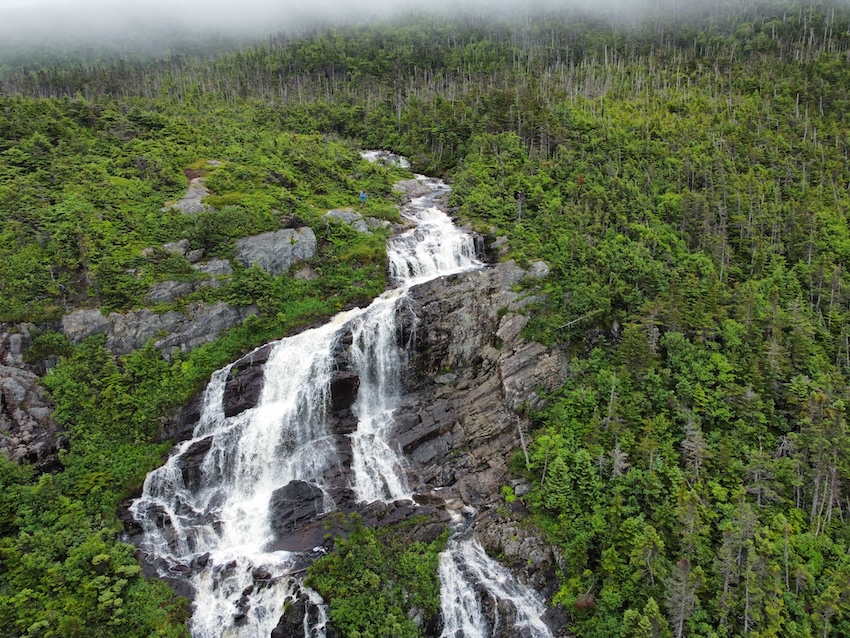
Field Notes: I packed up and left camp by 8:30am and quickly wrapped up the end of White Horse Path before washing dishes and filling water, then continued on to Biscan Cove Path just five minutes later. I finished Biscan around 11:30am and had to detour around a short section of Stiles Cove Path because of a film set. One of the crew gave me a ride through Pouch Cove, and even stopped at a convenience store for Gatorade. I was back on track by 12:30, moving through Stiles Cove and reaching Shoe Cove by about 1:15pm. After crossing the bridge around 2pm (I got distracted by a pod of humpbacks offshore…), I continued hiking through the afternoon and reached Spout River and its waterfall at 4pm. I arrived at Whirly Pool near Flatrock around 7 pm, and found a campsite next to the falls. It wasn’t very private, but some friendly locals showed me where to swim. A great way to end the day!

Day 5 — The Swirly to Redcliff Battery (KM 77.5–102.8)
Path(s): Father Troys, Silver Mine Head, Cobblers
Distance: 25.3 km
Camp: 📍 47.63933, -52.66690 / Redcliff Battery
Field Notes: I started hiking at 9am and reached Father Troys Trailhead by 9:30, navigating lots of early bedrock and catching sight of a pod of whales at Whale Cove (go figure!) before hitting long stretches of ATV trail. I finished Father Troys around noon and enjoyed a long lunch break with food from Lorina’s (yum!) and snacks from a kind local (thanks, Sam!). I started Silver Mind Head Path around 2:20 and reached Middle Cove by 3 pm. I continued on, and got to Cobblers Trail by 4 and found a place to camp at Redcliff Battery in St. John’s before 7pm. Caroline stopped by for a visit. No water here; need to refill at Cobblers Brook.


Day 6 — Redcliff Battery to Freshwater Bay (KM 102.8–122.3)
Path(s): Cobblers, Sugarloaf, Deadmans Bay
Distance: 19.5 km
Camp: 📍 47.53445, -52.68982 / Freshwater Bay
Field Notes: I left at 8:45 and walked a kilometre to the Cobblers Trailhead before reaching the Sugarloaf Path Trailhead by 10am at the 5 km mark. I spotted a bald eagle overhead along the way. Sugarloaf had quite a bit of litter (disappointing…), but by 12:30 I’d made it into Quidi Vidi and met up with Caroline and Claire for lunch at the brewery. The three of us then drove across town to Deadmans Bay Path and started hiking together around 3:50 (nice to have company for a change!). We reached Freshwater Bay by around 5:30 (no cell service), where they had a shuttle vehicle waiting, and I set up camp beside a pond with easy water for drinking and swimming. A minke whale swam offshore that evening, and the weather stayed perfect all day.
Day 7 — Freshwater Bay to Petty Harbour (KM 122.3–143.3)
Path(s): Deadman’s Bay, Cape Spear
Distance: 21 km
Camp: 📍 47.47086, -52.69179 / Petty Harbour
Field Notes: I started around 9:20am and finished Deadmans Bay by 11am, followed by a very short community walk before beginning the Cape Spear Path at 11:30. It was a cold and foggy morning, so I grabbed some hot chowder at the Cape Spear Café around 1:10, where I met some visitors from Ontario. I was back on the trail by 1:50 and reached my campsite near Petty Harbour around 5pm. The entire day was wrapped in thick fog, giving everything those classic Newfoundland vibes.
Day 8 — Petty Harbour to The Spout (KM 143.3–165.8)
Path(s): Cape Spear, Motion, Spout
Distance: 22.5 km
Camp: 📍 47.36637, -52.72645 / The Spout
Field Notes: I left camp at 10am and reached the Motion Path Trailhead by 11:05 before climbing steadily for about 20 minutes. By noon, I was at Freshwater River (6.75 km), taking a long shaded break under a huge overhanging rock (where I met Jo from Revelstoke!). I finished Motion Path around 5pm, paused for a waterfall break above Shoal Bay at 5:25pm, and reached the Spout at 6:40pm. I camped nearby, with an easy water source and a gorgeous waterfall, but not much flat ground. It was easily one of the hottest days on the entire thru-hike!
Day 9 — The Spout to Witless Bay (KM 165.8–195.8)
Path(s): Spout, Mickeleens
Distance: 30 km
Camp: 📍 47.26145, -52.81180 / Witless Bay
Field Notes: I watched whales offshore before starting at 9am, hiking 500 metres to reach the official ECTA campsite in about 12 minutes from The Spout. Honestly, the platforms were in rough shape, so I was happy with my decision. I arrived at a lighthouse around 11:30 and finished Spout Path around 12:30, roughly 11.6 km from my campsite. After a short break, I began Mickeleens Path around 4:50, powered through the late afternoon, and finished around 6:50 before settling in next to the Beaches Trailhead for the night.


Day 10 — Witless Bay to Cape Reddick (KM 195.8–220.8)
Path(s): Beaches, Tinkers Point, La Manche Village, Flamber Head
Distance: 25 km
Camp: 📍 47.15029, -52.85198 / Cape Reddick
Field Notes: I left Witless Bay at 9:30am and quickly spotted puffins offshore (and met Paulette and Lindsay all the way from Buffalo!). I continued on around 10am and finished Beaches Path around 12:20 — absolutely soaked from a very wet and muddy section. I stopped for snacks at The Hutch (Mobile), and started Tinkers Point Path around 1:35pm and finished by 3:30pm. Then reached La Manche Trailhead at 3:45pm, and began the trail proper at 4pm. I enjoyed exploring La Manche Bridge and then passed Flamber Head just before 6pm. There’s a beautiful exposed campsite at Cape Reddick, where a sunset lit up the whole headland.

Day 11 — Cape Reddick to Cape Broyle Trailhead (KM 220.8–241.8)
Path(s): Flamber Head, Brigus Head
Distance: 21 km
Camp: 📍 47.05642, -52.88755 / Inn on Capelin Bay
Field Notes: Breakfast started with a surprise when a mama fox carrying a gopher wandered out of the trees, a tiny kit following right behind her. I left camp at 9:40 a.m., reached a waterfall and bridge around the 2.7 km mark at 10:30, and spent the next stretch watching hundreds of puffins near Deep Cove as the trail followed the cliffs. I finished Flamber Head Path around 12:35, took a short break before the community walk, and reached Brigus Head Path by 1. I stopped again around 2 to watch whales feeding just offshore, then wrapped up the trail around 3:30 p.m. Kevin from Inn on Capelin Bay picked me up shortly after and welcomed me with a comfortable place to spend a night off the trail — highly recommend!
Day 12 — Cape Broyle Trailhead to Ferryland (KM 241.8–264.6)
Path(s): Cape Broyle, Caplin Bay
Distance: 22.8
Camp: 📍 47.02429, -52.88636 / Ferryland
Field Notes: After a great stay at the Inn on Capelin Bay, Kevin drove me back to the Cape Broyle Trailhead and I hit the trail around 9:30am. It was a hot day… and this isn’t an easy route. It’s comparable to White Horse or Piccos Ridge; I suggest it’s top three in terms of difficulty. I finished around 3:30 after a steady day of climbing, coastline, and heat. Then I started Caplin Bay Path at 4:40pm, took a 45-minute break (cheers, Sam!), and wrapped up the rest of the hike by 8pm. I found a place to camp on the hill in Ferryland.

Day 13 — Ferryland to Bear Cove Point (KM 264.6–288)
Path(s): Sounding Hills (Closed), Spurwink Island, Bear Cove Point
Distance: 23.4 km
Camp: Bear Cove Point
Field Notes: I left Ferryland at 8am and hitched a ride to Spurwink Island Path. Sadly, Sounding Hills was closed, so I didn’t get to hike it. I passed through Aquaforte by 8:30am, and then reached The Arch around 1:30. I finished Spurwink by 4pm and reached an open meadow on Bear Point Path around 6:30pm. After throwing my tent up, I cooked some supper and enjoyed my last evening camping on the East Coast Trail!
Day 14 — Bear Cove Point to Cappahayden Finish (KM 288–317.5)
Path(s): Bear Cove Point, Island Meadow
Distance: 20.6 km
Finish: Cappahayden
Field Notes: After looking at the weather forecast, I decided to hit the trail around 6am to try to beat the rain. I hoofed it through the remaining 6.4 km of Bear Cove Path, finishing by 8am. After a short rest in Cappahayden, I started Island Meadows (very muddy!!) at 9am and finished around 11:30am. That was the end my East Coast Trail thru-hike, and I was happy to see my friend Caroline at the finish line!
Pssst. You can find all of these campsite locations (and more, with photos!) on my map. It took me hours to put together, just for you. Click here. 🙂
East Coast Trail Wilderness Paths
| Path | Distance (KM) | Difficulty | Points of Interest |
|---|---|---|---|
| Long Shore | 17.2 | Moderate | Topsail Beach, scenic coastal views |
| Piccos Ridge | 14.5 | Strenuous | High plateaus, panoramic vistas |
| White Horse | 18.2 | Strenuous | Dramatic sea cliffs, challenging ridgelines |
| Biscan Cove | 7.0 | Moderate | Rugged coastline, sea views |
| Stiles Cove | 15.1 | Moderate | Waterfalls, sea stacks |
| Father Troys | 8.9 | Easy | Historic cart road, Beamer formation |
| Silver Mine Head | 3.8 | Easy | Middle Cove Beach, coastal scenery |
| Cobblers | 5.0 | Moderate | The Cobbler rock pillar, WWII battery |
| Sugarloaf | 8.8 | Difficult | Sugarloaf Head, views of Quidi Vidi |
| Deadmans Bay | 10.5 | Moderate | Fort Amherst, Freshwater Bay |
| Cape Spear | 11.5 | Moderate | Cape Spear National Historic Site, whale viewing |
| Motion | 10.3 | Difficult | Remote coastline, rugged wilderness |
| Spout | 16.3 | Strenuous | The Spout geyser, sea cliffs, Little Bald Head |
| Mickeleens | 7.2 | Moderate | Coastal views, access to Bay Bulls |
| Beaches | 7.1 | Easy | Witless Bay Ecological Reserve, pocket beaches |
| Tinkers Point | 5.0 | Easy | Headlands, views of Tors Cove |
| La Manche Village | 6.4 | Easy | Suspension bridge, abandoned La Manche village |
| Flamber Head | 11.5 | Difficult | Exposed headlands, remote coastal wilderness |
| Brigus Head | 6.4 | Moderate | Hares Ears rock formation, dramatic cliffs |
| Cape Broyle Head | 6.9 | Strenuous | Secluded beaches, steep rugged terrain |
| Sounding Hills | 5.9 | Moderate | Rolling hills, forest sections. Closed when I visited. |
| Spurwink Island | 17.0 | Difficult | Spurwink Island, dramatic coastline |
| Bear Cove Point | 11.6 | Moderate | Sea arches, rugged cliffs |
| Island Meadow | 10.1 | Moderate | Quiet meadows, Cappahayden terminus |
For more specific details on each of these wilderness paths, I highly recommend purchasing a copy of the East Coast Trail Full Map Set from the ECTA.
East Coast Trail Distances and Sections

| KM | Path / Segment | Location / Notes |
|---|---|---|
| 0.0 | Topsail Beach (Start) | Northern terminus of the East Coast Trail. |
| 17.2 | Long Shore Path | 17.2 km – Topsail Beach to Portugal Cove; coastal path, moderate hiking. |
| 18.3 | Long Shore to Piccos Ridge connection | 1.1 km – community walk through Portugal Cove to Piccos Ridge north trailhead. |
| 32.8 | Piccos Ridge Path | 14.5 km – Portugal Cove to Bauline; high, exposed ridge, strenuous “wilderness” feel. |
| 33.2 | Piccos Ridge to White Horse connection | 0.44 km – short road link toward Pouch Cove area. |
| 51.4 | White Horse Path | 18.2 km – Bauline to near Cape St. Francis; very rugged, remote cliffline wilderness path. One of the most challenging sections of hiking. |
| 52.1 | White Horse to Biscan Cove connection | 0.62 km – community/road link to Biscan Cove trailhead. |
| 59.1 | Biscan Cove Path | 7.0 km – below Cape St. Francis to above Pouch Cove; steep, scenic coastal path. |
| 61.0 | Biscan Cove to Stiles Cove connection | 1.9 km – community walk down into Pouch Cove and out toward Stiles Cove trailhead. |
| 76.1 | Stiles Cove Path | 15.1 km – Pouch Cove to Flatrock; big waterfalls, sea stacks, classic ECT scenery. |
| 77.6 | Stiles Cove to Father Troys connection | 1.5 km – walk through Flatrock to Father Troys trailhead. |
| 86.5 | Father Troys Trail | 8.9 km – Flatrock to Torbay; meadows, headlands. |
| 87.8 | Father Troys to Silver Mine Head connection | 1.3 km – community link through Torbay to Silver Mine Head trailhead. |
| 91.6 | Silver Mine Head Path | 3.8 km – Torbay to Outer Cove / Middle Cove; short and easy coastal path. |
| 93.4 | Silver Mine to Cobblers connection | 1.8 km – road/suburban walk toward Cobblers Path. |
| 98.4 | Cobblers Path | 5.0 km – Outer Cove to Red Cliff/Logy Bay; big views, WWII battery, radar site. |
| 102.4 | Cobblers to Sugarloaf connection | 4.0 km – paved/road walk to Sugarloaf trailhead at Ocean Sciences Centre. |
| 111.2 | Sugarloaf Path | 8.8 km – Logy Bay to Quidi Vidi; steep, popular, big views toward Cape Spear. |
| 113.7 | Sugarloaf to St John’s connection | 2.5 km – community walk into St. John’s (Signal Hill / city link). |
| 119.0 | St John’s to Deadmans connection | 5.3 km – walk out of the city to Fort Amherst / Deadmans north trailhead. |
| 129.5 | Deadmans Bay Path | 10.5 km – Fort Amherst to Blackhead; moderate coastal path with cliffs and coves. |
| 129.7 | Deadmans to Cape Spear connection | 0.23 km – short link toward Cape Spear road. |
| 145.1 | Cape Spear Path | 15.4 km – Blackhead / Cape Spear to Maddox Cove; includes Cape Spear National Historic Site, whale views. |
| 147.7 | Cape Spear to Motion connection | 2.6 km – road/community walk via Maddox Cove to Petty Harbour/Motion trailhead. |
| 161.5 | Motion Path | 13.8 km – Petty Harbour to Shoal Bay Road; wild, exposed, wilderness feel. |
| 177.7 | Spout Path | 16.2 km – Shoal Bay Road to Bay Bulls; remote, The Spout geyser, waterfalls, sea stacks. |
| 182.4 | Spout to Mickeleens connection | 4.7 km – road/community walk down to Bay Bulls and south to Mickeleens trailhead. |
| 189.6 | Mickeleens Path | 7.2 km – Bay Bulls to Witless Bay; easy–moderate coastline, puffin islands offshore. |
| 194.9 | Mickeleens to Beaches connection | 5.3 km – community walk through Witless Bay to Beaches Path trailhead. |
| 202.0 | Beaches Path | 7.1 km – Witless Bay to Mobile; easy walking with coves and small beaches. |
| 203.3 | Beaches to Tinkers connection | 1.3 km – short link along community roads to Tinkers Point trailhead. |
| 208.3 | Tinkers Point Path | 5.0 km – Mobile to Tors Cove; headlands, classic Irish Loop views. |
| 209.3 | Tinkers to La Manche connection | 1.0 km – short walk toward La Manche Village trailhead. |
| 215.7 | La Manche Village Path | 6.4 km – La Manche Provincial Park to coastline; suspension bridge, abandoned village. |
| 215.8 | La Manche to Flamber Head connection | 0.05 km – tiny link from park area to Flamber Head trailhead. |
| 227.2 | Flamber Head Path | 11.4 km – La Manche area to Brigus South; remote, exposed wilderness headlands. |
| 227.6 | Flamber to Brigus Head connection | 0.34 km – short track/road to Brigus Head trailhead. |
| 234.0 | Brigus Head Path | 6.4 km – Brigus South to Admirals Cove / Cape Broyle side; moderate coastal cliffs. |
| 241.1 | Brigus to Cape Broyle Head connection | 7.1 km – community walk/road toward Cape Broyle Head trailhead. |
| 260.5 | Cape Broyle Head Path | 19.4 km – Cape Broyle to Calvert; long, strenuous, big climbs and stream crossings. |
| 265.5 | Cape Broyle to Caplin Bay connection | 5.0 km – road/community walk via Calvert area. |
| 271.1 | Caplin Bay Path | 5.6 km – Calvert to Ferryland; easier mixed woods and old railbed, heritage sites. |
| 272.1 | Caplin Bay to Sounding Hills connection | 1.0 km – short connector into Ferryland / Sounding Hills trailhead. |
| 277.5 | Sounding Hills Path | 5.4 km – Ferryland to Aquaforte; rolling, partly forested coastal trail. Closed when I visited. |
| 280.5 | Sounding to Spurwink connection | 3.0 km – community/road walk to Spurwink Island trailhead (Port Kirwan side). |
| 300.8 | Spurwink Island Path | 20.4 km – Aquaforte/Port Kirwan area; big cliffs, Berry Head arch, very rugged. |
| 308.1 | Spurwink to Bear Cove Point connection | 7.3 km – road/community walk via Kingman’s Cove. |
| 320.0 | Bear Cove Point Path | 11.9 km – Kingman’s Cove to Renews; headlands, lighthouse, rugged cliffs. |
| 324.6 | Bear Cove to Island Meadow connection | 4.6 km – community link from Renews to Island Meadow TH. |
| 334.6 | Island Meadow Path | 10.0 km – Renews to Cappahayden; meadows, headlands, quiet forest; southern terminus. |

Tips for a Successful East Coast Trail Thru-Hike

Thru-hiking the East Coast Trail is all about smart planning, steady pacing, and embracing whatever the coast throws your way. Start by giving yourself enough time, as this trail is scenic but rugged, with frequent ups and downs. Carry enough food and battery power for long stretches without services, and top up water when you can, since some sources run dry later in the season. Keep your mileage flexible: fog, wind, and weather can slow things down, and you’ll want some time for whale sightings and the views. Most of all, take care of your feet, respect the coast, and stay steady on the tougher sections.
Have you thru-hiked the East Coast Trail? Do you have a tip to share? Drop a comment below and help other thru-hikers have a successful trip!
Planning Resources for the East Coast Trail

I put together this online guide to help thru-hikers plan their trip, but there are several other resources I’d recommend as well.
My number one suggestion is the East Coast Trail Thru-Hike Planner, a community-built spreadsheet packed with updated distances, campsites, water sources, elevation notes, and logistics.
I also recommend exploring the East Coast Trail Association website, which offers detailed path pages with maps, elevation profiles, distances, access points, and useful trail notes.
Between these two resources, you can get a clear picture of what you can expect. And once again, I highly suggest joining the ECT Thru Hike – End to End on the East Coast Trail Facebook group for trail updates, and to connect with other thru-hikers and folks from Newfoundland and Labrador.
Are you planning an East Coast Trail adventure someday soon? Was this guide helpful for your planning? Leave a comment below!
Save this for later? Hover over the image to add to Pinterest 👇

Thomas Coldwell has always been fond of the outdoors. He loves hiking, paddling, and camping, and thoroughly enjoys creating outdoor adventure resources for people like you. Originally from Nova Scotia, Thomas has lived in four Canadian provinces (NS, NB, ON, AB) and has travelled in 20 countries and counting.

Oh my gosh Thomas…congrats on an extremely well done and informative guide to the ECT. Well, this old gal won’t be doing this anytime soon but the day hikes on the trails interest me. This was a great read on a snowy day. Loved the east coast so much, we are going back 2026 and maybe Nfdl also??Wishing you a great winter and always look forward to hearing about your adventures…you’re the best…Cheers
Thanks for the nice comment, Shirley. I’m glad you enjoyed it, and I hope you get a chance to explore some of the ECT paths next year. Happy hiking!