
Spending time in Kananaskis Country? Consider hiking to the stunning Galatea Lakes! There’s something for everyone here. If you want a relatively easy day hike, head out to Lillian Lake for a picnic lunch. For more of a challenge (and a greater reward!), keep going up to the two Galatea Lakes tucked away in the spectacular Rocky Mountains.
A couple of years ago, we planned a hike to Galatea Lakes trail in Kananaskis Country. The end of July was a great time for this one, as the temperature warmed up and the snow melted away. However, if you’re looking for solitude in the mountains, you won’t find what you’re looking for at Galatea Lakes during peak season. Visit mid-week or later in the day to try to avoid the crowds.
This post includes affiliate links. If you make a purchase through one of the links, I may receive a percentage of the sale at no extra cost to you.
About Galatea Lakes Trail

Location: Kananaskis Country, Alberta
Distance: 18 km out and back; loop around Galatea Lakes
Difficulty: Moderate to difficult
Elevation: 700 m elevation gain
Time: 5 – 7 hours
Dog-friendly: Yes, but dogs must be kept on a leash.
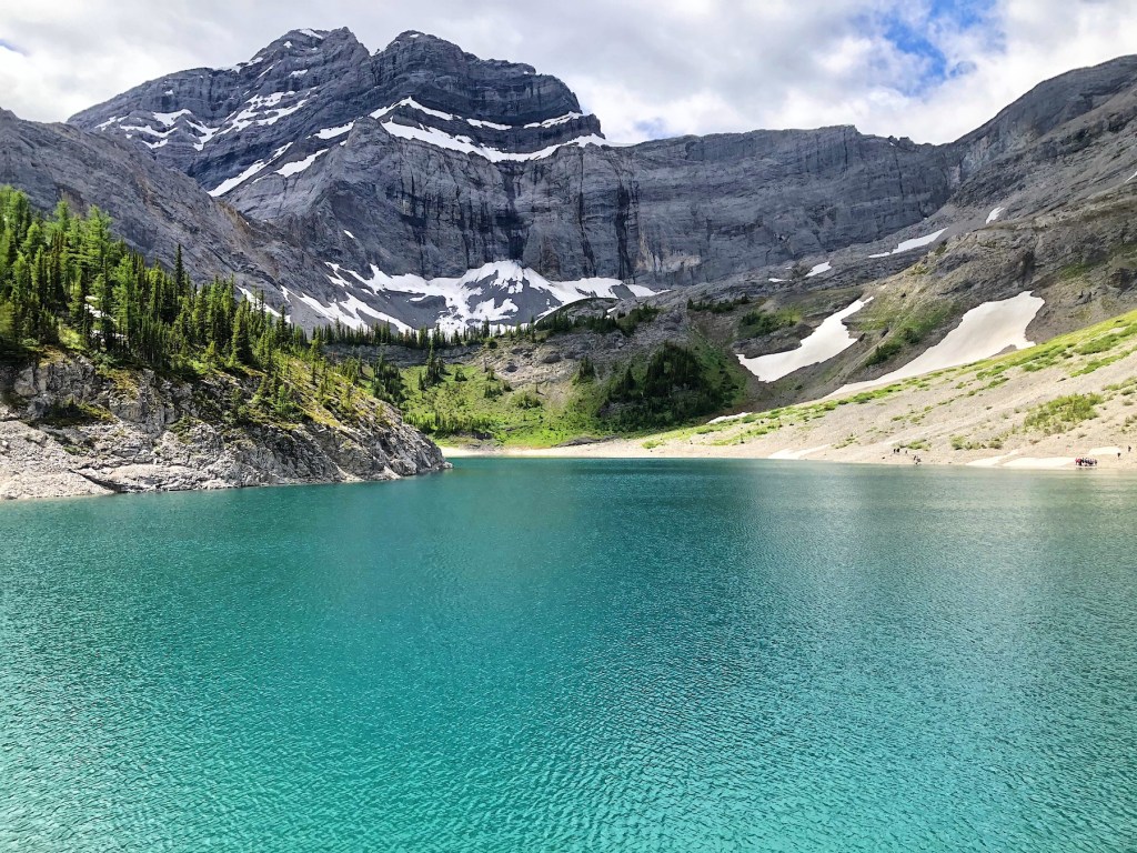
Features: Galatea Lakes hike includes a forested trail with progressively better Rocky Mountain views. Of course, Lillian Lake is a worthy day hike, but the trek up to Lower Galatea Lake and Upper Galatea Lake is absolutely spectacular.

Finding the Trailhead

You shouldn’t have any trouble finding the Galatea Lakes trailhead. If you’re coming from Calgary, head west on the Trans Canada until reaching Exit 118 for Kananaskis Country. Turn left onto Highway 40 and drive for about 32 km. Watch for the Galatea parking sign on your right.
During the summer, Galatea Lakes parking lot can become very crowded. Consider another hiking option (like Upper Kananaskis Lake or Ribbon Falls) if the parking area is too full.
Galatea Lakes Hike—Trailhead to Lillian Lake

Start the Galatea Lakes hike by descending to the suspension bridge over the Kananaskis River. Then continue through the forest on a nicely groomed and easy-to-follow trail. I enjoyed the moss covering the forest floor and occasional mountain views. You’ll cross Galatea Creek several times on solid bridges (apparently 11 in total) heading up Galatea Valley. Most hikers should reach Lillian Lake after about 2 hours or so. All the lakeside benches were occupied when we arrived, so we found some quiet ground to take in the views of Lillian Lake and have a snack.
Depending on the time of year, you may run into muddy trail sections so bring hiking boots or shoes. Plus, your feet will appreciate good support on this fairly long day hike. Hiking poles can also be very useful for extra stability.
Note: Lillian Lake Backcountry Campground is a good option for beginner backpackers (intermediate hikers). You can book your backcountry reservation online. This campground has 17 campsites, a group fire pit, and an outhouse toilet. From the campground, you could day trip over to Ribbon Lake or up to Galatea Lakes.


Galatea Lakes Hike—Lillian Lake to Galatea Lakes

Do you plan to keep going to Galatea Lakes? Prepare for a steep incline through the forest and then up the scree trail. From Lillian Lake Backcountry Campground, follow the trail past the outhouse and onto a narrow path in the woods. You’ll soon leave the forest for a steep and rocky trail. There’s close to 200 metres of elevation gain in the last two kilometres. Don’t forget to turn around for great views of Lillian Lake!
When you arrive at Lower Galatea Lake, hike around the right side for unbeatable views. Once you reach the end, continue up the dirt path to find Upper Galatea Lake tucked away. Once you’ve taken in the grandeur, either return the way you came (easiest option) or keep going on the rock scree trail on the south side of Lower Galatea. You’ll end up on a steep descent to Lillian Lake to reconnect with your previous route. Listen for the pikas as you climb down.
Read more: Bear’s Hump Trail in Waterton Lakes National Park


Know Before You Go

Seasonal closure: Galatea Creek Trail is closed every year from May 1 to late June. This allows the trail to dry and prevents damage to the area. Visit the Alberta Parks website for other trail closures.
Conservation pass: Starting June 1, 2021, visitors to K-Country are required to buy the Kananaskis Conservation Pass. If you don’t have a pass already, you can purchase online or at the visitor centres in the park.
Parking: Galatea Lakes has a large parking area. However, this lot quickly fills up in the summertime. Choose a plan B just in case.
Toilet: You’ll find outhouse toilets at the parking lot and at Lillian Lake Campground. These toilets are heavily used.
Trail markers/signage: Significant upgrades came to Galatea Lakes Trail following damage by the 2013 flood. Plenty of trail signs and markers lead the way (hard to get lost here). As a popular trail, there are clear road signs before the parking lot as well.
What To Bring on a Hike

Galatea Lakes hike is a long day hike, so remember to pack hiking essentials for your trip. If you don’t already have a daypack, I swear by the Osprey Hikelite 18. It’s been my summer hiking pack for a few years now… and it’s worth its weight in gold!
I like to use trekking poles, especially on longer hikes. These Komperdell poles are very light, packable, and super sturdy. Komperdell is an Austrian company and I’ve been very impressed with the brand. After lots of rugged use, they replaced both lower sections of my poles after I broke them on the West Coast Trail!
You’ll want to carry at least two litres of water on this hike. I use this Osprey bladder bag. Bring a water filter (like this compact MSR Trailshot) to refill your bottle or reservoir.
Weather in the mountains can be unpredictable. Always carry several layers with you. I use this Arc’teryx Beta LT as an outer layer, to stay protected from the wind and rain.
GPS can be helpful but I’d still recommend this Gem Trek Kananaskis Lakes map.
Read more: 10 Day Hiking Essentials: What to Bring on a Hike
More Kananaskis Hikes

Here are a few more hiking trails in Kananaskis that you might want to add to your list (if you haven’t already):
- South Lawson Peak in Kananaskis, Alberta
- Mount Burke Hike in Kananaskis, Alberta
- King Creek Ridge Hike in Kananaskis, Alberta
- The Breathtaking Pocaterra Ridge Hike in Alberta
- The Mount Yamnuska Hike in Alberta is a Must
Galatea Lakes Trail Map
Have you hiked Galatea Lakes in Kananaskis Country? Tell me about your experience in the comments below.
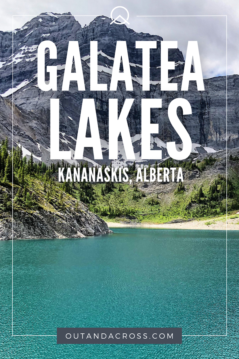
Save this for later? Hover over the image to add to Pinterest!
Thomas Coldwell has always been fond of the outdoors. He loves hiking, paddling, and camping, and thoroughly enjoys creating outdoor adventure resources for people like you. Originally from Nova Scotia, Thomas has lived in four Canadian provinces (NS, NB, ON, AB) and has travelled in 20 countries and counting.


