
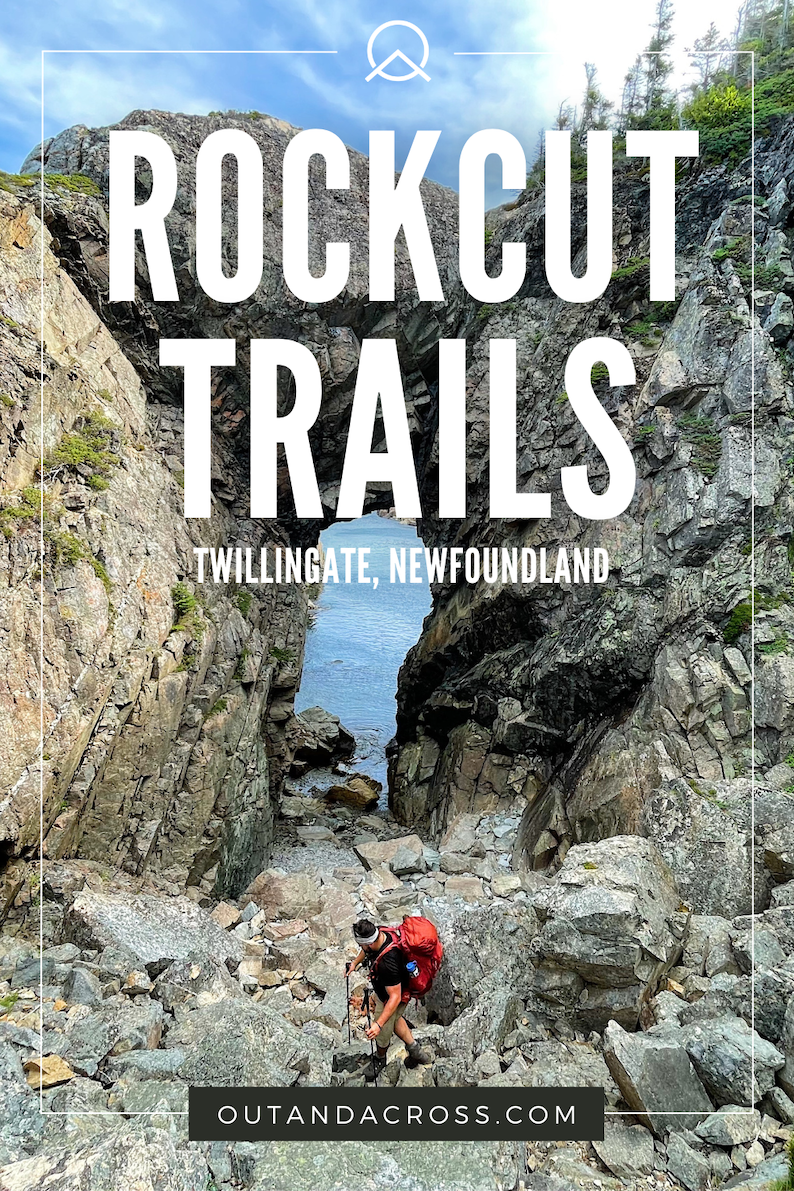
Newfoundland has a new and improved trail system — and it’s very impressive! It’s not exaggerating to say that Rockcut Twillingate Trails has to be among the best coastal hiking in Newfoundland. From French Beach to Lower Little Harbour, the trail offers nearly constant ocean views with overnight options on brand-new tent platforms. What could be better?
Last Updated: January 9, 2026
Back in August, I ventured over to Newfoundland (for the first time, ever!) and had a few outdoor adventures in mind. After learning about Rockcut Trails (thanks, Carol!), I knew I had to add an overnight trip to my list. After all, few things in life compare to sleeping by the sea (at least for me). Sadly, arriving in August meant missing peak iceberg and whale-watching season, but even so, there’s much to do in Twillingate. For visitors looking for a manageable challenge, Rockcut Twillingate Trails is the place to be.
This post includes affiliate links. If you make a purchase through one of the links, I may receive a percentage of the sale at no extra cost to you.
Rockcut Twillingate Trails Map
Check out Rockcut Twillingate Trails virtual map to help plan your trip!
About Rockcut Twillingate Trails

Location: Twillingate, Newfoundland and Labrador
Trails: French Beach, Spiller’s Cove, Codjacks Cove, Lower Little Harbour
Distance: 20 km point to point
Difficulty: Moderate
Elevation: Varies, but moderate
Time: 6 – 8 hours / 2 days
Dog-friendly: Yes, but dogs should be on a leash.
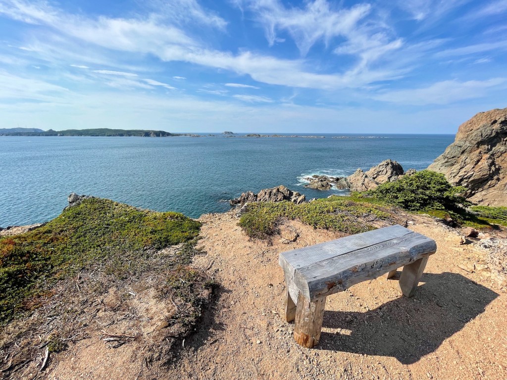
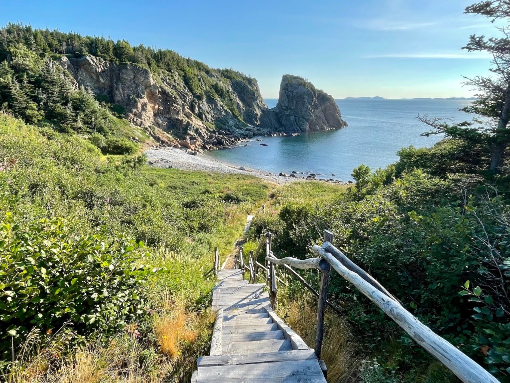
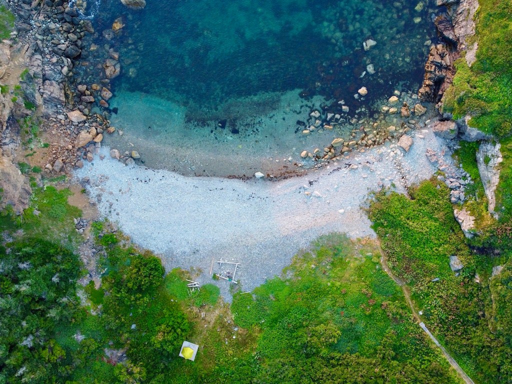
Features: Rockcut Twillingate Trails combines several historic paths with new and improved infrastructure on South Twillingate Island. Walk on the edge and stroll through history on trails originally trodden by Twillingate residents. Hiking from French Beach to the Lower Little Harbour Loop includes 4 tent platforms, multiple benches, beautiful beaches, and nearly constant coastal views.
A big thank you to Grant White from the Town of Twillingate for helping to organize my trip. Thanks again, Grant!

Rockcut Twillingate Trails History

Did you know that Rockcut Twillingate Trails are not completely “new”? Most of the trails were established by Twillingate residents for fishing, logging, and accessing the coast. In fact, the name “Rockcut” comes from coastal overhangs that offer relief from rain and wind (and boy, is it windy!). When you hike Rockcut Trails, you’re really taking a stroll through a living history. Today, the Town of Twillingate and other stakeholders maintain the trail system with helpful signage, wooden tent platforms, wooden stairs and boardwalk, and modern branding.
Note: When you visit Rockcut Trails, show respect to the residents of Twillingate by protecting the environment and the trail system. Leave no trace on the trail. Don’t take shortcuts. If you pack it in, pack it out. Be considerate to other hikers, too.
Finding the Rockcut Trailhead

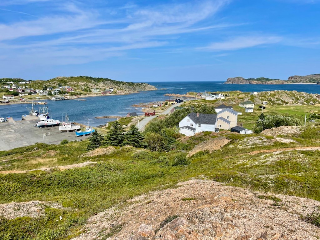
The Twillingate Islands are found on the north-central tip of Newfoundland. Rockcut Trails has several different access points, but I started at the French Beach parking area. From downtown Twillingate, head north of Main Street toward Haywards Lane for about 5 km. After 10 minutes, you’ll find parking where the road ends and the French Beach trailhead begins. See the map above.
Read next: 7 Best Things To Do in Twillingate, Newfoundland
Where To Say in Twillingate

I stayed at the Sunshine Inn (a lovely complimentary stay) the night before starting my hike, which made for an easy start the next morning. If you’ve never been, Twillingate has a mix of small inns, B&Bs, vacation rentals, and campgrounds (but book early, especially if you’re visiting in peak season!). Whether you’re visiting for a week or just a night, there are plenty of places to stay in Twillingate.
Day 1 — French Beach to Codjacks Cove (8.5 KM)

After lunch at Split Rock Brewery, I packed up my gear and set off on the French Beach Trail. At first glance, I was impressed by the freshly manicured pathways and new signage. With clearly established trails and signage, I didn’t rely on my map but worth picking one up at the Town of Twillingate (or using this virtual map). You’ll follow the coastline for most of the hike, but I still recommend a map and compass. I’d highly suggest trekking poles and hiking boots for this route as well.
Hiking from French Beach to Codjacks Cove includes three different hiking trails: French Beach, Spillar’s Cove, and Codjacks Cove. Day hikers can choose to do one or more of these coastal trails. Each one offers impressive coastal scenery and is consistently maintained by the Town of Twillingate.
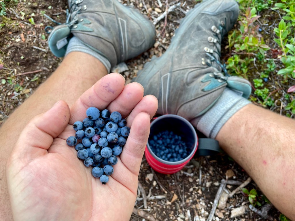
At nearly 30 degrees, I hiked this rolling coastal terrain on one of the hottest August days. To be fair, I’d much rather have warm temperatures compared to wet and rainy weather (though I always bring my rain shell, just in case). I brought extra water along for drinking and cooking (I use this 2-litre reservoir and Nalgene bottles).
I started hiking around 3:45pm and made it to Codjacks Cove by 7:00pm. Thankfully, The Tickle-Ass tent site in Codjacks was free for the taking (great name, right?). At first, I assumed this was part of Newfoundland’s renowned humour, but then learned that all sites are named after common birds. Still, funny name for a bird! 😂 After pitching my tent and eating a quick supper, it was time to settle in for the night.


Day 2 — Codjacks Cove to Lower Little Harbour – 11.5 KM
After breakfast by the sea, I packed up my tent and left Codjacks around 8:20am. Once you climb out of the cove, the terrain shifts from gravel to softer dirt through patches of forest. On a rainy day, I can imagine some muddy sections forming on this trail. If you’re as lucky as me, you’ll find two days without any rain.
In about 2.5 km (1 hour), I made it to The Razorbill tent platform. If Codjacks is occupied, The Razorbill is another great overnight option. Codjacks Cove Trail continues closely along the coastline until reaching a private cottage. Then continue along an ATV trail through the woods to the Codjacks Cove trailhead. I finished Codjacks around 10:30am, including a generous break for photos and drone footage.
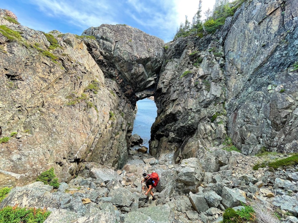
You could end your trip after Codjacks Cove Trail, though I highly suggest hiking the Lower Little Harbour Loop, too. To access the trailhead, continue on the paved Little Harbour Road for about 1 km. Then find the Lower Little Harbour parking lot on your left. The loop includes an impressive natural arch and expansive coastal views. Jones’ Cove is also worth visiting with the fourth tent platform, The Gannet. I finished the route around 1:30pm.
Hiking from Codjacks Cove to Lower Little Harbour Loop took about 5 hours. However, many would take less time without stopping for photos and video. At the end of my hike, Clifford from the Town of Twillingate shuttled me back to my car (thanks, Clifford!).
Read next: Green Gardens Trail: Hiking in Gros Morne National Park


Hiking Lower Little Harbour Loop
Once on Lower Little Harbour Loop, you can decide whether to hike clockwise or counterclockwise. I ventured clockwise toward the Natural Arch first and then continued to Jones’ Cove and The Gannet. For those looking for an easier adventure, the hike to the natural arch follows an old dirt road and isn’t too strenuous. However, hiking to Jones’ Cove is more rugged and requires a level of fitness. To be sure, the entire route is consistent with the maintenance of Rockcut Trails.
Read more: 4-Day Long Range Traverse Hike in Gros Morne National Park


Rockcut Twillingate Trails Campsites

| KM | Campsite | Description |
|---|---|---|
| 4 | The Osprey | Overlooks Spiller’s Cove. Wooden tent platform. No outhouse. |
| 8.5 | The Tickle-Ass | Down in Codjacks Cove. Wooden tent platform. No outhouse. |
| 11 | The Razorbill | Located on Burn’s Point. Wooden tent platform. No outhouse. |
| 18.5 | The Gannet | Located beside Jones’ Cove. Wooden tent platform. No outhouse. |
Rockcut Trails offers backcountry camping options in scenic locations. You’ll find one new wooden tent platform at each site. With eye hooks for guy lines, you’ll have no trouble tying down your tent to protect from strong winds. The Tickle-Ass and The Gannet are both quite sheltered. The Razorbill and The Osprey are more exposed.
No Toilets on Rockcut Trails
You won’t find a toilet at any of the campsites. Be prepared to dig a hole at least 7 inches deep and 30 metres (100 feet) away from the campsite, waterways, and trail. Used toilet paper can be burned or packed out.
Note: Sites are available on a first come, first serve basis. They will eventually require backcountry permits. Contact Rockcut Trails for more information.


What To Bring on Rockcut Twillingate Trails

What you bring on the Rockcut Trails depends on how long you plan to stay. For a day hike, be sure to pack the 10 Hiking Essentials and be prepared and safe. For an overnight stay, I recommend bringing gear for a typical multi-day hike. I brought extra water because there were no freshwater sources available. While this route is not very far from the Town of Twillingate, it would take time for emergency crews to conduct a rescue.
Here is my packing list:
- Osprey Kestrel 68
- Waterproof pack cover
- Tent
- Sleeping bag
- Sleeping pad
- Sleeping bag liner
- Siltarp
- Camp shoes
- Scarpa hiking boots
- Arc’teryx Beta LT rain jacket
- Jetboil camp stove
- Campsuds soap
- Osprey water reservoir
- Water bottle
- Komperdell hiking poles
- Lighter / matches
- GSI cup
- Spoon
- Sunscreen
- Sunglasses
- Bug spray
- Toilet paper
- Towel
- Toothbrush / toothpaste
- MSR TrailShot
- Headlamp
- Paracord
- Buff
- Mora knife
- First aid kit
- 2 merino wool tees
- 1 long sleeve (Patagonia Capilene)
- 1 pair of pants
- 1 pair of shorts
- 1-2 pairs of merino underwear
- 2 pairs of merino wool socks
- Fleece sweater
- Warm hat / gloves
- Map / compass
- Satellite communications (Zoleo)
- Powerbank / cables
- Camera
- Food
Note: Access to freshwater is very limited on the Rockcut Trails. Carry extra water for an overnight trip. When collecting water from a freshwater source, remember to filter or purify before consuming.

Know Before You Go

Parking: There are several parking options to access Rockcut Trails. For this route, make your way to the French Beach parking area (see map below).
Toilet: You won’t find any toilets on the Rockcut Trails. Be prepared to dig a hole at least 7 inches deep and 30 metres (100 feet) away from the campsite, waterways, and trail. Bring a little trowel.
Water: Freshwater is limited on the Rockcut Trails. Bring enough water for the duration of your trip (including drinking and cooking, if staying overnight). I brought a 2-litre Osprey Reservoir and a couple of Nalgene bottles.
Shuttle: If you’re planning to hike point to point, you’ll need to shuttle from one end to the other. If you have two vehicles, leave one at the other end before you begin. Or arrange a shuttle with a Twillingate local. 🙂
Backcountry Camping: You’ll find four different campsites on the Rockcut Trails route from French Beach to Lower Little Harbour Loop. First come, first serve. Backcountry permits may be required in the future.
Safety: Leave your trip plan with someone you trust (include what to do if they do not hear from you). Bring necessary gear to stay safe on the trail.

Top of Twillingate — Another Rockcut Trails Hike

Looking for more overnight hiking options in Twillingate? Top of Twillingate offers a short and sweet hike with some of the best views of Twillingate and the surrounding area. Most hikers will complete this route in under an hour, but you could choose to spend the night on The Common Mure. While not overly challenging, you may find some of the include to test your endurance if you’re new to hiking. Like the other Rockcut Trails, Top of Twillingate is highly maintained and a great spot to spend part of your day.
Read next: Top of Twillingate Trail: An Easy Newfoundland Hike (With Views!)

Rockcut Twillingate Trails Video
Are you planning to visit Twillingate, Newfoundland? Did you find this Rockcut Trails information useful? Let me know in the comments below!
Save this for later? Hover over the image to add to Pinterest 👇
Thomas Coldwell has always been fond of the outdoors. He loves hiking, paddling, and camping, and thoroughly enjoys creating outdoor adventure resources for people like you. Originally from Nova Scotia, Thomas has lived in four Canadian provinces (NS, NB, ON, AB) and has travelled in 20 countries and counting.


Glad you enjoyed the Twillingate Rock Cut Trail system the trail in Little Harbour was dedicated in memory of my brother Fred Bridger he did a lot of work on the trail systems in Twillingate and I am sure that now he is smiling because of your comment thank you very much Fred passed on December 2021 but I believe he is watching over the trail system again thanks
Hi Clarence, thanks for your note. I remember seeing the dedication sign for Fred on the trail. What a beautiful legacy! I’m very grateful to your brother and those who valued hiking trails enough in the past to make sure trails remain today.