
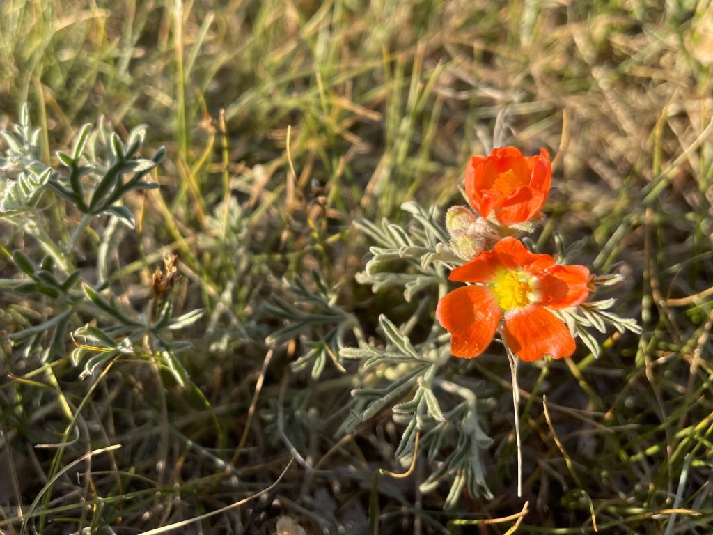
Are you ready for a unique weekend adventure in southern Alberta? This Milk River canoe trip could be just the thing for you! We thoroughly enjoyed paddling the Milk over three days through the wild and rugged landscapes of the Canadian badlands. Struck by the impressive geological formations and diverse wildlife all around, we found a river that’s full of life and less popular than some natural attractions in Alberta.

Last Updated: January 8, 2026
I had the chance to canoe the Milk River back in June 2021. A Milk River canoe trip is fast becoming a popular early-season adventure, not just for Albertans but for folks from outside of the province as well. After spending a few days on this milky river, it’s not hard to understand why this place is gaining popularity. If you plan a trip, don’t miss Poverty Rock Campground. Keep reading to see what I mean.
This post includes affiliate links. If you make a purchase through one of the links, I may receive a percentage of the sale at no extra cost to you. Thanks for your support!
Milk River Canoe Trip Map
About the Milk River — Canoeing in Southern Alberta

Location: Milk River, Alberta
Distance: 73 km point-to-point
Difficulty: Moderate
Time: 3 days
Campgrounds: Under 8 Flags, Gold Springs, Poverty Rock, Writing-on-Stone
Portages: None
Season: June to August (depending on water levels)
Reservations: Required for Gold Springs & Writing-on-Stone
Pets: Dogs are allowed on a leash.
Features: This Milk River canoe trip involves easy to intermediate river paddling with opportunities for frontcountry and backcountry camping along the way. Experience the Canadian Badlands from water with high riverbanks and hoodoos towering above. Paddlers should be prepared for Class II to III river rapids that require intermediate paddling skills. Canoeing the Milk River is one of the best outdoor adventures in Southern Alberta!

Milk River History

The Milk River spans over 1,173 km from Montana to Alberta. Lewis Meriwether (you know, of the famous Lewis and Clark expeditions) described the Milk River this way in his journal: “The water of this river possesses a peculiar whiteness, being about the colour of a cup of tea with the admixture of a tablespoonful of milk.” That’s how the Milk River got its name.
But long before Lewis and Clark arrived on the scene, Indigenous communities lived, worked, and thrived on the lands surrounding “Kináksisahtai” or “Little River” — which is what the Blackfoot First Nations called the Milk River. It’s important to recognize that First Nations have inhabited these lands for thousands of years and you can still find cultural signs like rock carvings and paintings in the area. If you have time, take a trip to Head-Smashed-In Buffalo Jump Interpretive Centre which preserves 6,000 years of cultural heritage (not too far from Milk River). It’s a UNESCO World Heritage Site and well worth a visit.

Who Should Paddle The Milk River?

The Milk River is not for novice paddlers. Before canoeing the Milk, visitors should have previous moving water canoe skills and wilderness camping experience. Paddlers should know their strokes (in bow and stern) and understand how to best respond to river safety and rescues in moving water. All that to say, the Milk River is an intermediate canoe trip. I have heard stories of boats wrapped around large rocks for under-experienced adventurers. I also highly suggest completing wilderness first aid training before heading out.
Read next: Crypt Lake Hike in Waterton Lakes National Park

When To Paddle The Milk River

Canoeing the Milk River is best from early June to early July. I’m told the river tends to become too low by August. Before heading out, be sure to check the Milk River flow rate to ensure the best paddling experience possible. If the flow rate is below 12 m³/s, that’s going to be too low. On the other hand, if the flow rate is greater than 22 m³/s, that’s probably too fast for most paddlers. The ideal Milk River flow rate is somewhere between 14 and 16 m³/s. We found that 17 m³/s was just absolutely perfect for our 75-km paddle.
If you’re hoping for some solitude, try paddling during the week to avoid the crowds. Launching from the Town of Milk River on Saturday and finishing on Monday afternoon worked well for us. Milk River Raft Tours sold out of canoes for Friday so it seems most paddle from Friday to Sunday. Consider starting your trip on Saturday if you want to try to have Poverty Rock all to yourself (that’s what we did!).

Directions to the Boat Launch
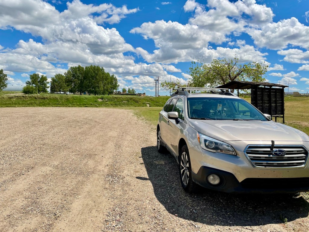
You can find parking and the boat launch at the Under 8 Flags Campground in the Town of Milk River. If you’re driving from Calgary, head south past Lethbridge and continue until reaching Milk River after 3 hours. Turn left off of Highway 4 onto Railway Street. Pass the Milk River Visitor Centre on your right, drive across the bridge over Milk River, and turn right into the Under 8 Flags parking area.
Read next: Your Complete Guide to the Bagwa Canoe Route in Saskatchewan
Where To Stay Near Milk River (Before & After Your Paddle)

If you’re looking for a place before or after your paddle, staying in Lethbridge is the most practical option. It’s about an hour’s drive from the Town of Milk River and offers the widest range of accommodations, along with easy access to food and supplies.
Milk River Canoe Trip Itinerary

You can choose from several options for your Milk River canoe trip. We planned a 3-day paddle from Milk River Town to Writing-on-Stone Provincial Park, but it’s possible to enjoy shorter paddling routes on the river. For example, if you’re short on time, you can shave off 18 km by starting at Gold Springs Park Campground instead of Milk River Town. Or you can arrange a pick-up at Weir Bridge or Coffin Bridge instead of paddling to Writing-on-Stone. However, if you want my opinion, I wouldn’t miss the chance to stay overnight at Poverty Rock Backcountry Campground.
Here are some of the key distances on the Milk River:
Milk River to Gold Springs Campground — 18 KM / 2 – 3 hrs
Gold Springs Campground to Coffin Bridge — 19 KM / 2 – 3 hrs
Coffin Bridge to Poverty Rock Campground — 14 KM / 2 – 3 hrs
Poverty Rock Campground to Weir Bridge — 10 KM / 1 – 2 hrs
Weir Bridge to Writing-on-Stone Provincial Park — 10 KM / 1 – 2 hrs

Day 1 — Milk River to Gold Springs (18 KM)

After dropping a set of keys off with Ken and Wendy (Milk River Raft Tours), we made our way to the Under 8 Flags Campground to begin our Milk River canoe trip. There’s a decent spot to launch a canoe next to the bridge. Right away, the milky colour of the river stood out. It wouldn’t be long before we’d realize how this opaque colour hides rocks masterfully (even those an inch or two from the surface!).
Gold Springs Campground is situated along the Milk River and offers several campsites on the river’s edge. Day one involved paddling 18 km for about 2.5 hours to reach our campsite (R4). Gold Springs has potable water and flush toilets, along with outhouses for guests to use. Coin-operated showers are typically available but were closed due to the pandemic. I was happy with our $25/night campsite and a bundle of wood for $10. If you forget something, there are a few other supplies (and treats) in the campground office (don’t forget cash or card). We had cell service as well.
After a good night’s rest at Gold Springs, it’s a good chance to refill drinking water. We brought a 20-litre water jug to use for our journey. This is the last chance to fill up before Writing-on-Stone Provincial Park. You can find drinking water taps located throughout the campground. When I asked Ken about filtering the river water, he said, “I wouldn’t do it.” I brought the water filter just in case.
Read next: Your Complete Guide to the Bowron Lake Canoe Circuit


Day 2 — Gold Springs to Poverty Rock (35 KM)
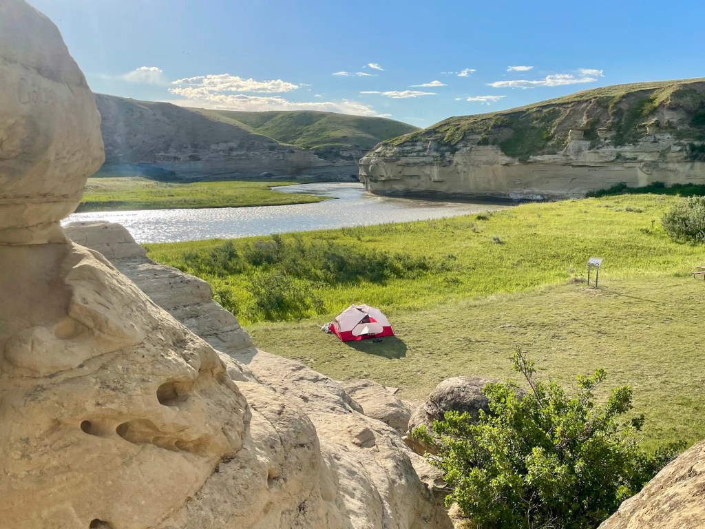
I have to admit, Poverty Rock surprised me. When I first thought about a backcountry campground accessible by boat, I didn’t imagine such a well-maintained and comfortable site. The first thing I noticed was the signage along the river, making it hard to miss this place. Then we found multiple first come, first served sites to choose from, with picnic tables, two communal fire pits, and a cooking shelter for rainy days. Off to the side, there’s an enclosed outhouse for visitors to use. Most impressive of all was the towering sandstone structure, Poverty Rock itself, providing some shade in the hot afternoon sun. Did I mention there’s no charge for this campsite? That’s right… it’s free!
Writing-on-Stone Provincial Park maintains Poverty Rock Backcountry Campground, though it isn’t officially part of the park. Even so, Writing-on-Stone tracks campground usage and asks visitors to register beforehand (no cell service here). When we arrived on Sunday afternoon, there wasn’t another soul in sight. We had the entire campground to ourselves. I imagine that you could find a little slice of quietness even when it’s busy. We found a few ticks here, so don’t skimp on the bug spray.
You experience several sets of rapids between Gold Springs and Poverty Rock. The largest stretch is known as the Rock Garden (not recommended for tubing). We paddled 35 km in about 7 hours, with a decent lunch break and a few short rest stops. Day two was a very fun and tiring stretch of the river — with plenty of rocks to dodge!


Day 3 — Poverty Rock to Writing-on-Stone (20 KM)

We lucked out with great (though very hot) weather the entire trip. Day three, our final 20-km stretch from Poverty Rock to Writing-on-Stone was during a heat warning with temperatures of 35+ degrees. Thankfully for us, there was a fair breeze on the water, but that headwind slowed us down a bit. Shade was nearly impossible to find. If you’re paddling in the heat, I suggest bringing a head covering (like a Buff or hat) and LOTS of sunscreen.
The final stretch of our Milk River canoe trip took just under 3 hours. With very few rapids, this was the easiest paddling and very scenic with hoodoos on the high riverbanks. If you’ve never been to the Canadian Badlands, these massive sandstone structures create impressive and captivating scenery. For paddling wanting a shorter trip, you could arrange a shuttle from Weir Bridge instead of completing the distance to Writing-on-Stone. Though it’s worth continuing to the park if you have the time.
When you arrive at Writing-on-Stone, you will find flush toilets and cold drinking water. We were off of the river around noon, after hours of paddling in the scorching heat. We didn’t linger too long in the park but it’s worth exploring the hoodoos. If you shuttle with Milk River Raft Tours, Ken and Wendy will park your vehicle in Writing-on-Stone’s overflow parking. It’s about a 10-minute walk from the boat launch. A parking permit is required but Milk River Raft Tours arranges if you shuttle with them.
Read next: Your Complete Guide to Canoeing the Yukon River


Canoe Rentals and Shuttle Booking

You don’t have to have your own canoe to paddle the Milk River. Canoe rentals and shuttle services are available from Ken and Wendy Brown at Milk River Raft Tours in the Town of Milk River. Give them a call at 403-642-7619 to arrange your canoe or shuttle. Canoe rentals were $50 per day and shuttle service was $75 per vehicle. However, costs may have changed so inquire with the Browns for updated pricing. We brought our own canoe and organized the shuttle with them — it was very smooth!
Milk River Wildlife
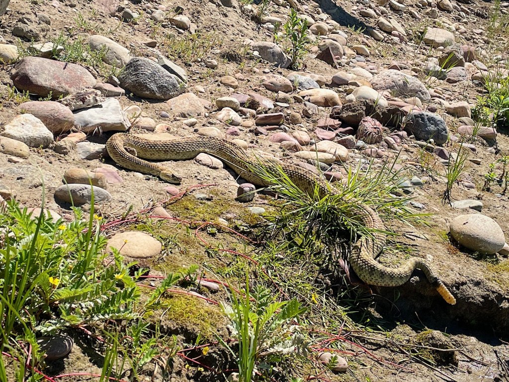
Did you know the Milk River is home to some of the most interesting wildlife in the Canadian Prairies? You can find mammals like mule deer, white-tailed deer, pronghorn, yellow-bellied marmot, and white-tailed jack rabbit. These semi-arid Badlands also make the perfect habitat for reptiles like the prairie rattlesnake. We came across a rattlesnake floating with its head under water. After realizing he was near the end of his life, I carefully brought him ashore with the use of my paddle. I wouldn’t suggest moving a rattlesnake, as they are venomous and provincially protected. There are many rattlers in the area but often a bit inconspicuous. Catching a close-up glimpse was a treat (though sad circumstances).
Throughout our three-day canoe trip, we also came across mule deer, pronghorn, great horned owls, a coyote, swallows, several hawks, bald eagles, marmots, and more. If you enjoy the chance to view wildlife from a distance, don’t forget to bring your camera to the Milk River. Remember, never feed wild animals and maintain a safe distance to help keep yourself and the wild animals safe.

What To Bring — Milk River Canoeing in Alberta

For me, one of the great things about canoe tripping (compared to backpacking) is not having to carry all of the gear. In other words, you can generally bring a bit more but I still try to pack fairly lightweight. Here’s what we brought along:
Camping Gear
- MSR Elixer 3 Tent
- Groundsheet
- Sleeping pads
- Sleeping bags
- Siltarp
- Hammocks
- Rain jacket
- Water container (20 litres)
- Food / snacks
- Headlamp
- Bug spray
- Sunscreen
- Matches
- Jetboil stove & fuel
- Pots
- Bowls & spoons
- Knife
- Biodegradable soap & scrub
- Toiletries
- Toilet paper
- Trowel
- Map / compass
- Zoleo sat comm
- Powerbank & charger
- Dry bags
- Sunglasses
- Binoculars
- Book
- First aid kit
- Bear spray
- Car keys (plus spare for shuttle)
- Wallet
- Camera
- Clothing
Canoe Gear
- PFD / life jacket
- Paddles
- Extra paddle
- Painter
- Bailer / pump
- Throw bag
- Signalling device (whistle)
- Canoe barrel
Additionally, I like to bring:
- Pilot knife (attached to PFD)
- Waterproof flashlight
Note: Transport Canada mandates specific safety equipment depending on the size of your craft. Make sure you know what you need in your boat before you head out!

Milk River Navigation & Safety

Before starting your Milk River canoe trip, spend some time becoming familiar with the river. I suggest using Clayton Roth’s “A Paddler’s Guide to the Milk River” for a useful paddle map, called the best resource out there for canoeing the Milk River. That being said, I have heard it’s hard to find (you can borrow mine, just reach out). You can also contact Paddle Alberta to find more information. Check out my canoe route map (above) for navigation support.
Ensure you leave your trip plan with someone you trust, including your itinerary, when you plan to be in touch, and what to do if they don’t hear from you. Check out AdventureSmart for more resources. Complete a wilderness first aid course before you go (if you haven’t already) and bring a satellite communications device in case of an emergency.
Read next: Best Places to SUP in BC’s Cariboo Region

Milk River Reservations

Campsite reservations are needed for Under 8 Flags Campground, Gold Springs Campground, and Writing-on-Stone Provincial Park. Poverty Rock Backcountry Campground is first come, first served and does not require advanced reservation. However, Writing-on-Stone asks that visitors to Poverty Rock register in advance (no fee required) for monitoring purposes.
Under 8 Flags Campground: 403-647-4284
Gold Springs Park Campground: 403-647-2277 (Book riverside campsite)
Writing-on-Stone Provincial Park: 403-647-2364 (Register for Poverty Rock)

Rules of the River

Leave No Trace: Pack out what you pack in. Preserve the historical features along the river by leaving them unspoiled and intact. Take nothing but pictures, leave nothing but footprints.
Respect Others: Respect the solitude along the river and treat other visitors kindly. Alcohol is prohibited. No firearms allowed.
Private Property: The banks of the river from the high water mark are private property. Please respect property owners.
Wildlife: Do not feed or disturb wildlife. If you bring your dog, please keep them on a leash and pack out your dog’s waste (use a smell-proof bag).
Safety: Follow safe boating standards and Transport Canada guidelines for watercraft. Bring the proper gear and make sure you’re ready for river paddling.
Fires: No campfires are permitted unless in an established and official campfire ring.

Milk River Canoe Trip Video
Have you paddled the Milk River in Southern Alberta? How was your experience? Let me know in the comments!
Save this for later? Hover over the image to add to Pinterest 👇
Thomas Coldwell has always been fond of the outdoors. He loves hiking, paddling, and camping, and thoroughly enjoys creating outdoor adventure resources for people like you. Originally from Nova Scotia, Thomas has lived in four Canadian provinces (NS, NB, ON, AB) and has travelled in 20 countries and counting.


Looks great want to do it July/2023 long weekend will the water be high enough.What time of the year did u go
It’s a nice paddle! It’s possible to do in July, though you should keep an eye on the water levels: https://rivers.alberta.ca Paddled in June and it was perfect.
I have done this trip many times since the 1980’s. Wonderful to see it still being explored. The first leg from Milk River to Gold Springs is not as interesting as the middle section. Continue down to Deer Creek bridge or the Aiden bridge to extend the trip.
Thanks for your comment. A really interesting river to explore, for sure. I would love to return someday for a longer trip — thanks for the tip!