Kananaskis is packed with hiking trails, and the best part is that there’s something for everyone. Whether you’re after a peaceful walk through the forest or a climb that leads to panoramic mountain views, these hikes are a great place to start. Here are 19 of the best day hikes in Kananaskis for your next adventure.
Over the past several years, I’ve been lucky enough to explore several different hikes in Kananaskis. Some have been short and steep, others long and gentle. Each one has left me with a reason to come back. That’s the thing about Kananaskis, right? You could spend a lifetime exploring and still find more to discover! If you’re planning a trip or just looking for a new trail to check out, these are some of my favourite day hikes in Kananaskis Country.
This post includes affiliate links. If you make a purchase through one of the links, I may receive a percentage of the sale at no extra cost to you.
Map of Hikes in Kananaskis
Summits & Ridges — Adventurous Hikes in Kananaskis
Kent Ridge

Distance: 7 km out and back
Elevation: 650 metre gain
Time: 3 – 4 hours
Difficulty: Moderate
Dog-friendly: Yes, but dogs must remain on a leash.
Kent Ridge is a climb that doesn’t hold back. You’re gaining elevation right from the start, and before long the trees drop away to reveal Spray Valley spread out below. When I made the trek, I remember stopping for a breather and looking back to see just how fast the forest had disappeared. It’s not an easy climb, but the views from the ridge make it one of those hikes you don’t forget.
👉 Read the Kent Ridge trip report for route details and photos.
Packenham Junior Peak
Distance: 5.5 km out and back
Elevation: 630 metre gain
Time Required: 2.5 hours
Difficulty: Moderate due to steep and uneven terrain
Dog-Friendly: Yes, but dogs must remain leashed.
I came across this hike while searching for something on the shorter side, and it turned out to be a real hidden gem. That being said, it’s not an easy walk in the park. The ridge views show up fast, giving you that big-mountain feel without the full-day grind, but you can expect some steep trekking toward the summit. When I hiked it, I was surprised by how much payoff there was for such a modest distance — it’s definitely worth adding to your list. Bring a pair of hiking poles (seriously, they’re helpful).
👉 Check out my Packenham Junior Peak trip report for the full details and photos.
Highwood Ridge

Distance: 12.5 km out and back
Difficulty: Difficult
Elevation: 730 metre elevation gain
Time: 4 – 5 hours
Family-Friendly: This would be a difficult hike/scramble for kids.
Dog-friendly: Yes, but dogs must remain on a leash.
Highwood Ridge packs a bit of everything into one hike. The trail starts in the forest, works its way into some light scrambling, and then opens onto a wide-open ridge with views that stretch as far as you can see. This was a special hike for me; leaving my doggos ashes behind on the ridgeline (after all, a mountain dog belong in the mountains). I loved how the scenery kept changing, each section feeling like its own adventure, and I like the imagine Bella the Berner bouncing around up here.
👉 If you’re planning to visit, find all the details and photos in my Highwood Ridge trip report (and say “hi” to Belle for me, would ya?).
Sarrail Ridge

Distance: 11.5 km out and back
Difficulty: Difficult
Elevation: 670 metres elevation gain
Time: 4 – 5.5 hours
Dog-friendly: Yes, but dogs must be on a leash.
Sarrail Ridge is a tough push above Rawson Lake, but the steep climb is worth every step. From the ridge, the view over Upper Kananaskis Lake is one of the best in the entire area. When I hiked here, I remember just standing there, taking in the turquoise water against the surrounding peaks — Bella the Berner loved this place, too!
👉 Check out my Sarrail Ridge trail report for everything you need to know before you head out.
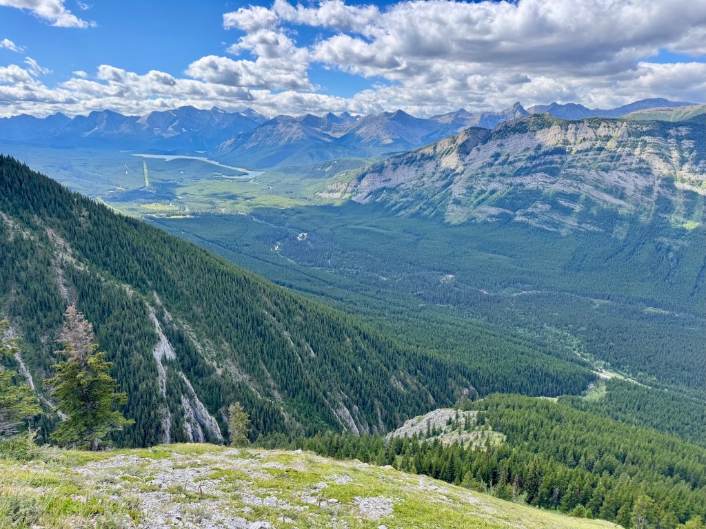
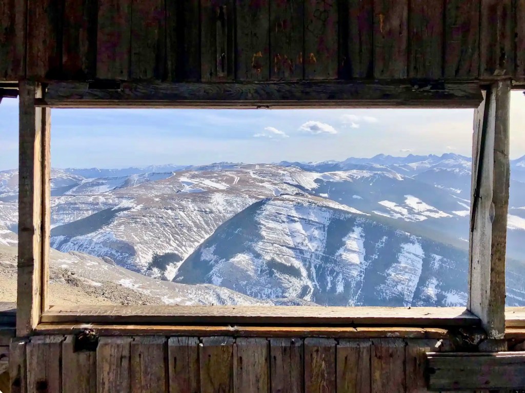
Mount Burke
Distance: 13.5 km out and back
Difficulty: Moderate to difficult (if you’re not a regular hiker)
Elevation: 940 metre gain
Time: 5 – 7 hours
Dog-friendly: Yes, but dogs must be kept on a leash.
The climb up Mount Burke is rugged and steady, leading to the old fire lookout that still sits on the summit. It’s still considered one of the lesser-known hikes in Kananaskis, so you could even have the summit to yourself like I did. On my hike, the wind came barreling across the ridge (I was glad I brought a shell jacket), but the wide-open 360-degree views more than made up for it. It’s one of those peaks where the effort feels matched by the reward.
👉 You’ll find maps, route info, and photos in my full Mount Burke trip report.
Yates Mountain

Distance: 12.5 km out and back
Difficulty: Moderate
Elevation: 550 metre gain
Time: 3 – 5 hours
Dog-friendly: Yes, but must be kept on a leash.
Yates Mountain is one of those classic Kananaskis hikes — close to Calgary, doable in every season, and always worth the trip. The climb isn’t especially tough, but it’ll take some time to reach the summit. When you make it to the lookout, the view of Barrier Lake at the base of Mount Baldy feels like a proper reward. It’s a really popular place, so it’s perfect if you’re hiking solo and want to make sure you’re not alone.
👉 For directions and more, see my full Yates Mountain trail report.
King Creek Ridge

Distance: 8 km out and back
Difficulty: Difficult (very steep sections)
Elevation: 750 metre gain
Time: 4 – 5 hours
Dog-friendly: Yes, dogs are allowed on the trail (but must remain on a leash).
King Creek Ridge doesn’t waste any time — it’s steep right from the start and what some might call a “leg burner.” The good news is the payoff is worth it (to me, anyway), with spectacular views as soon on the ridge walk. Depending on your fitness level and hiking abilities, it’s not an overly long day, but delivers that big sense of accomplishment. I’ve hiked King Creek Ridge a couple of times in the winter, and highly suggest wearing trail crampons.
👉 You can find the full details in my King Creek Ridge hike post.
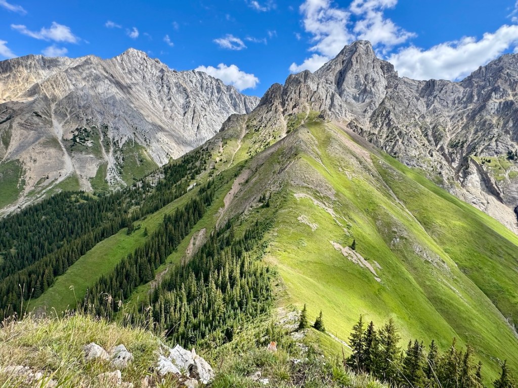
Tent Ridge

Distance: 12 km loop
Difficulty: Difficult
Elevation: 800 m elevation gain
Time: 5 – 6 hours
Dog-friendly: Yes, but dogs must remain on a leash.
Tent Ridge is one of the most popular hikes in Kananaskis, and it’s easy to see why. The horseshoe loop takes you across multiple ridges, each one offering fantastic views of the Kananaskis backcountry. When I hiked here, I was blown away by the scenery — especially the view of Spray Lakes Reservoir. It’s a well-known Kananaskis adventure that lives up to the hype.
👉 Check out my Tent Ridge trip report before heading out.
Little Lougheed

Distance: 6 km out and back
Difficulty: Moderate to difficult, depending on fitness level
Elevation: 760 metres elevation gain
Time: 4 – 6 hours
Dog-friendly: Yes, but dogs must stay on a leash.
What Little Lougheed lacks in distance, it makes up for in effort. The popular trail climbs sharply most of the way, with better and better views of Spray Lakes Reservoir and the towering mountain peaks below. The views feels much bigger than the hike itself. Little Lougheed is a popular winter trek, but always check conditions before reaching the trailhead. It’s the kind of day trip that’s great most of the year.
👉 You can find all the details in my Little Lougheed trip report.
Pocaterra Ridge

Distance: 11 km point-to-point
Difficulty: Difficult
Elevation: 746 metre elevation gain
Time: 5 – 7 hours
Dog-friendly: Yes, but dogs must remain on a leash.
Pocaterra Ridge is a truly classic Kananaskis hike, and if you catch it during larch season, it’s nothing short of spectacular. Golden slopes roll into endless ridge views, making it one of the most colourful autumn hikes in Kananaskis. It’s just as rewarding in summer. It’s worth noting that Pocaterra Ridge isn’t a short trek; consider leaving a bike for the end or bring a second vehicle to shuttle.
👉 You can find all the details in my Pocaterra Ridge trip report.
South Lawson Peak

Distance: 8.5 km out and back
Difficulty: Difficult (due to steepness)
Elevation: 770 metres gain
Time: 5 – 6 hours
Dog-friendly: Yes, but pets must be kept on a leash.
South Lawson Peak is a quieter alternative to some of the busier Kananaskis hikes. The approach is steep and steady, but once you’re on the ridge you’ll find impressive views over the Kananaskis Lakes and the surrounding peaks. You can see King Creek Ridge on the other side of Highway 40. It’s an underrated favourite of mine, especially if you’re looking for a bit more solitude. Bring a warm layer in case the colder temperatures roll in.
👉 You can find maps, photos, and the full route in my South Lawson Peak trip report.
Lakes & Cirques — Gentler Hikes in Kananaskis
Chester Lake
Distance: 8 km out and back
Difficulty: Easy to moderate
Elevation: 315 metre gain
Time: 3 – 4 hours
Dog-friendly: Yes, but must remain on a leash.
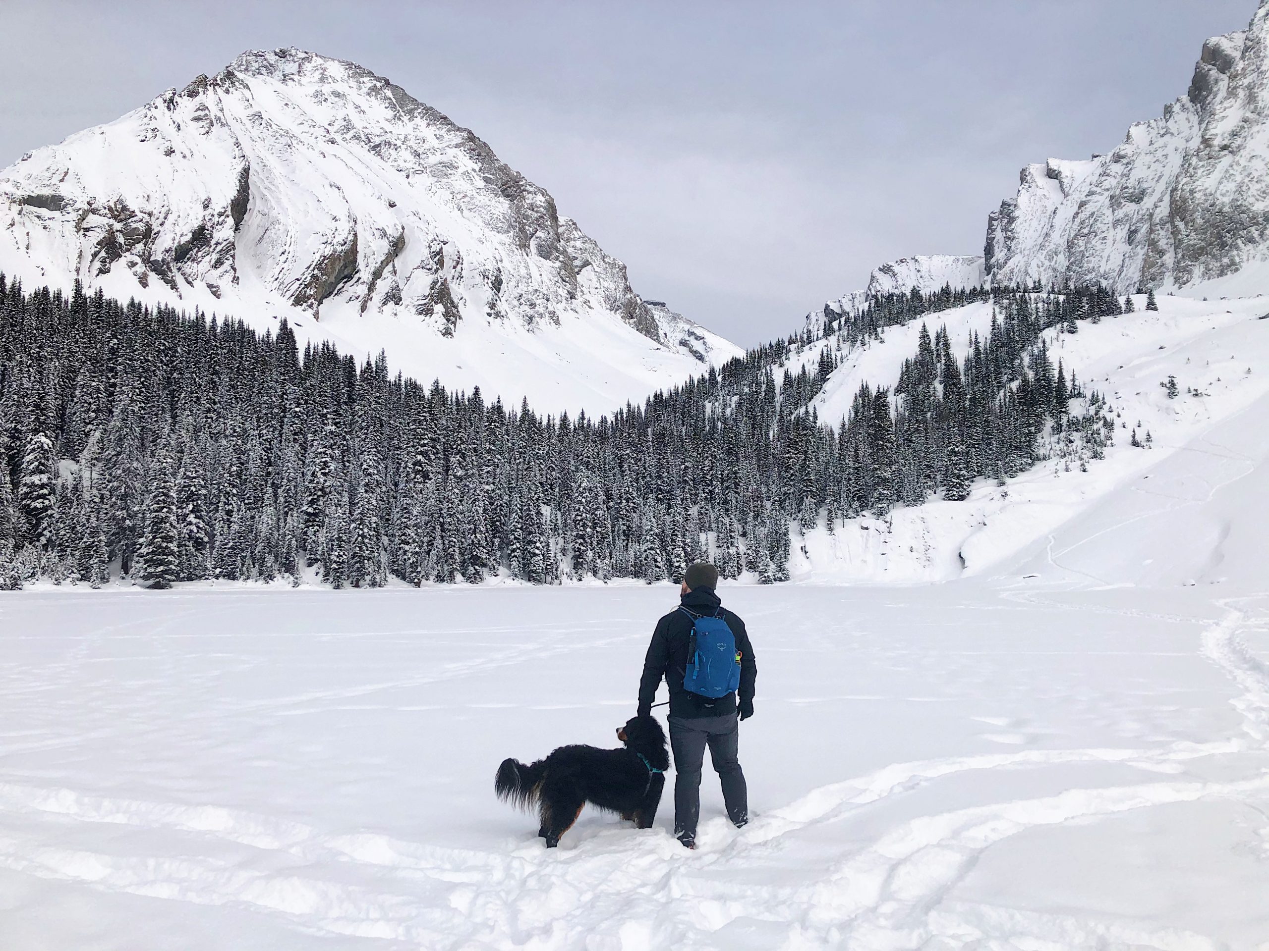
Chester Lake is a great choice for families or anyone after a more relaxed day in the mountains. You’ll hike through mountain meadows that glow with larches in the fall and transforms into a frozen wonderland in winter — making it one of the best year-round hikes in Kananaskis. I’ve only explored Chester Lake in the winter, and loved the chance to walk on the frozen lake with my buddy, Bella the Berner.
👉 You can find maps, photos, and details in my Chester Lake trip report.
Ptarmigan Cirque

Distance: 4 km loop
Difficulty: Easy
Elevation: 221 metre gain
Time: 1.5 – 2 hours
Family-Friendly: Yes, but not stroller-friendly.
Dog-friendly: Yes, but dogs must remain on a leash.
Ptarmigan Cirque is one of those quick trips that gets you fast mountain views. It’s especially stunning in September when the larches turn golden, but it’s a great option all season long. Short and packed with scenery, it’s hard to beat for such a modest effort. It’s a great option for families with young kids or beginning hikers in the Rockies.
👉 You can find full trail info and photos in my Ptarmigan Cirque trip report.
Rawson Lake

Distance: 7 km out and back
Difficulty: Moderate (slippery in the winter)
Elevation: 320 metre gain
Time: 3 – 4 hours
Dog-friendly: Yes, but must remain on a leash.
Even without adding Sarrail Ridge, Rawson Lake is a destination all on its own. Tucked into a cirque and surrounded by steep walls, it feels like you’ve stepped right into a postcard. I’ve always found it a rewarding spot to just sit for a while and take in the setting. And it’s another Kananaskis hike that’s worth visiting any time of the year.
👉 You can find maps, tips, and photos in my Rawson Lake trail report.
Galatea Lakes

Distance: 18 km out and back; loop around Galatea Lakes
Difficulty: Moderate to difficult
Elevation: 700 m elevation gain
Time: 5 – 7 hours
Dog-friendly: Yes, but dogs must be kept on a leash.
Galatea Lakes makes for a full-day adventure, leading to a string of alpine lakes that keep getting better the farther you go. Late summer is my favourite time to be up here, when the water glows turquoise against the rocky backdrop. Each lake has its own character, but getting from Lillian Lake to Upper and Lower Galatea Lakes takes some effort. Bring plenty of water, snacks, hiking poles, and other day hiking essentials.
👉 You can find maps, photos, and full details in my Galatea Lakes trip report.
Arethusa Cirque

Distance: 5 km lollipop (out and back w/ loop at the end)
Difficulty: Easy
Elevation: 275 metre gain
Time: 2 – 2.5 hours
Family-friendly: Yes, but minimal signage on the trail.
Dog-friendly: Yes, but dogs must stay on a leash.
Arethusa Cirque is a fairly short but stunning loop that shows off a lot in a little time. It’s another golden larch hike in September, and probably one of my favourite easier hikes in Kananaskis. The rugged trail heads through forest before opening into a rocky cirque ringed by jagged peaks.
👉 You can find maps, photos, and full details in my Arethusa Cirque trip report.
Upper Kananaskis Lake

Distance: 16 km loop
Difficulty: Easy to moderate (due to length)
Elevation: 269 metre gain
Time: Approx 5 to 6 hours
Dog-friendly: Yes, but dogs must remain on a leash.
The trail around Upper Kananaskis Lake is a very popular hike and one of the most scenic loops in the Rockies. It’s a mix of forest paths, waterfalls, and wide-open shoreline views with peaks towering all around. On my first hike here, we stumbled into a grizzly bear and skirted safely around on the rocky shore. Be sure to check out bear warnings in the area. I like that you can make it a full loop or just wander a section if you’re after something shorter.
👉 You can find everything you need to know in my Upper Kananaskis Lake trip report.
Waterfalls — Scenic Hikes in Kananaskis
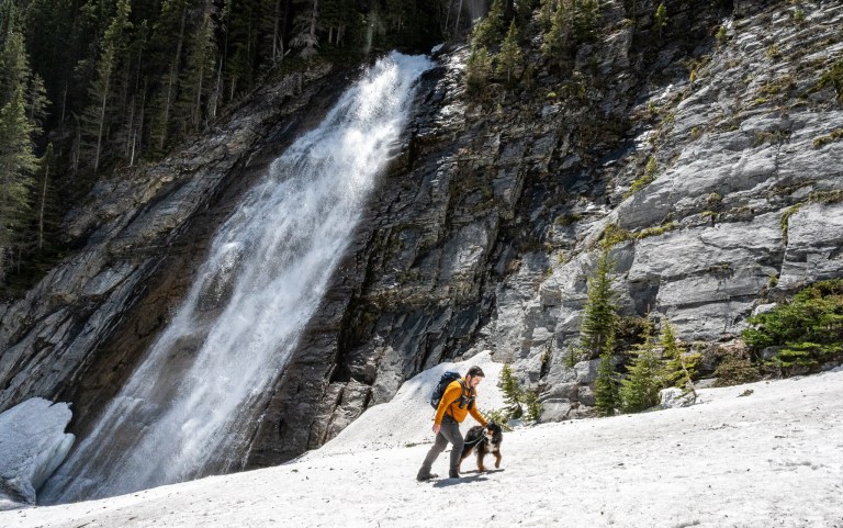
Ribbon Falls

Distance: 21 km out and back
Difficulty: Moderate (due to length)
Elevation: 447 metre gain
Time: 6 – 7 hours
Dog-friendly: Yes, but must be kept on a leash.
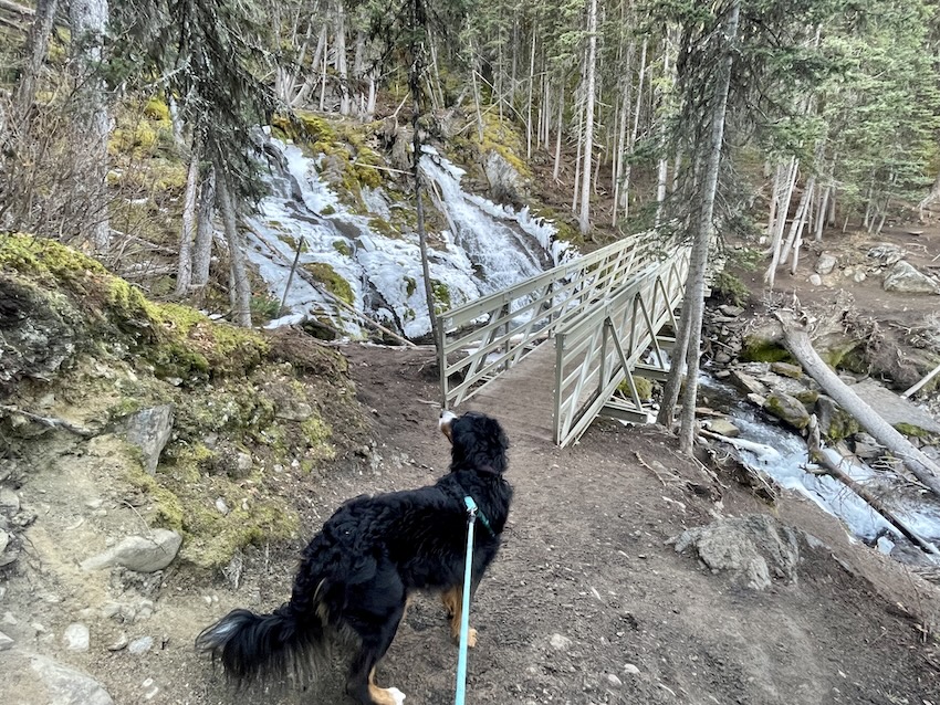
Ribbon Falls is a classic valley hike that rewards you with an impressive waterfall close to the backcountry campground. The trail follows Ribbon Creek up and down through forest, with mountain views opening up along the way. It’s a longer outing, but gentler grade makes it very manageable, and the sight of the falls at the end is worth the trek.
👉 You can find maps, photos, and details in my Ribbon Falls trip report.
Edworthy Falls

Distance: 9 km out and back
Difficulty: Moderate
Elevation: 390 m elevation gain
Time: 3 – 4 hours
Dog-friendly: Yes, but dogs must remain on a leash.
Edworthy Falls is a well-loved trail in Kananaskis, and it’s easy to see why once you get out there. The route takes you through forest and meadows past Elbow Lake, before finishing at a beautiful waterfall tucked into the valley. It’s not overly difficult, which makes it a great choice for a wide range of hikers, but still feels like a proper mountain day out.
👉 Check out my Edworthy Falls trip report to find all the details.
Where To Stay Near Kananaskis Country

If you’re hiking in Kananaskis, it’s worth putting a bit of thought into where you stay. I’ve stayed at Mount Engadine Lodge, which is a great option if you want to be immersed in the mountains. I’ve also stayed at Kananaskis Mountain Lodge, which is convenient for many trailheads. For budget-friendly options, you can book one of the Kananaskis campgrounds. And if you want more choice, check out accommodations in Canmore or Banff.
What to Bring – Day Hikes in Kananaskis

Kananaskis is packed with variety, and conditions can change fast, so it’s always important to be prepared with day hiking essentials. Whether you’re out for a short ridge scramble or a longer lake loop, here are some things I always recommend:
- Day Pack – A comfortable backpack to carry the basics (snacks, layers, water, etc).
- Water & Snacks – At least 2 litres of water per person and plenty of food. For longer days, bring electrolyte tablets and a water filter.
- Footwear – Sturdy hiking boots or trail shoes with good grip. Many trails have rocky, rooty, or muddy sections.
- Layers – Weather changes quickly in the Rockies. A breathable base layer, warm mid-layer, and a waterproof/windproof shell are a must.
- Navigation – Download offline maps (AllTrails, Gaia GPS) or bring a paper map and compass. Cell service is spotty in much of Kananaskis (you might want a satellite communications device).
- Sun Protection – Sunscreen, sunglasses, and a hat; the alpine sun is strong, even on cooler days.
- Poles – Super helpful to use trekking poles on steep climbs and descents (I swear by them on hikes like Pocaterra Ridge or King Creek Ridge).
- Safety Gear – A first-aid kit, headlamp, and bear spray (make sure you know how to use it).
- Seasonal Additions:
- Winter/Fall – Microspikes or crampons for icy trails, extra insulation, and hand warmers. Check out this winter hiking gear post for more ideas.
- Summer – Bug spray and extra water capacity for hot days.
These are my go-to items. As the saying goes: There’s no such thing as bad weather, only bad gear. Pack for the conditions you might face (including emergencies), not just the ones you expect.
Know Before You Go — Hiking in Kananaskis Country

Before heading out, there are a few things to keep in mind for hiking in Kananaskis:
Park Pass: Kananaskis Conservation Pass is required to park at trailheads, and it’s easiest to purchase online in advance.
Wildlife: Wildlife is part of the experience here: bears, moose, wolves, and even mountain goats are common. Carry bear spray and know how to use it.
Weather: Weather can change quickly in the Rockies, so always check the forecast and trail reports before you leave. Be prepared with proper layers.
Cell Service: Spotty at best, so download offline maps and let someone know your plans.
Leave No Trace: Most importantly, practice Leave No Trace principles: pack out everything you bring in (including doggy bags), stay on marked trails, and respect this incredible landscape so it stays wild for future hikers!
Do you have a favourite day hike in Kananaskis to add to the list? I’d love to hear about it. Let me know in the comments.
Save this for later? Hover over the image to add to Pinterest 👇
Thomas Coldwell has always been fond of the outdoors. He loves hiking, paddling, and camping, and thoroughly enjoys creating outdoor adventure resources for people like you. Originally from Nova Scotia, Thomas has lived in four Canadian provinces (NS, NB, ON, AB) and has travelled in 20 countries and counting.