
As one of the lesser-known hikes in Kananaskis, Mount Burke brings plenty of incredible Rocky Mountain scenery above the treeline. Starting in Cataract Creek, follow an established trail through the forest and climb up to the old Cameron Lookout hut. While less popular than other Kananaskis trails, Mount Burke is perfect if you want a quieter outdoor adventure (especially in the shoulder seasons). Who knows, you might even have the summit all to yourself!
Last Updated: March 7, 2024
I was surprised to be one of the only people hiking up Mount Burke in early April 2021. Unlike other Kananaskis hiking trails, Mount Burke hasn’t quite gained the level of popularity, which was one of the draws for me. It’s certainly less popular than sought-after day trips like King Creek Ridge and Pocaterra Ridge. While Mount Burke is a bit of a slog, my trek to the summit was worth every step!
This post includes affiliate links. If you purchase through one of the links, I may receive a percentage of the sale at no extra cost to you. Thanks for your support!
About Mount Burke Hike
Location: Cataract Creek Provincial Recreation Area, Kananaskis Country, Alberta
Distance: 13.5 km out and back
Difficulty: Moderate to difficult (if you’re not a regular hiker)
Elevation: 940 metre gain
Time: 5 – 7 hours
Dog-friendly: Yes, but dogs must be kept on a leash.
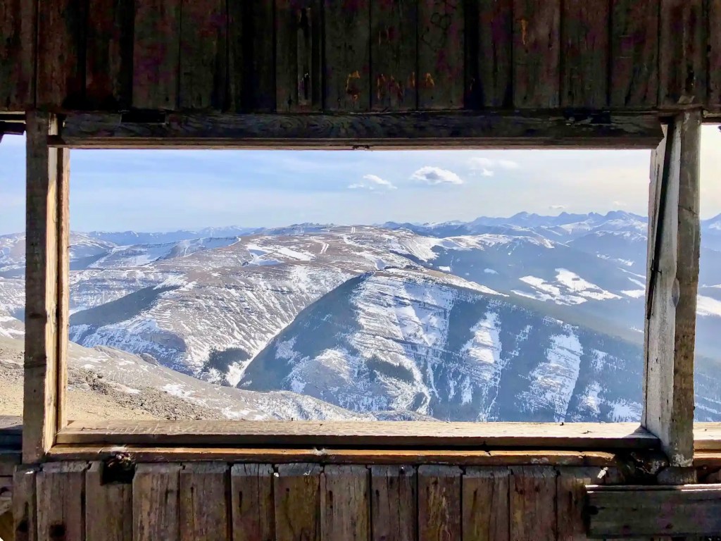
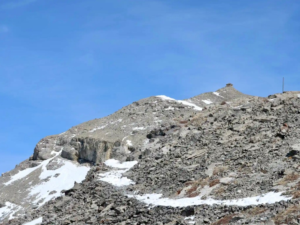
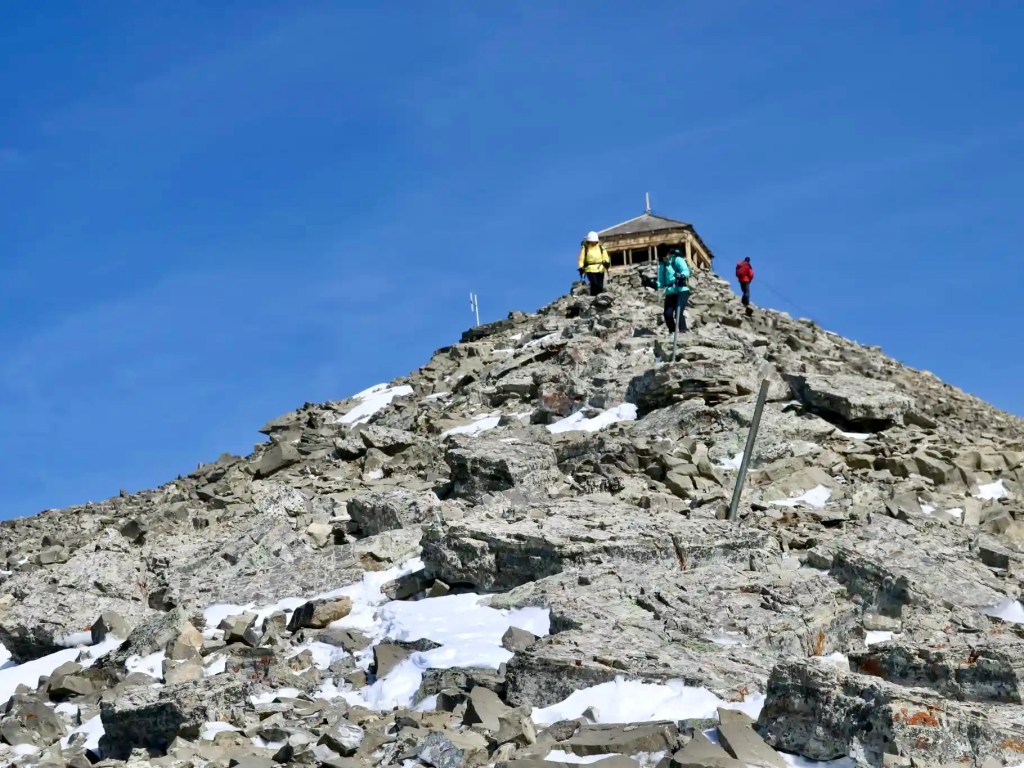
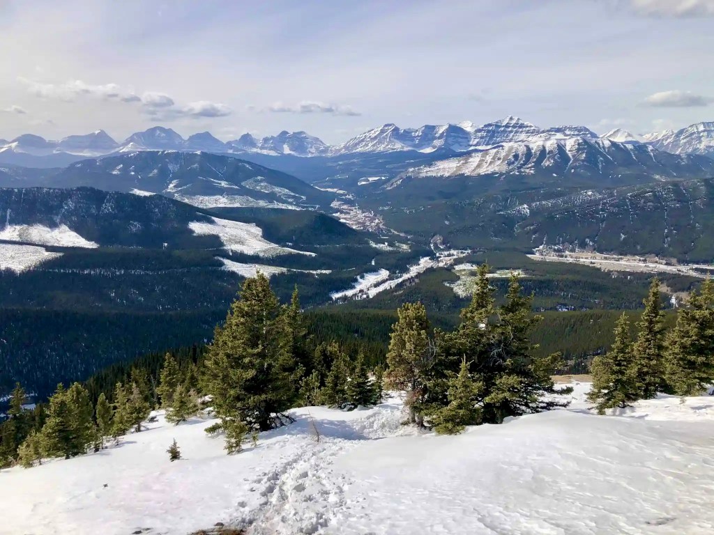
Features: The Mount Burke hike flows through the forest until rising above the treeline with spectacular panoramic views behind. The trail continues along the ridge and finally up a rocky scree path to the summit. An old fire lookout sits on top of Mount Burke, creating a unique experience for photos at the summit (but it doesn’t stop the wind!).
Mount Burke Trail Map
Directions to the Trailhead
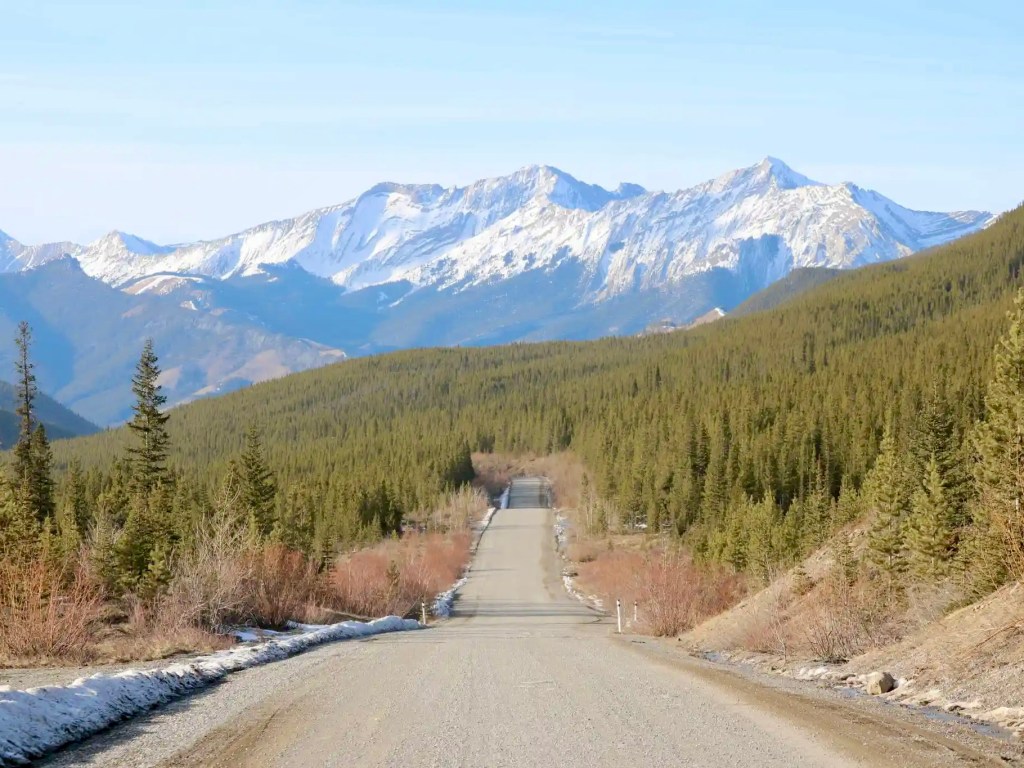
Mount Burke Trailhead is found in the Cataract Creek Provincial Recreation Area in Kananaskis Country. If you’re travelling from Calgary, drive south toward Longview on Cowboy Trail (Hwy 22) through Diamond Valley. As you approach Longview, take your right (west) onto Hwy 541 just before Longview. Head west for about 43 km until the seasonal road closure blocking the road to Highwood Pass (where Hwy 541 becomes Hwy 40). At the winter gate, turn left (south) onto the gravel road (Hwy 940) and follow for about 15 km to Cataract Creek PRA. Prepare to drive between 1.5 – 2 hours from Calgary. It’s worth the trip!
Note: Don’t trust Google Maps for directions from Calgary. For some reason, Google Maps routes further south and essentially doubles (!) the driving time. Apple Maps provided the route described above.
Mount Burke Hike — Lesser-Known Kananaskis Hiking Trail
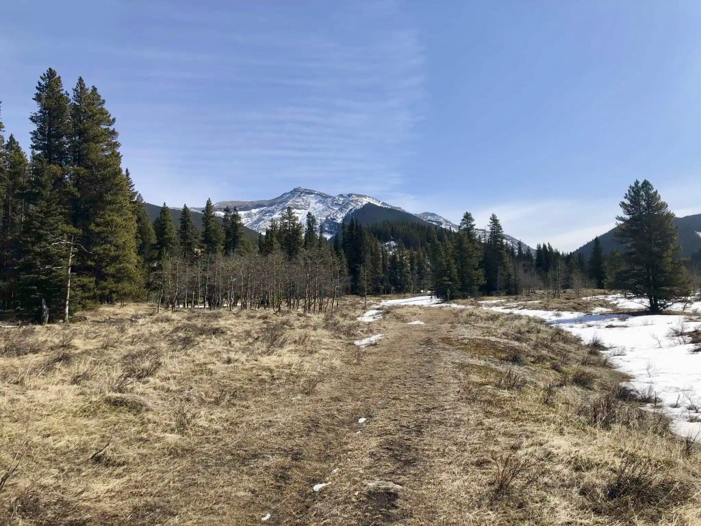
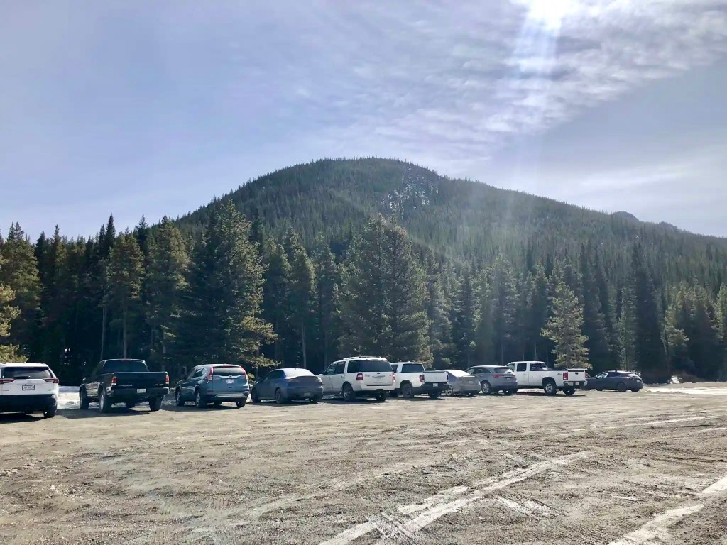
From the parking area, I walked east past the winter gate and along the road toward Cataract Creek Campground. The campground is closed until May 16. I crossed the bridge over Salter Creek and soon found the “Mount Burke” trailhead sign (after about 1 km) on the right-hand side. Follow the trail that will soon ascend into the forest. I was thrilled to find an early-season hike since many mountain hikes are inaccessible this time of year.
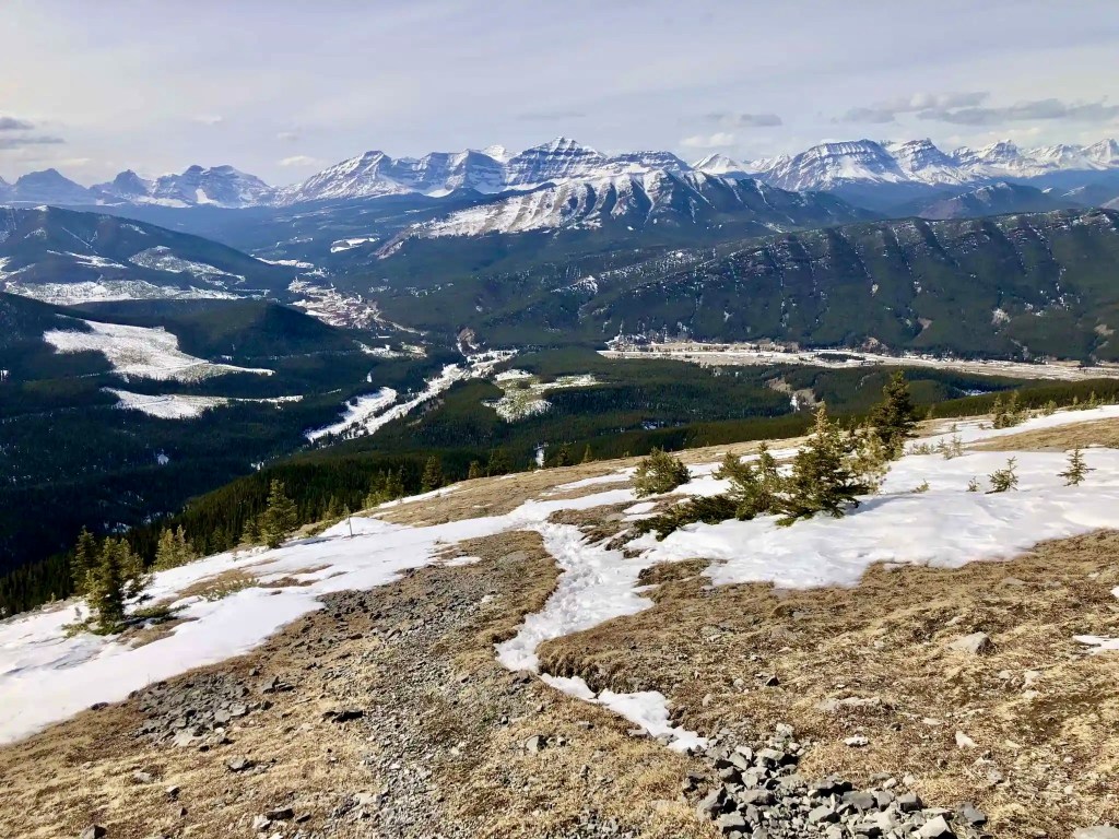
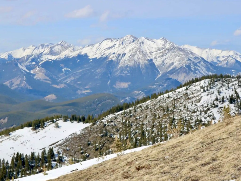
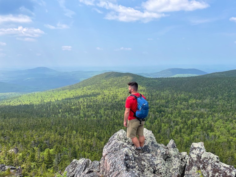
When I was hiking through the forest, it felt somewhat long as I trudged alone. The time may pass a tad quicker if you’re hiking with friends. Thankfully, there are a few switchbacks and moderate grades to make the uphill hiking a bit more manageable. After a couple of hours, reaching up above the treeline made everything feel more worthwhile. What is it about seeing those mountains that motivates us to keep going? Turn around and soak up progressively better views, as you make your way up the mountain. Try to choose a clear hiking day for the full effect!
Read next: Prairie Mountain Hike Near Bragg Creek, Alberta

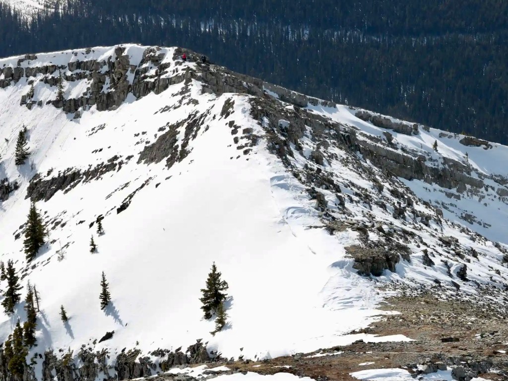
Ridge Walk to the Mount Burke Summit
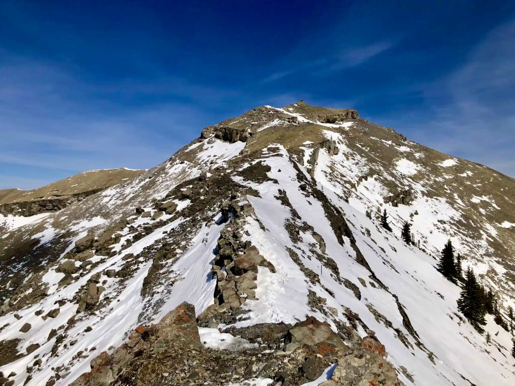
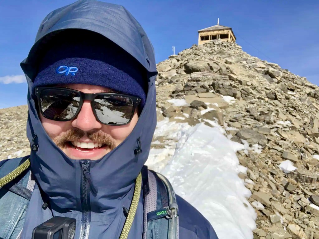
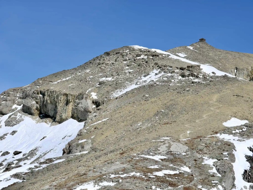
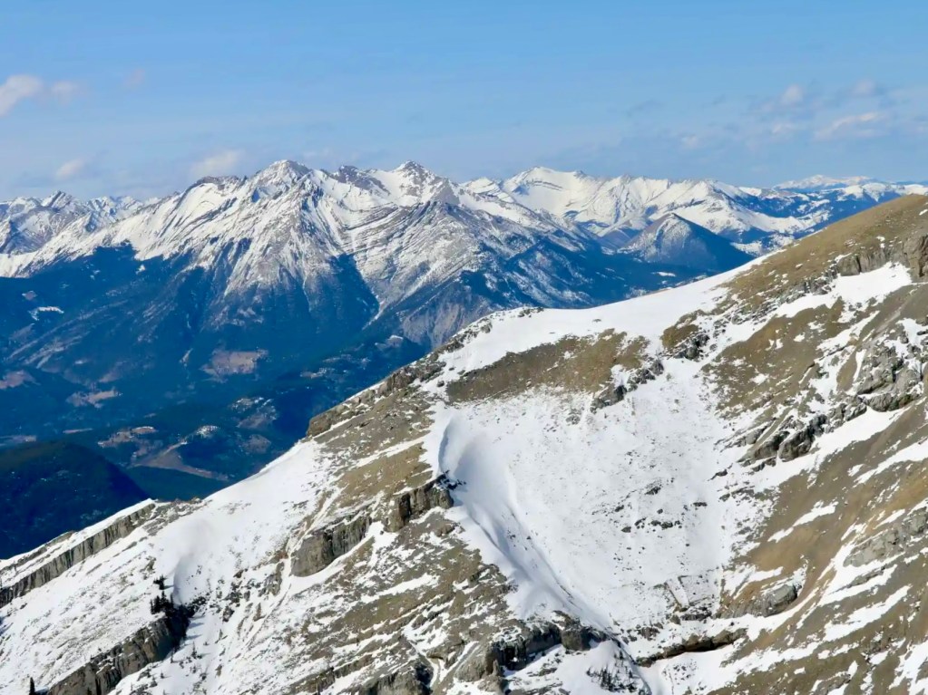
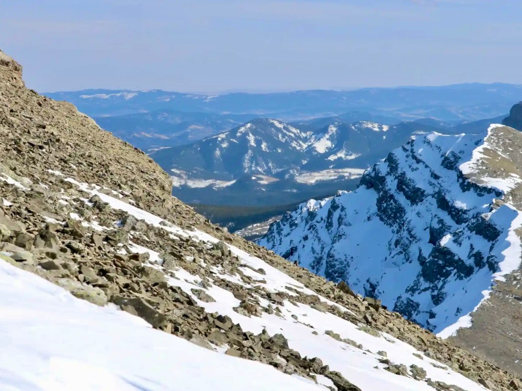
If you’re hiking the snow, you will want to use trail crampons for the short and narrow ridge. I was also glad to have my hiking poles for extra stability. On your way to the top, the terrain becomes trickier with rocks and boulders to navigate but nothing too extreme. Stick to the snow and ice-packed trail to avoid mishaps. The Cameron Fire Lookout gradually became closer and closer, as you make your way up the rocky scree (but no need to scramble).
As I hiked up to the top, I passed a group of three making their way down. I added my outer shell to shield me from the windy summit. Mount Burke is about 2,541 metres above sea level and provides 360-degree views if the weather cooperates. For the entire out-and-back hike, give yourself at least five hours for 13.5 km in the off-season.
Did you know? Cameron Fire Lookout was operated by the Alberta Forest Service from 1929 to 1953 and then it was replaced by lookouts on Raspberry Ridge and Hailstone Butte. How would you feel about spending the night in this lookout hut?

What To Bring — Mount Burke Hike
When you’re hiking the Kananaskis, remember to bring your day pack with hiking essentials. In the early season, it can be hard to know how to pack but I needed those warm layers (especially on the summit). I usually have trail crampons in my pack in the early season and needed them for Mount Burke. As an advocate for hiking poles, I carry them in my pack and more often than not I use them.
Bring at least two litres of water (I like this reservoir) and some extra water if you’re bringing your doggo. You never knew when you or someone else may need a first aid kit for a minor injury, including Leukotape to manage blisters. Honestly, Leukotape is so much better than Moleskin… I could go on for days. Remember to bring bear spray and even a holster for easy access.
Read next: 10 Day Hiking Essentials: What to Bring on a Hike
Know Before You Go
Park Pass: You will need to purchase a Kananaskis Conservation Pass if you haven’t already.
Parking: Parking is available in the Cataract Creek Provincial Recreation Area. No additional parking fees. There’s another small parking area beside the trailhead (accessible from May 16 to Sept 15).
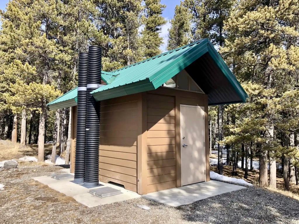
Toilet: An outhouse toilet is available year-round in the Cataract Creek PRA.
Pets: Dogs are permitted on the trail but must remain on a leash. Please pick up after your pet (consider this smell-proof bag).
Seasonal Closure: Cataract Creek Campground is open from May 16 to September 15. In the. winter months, the campground entrance has a gate closure.
Wildlife: Whenever I hike in Kananaskis, I carry bear spray in a holster for easy access. Talking is better than bear bells. As a frequent solo hiker, I sometimes carry a wildlife deterrent horn as an extra precaution.
Avalanche: If you’re hiking in the winter or shoulder season, check the avalanche forecast in Kananaskis before heading out. Do not hike in high-risk avalanche conditions without proper training and gear.
Navigation: Mount Burke Trail is fairly well-established but you won’t find any signage (apart from the “Mount Burke” sign at the beginning). Bring the Gem Trek Highwood & Cataract Creek map along. You can download Mount Burke on AllTrails for offline use.
Note: Leave the bear bells (or shall I say, “dinner bells”) at home. Bear bells are not an effective bear deterrent — but 100% effective at annoying fellow hikers. I’ve heard Parks Canada staff say that bear bells can have the reverse effect and attract bears out of curiosity. Be sure to talk or sing (even off-key) and make your presence known. Carry bear spray in case of an encounter.
More Kananaskis Hiking Trails

Are you looking for more Kananaskis hiking trails? Consider adding some of these to your list:
- Little Lougheed Hike in Kananaskis Country
- Prairie Mountain Hike Near Bragg Creek, Alberta
- Galatea Lakes Hike in Kananaskis Country, Alberta
- Tent Ridge Hike: One of the Best Hikes in Kananaskis
- South Lawson Peak Hike in Kananaskis Country
- Mount Yamnuska Hike Near Canmore, Alberta
Have you experienced the Mount Burke hike in Kananaskis Country? What was it like for you? Let me know in the comments!
Save this for later? Hover over the image to add to Pinterest!

Thomas Coldwell has always been fond of the outdoors. He loves hiking, paddling, and camping, and thoroughly enjoys creating outdoor adventure resources for people like you. Originally from Nova Scotia, Thomas has lived in four Canadian provinces (NS, NB, ON, AB) and has travelled in 20 countries and counting.

It’s planned for tomorrow with such a good weather forecast.
Enjoy it, Leigh! Definitely a worthwhile hike.