
Looking for an adventurous day in the mountains? The Mount Yamnuska hike is a challenging day trek near Canmore, Alberta. This iconic peak in Bow Valley Wildland Provincial Park demands solid preparation and careful decision-making along the route. Expect hands-on scrambling, steep rock faces, and an exposed section protected by chains. If you’re comfortable with exposure and up for a challenge, Mount Yamnuska might be exactly what you’re looking for.

Last Updated: January 2026
If you’ve driven the Trans Canada through the Rockies, you may have noticed the flat rock face of Mount Yamnuska (officially called “Mount John Laurie”) near the town of Canmore. In early October 2020, I planned a solo day trip to complete the challenging Mount Yamnuska hike before the snow arrived. As a difficult hike and an easy-to-moderate scramble, Mount Yamnuska is a unique and demanding adventure for outdoor lovers. If you’re looking for a physically and mentally tough trip, keep reading to find out more.
This post includes affiliate links. If you purchase through one of the links, I may receive a percentage of the sale at no extra cost to you. Thanks for your support!
Mount Yamnuska Trail Map
About the Mount Yamnuska Hike (Canmore, Alberta)

Location: Canmore, Alberta
Distance: 12 km loop
Difficulty: Difficult hike / easy-to-moderate scramble
Elevation: 930 metre gain
Time: 5 – 6 hours
Dog-friendly: Yes, but must remain on a leash. That being said, I wouldn’t personally bring my dog on this hike due to exposure and scrambles.
Features: The Mount Yamnuska hike features spectacular summit views of the Bow Valley. Main challenges include rock scrambles (including “The Chimney”), exposed ledge with chains, and steep scree hiking. All of these challenges can be enjoyable for some and intimidating for others, and should be approached carefully. Complete the Mount Yamnuska hike as an out-and-back to the summit or continue around for the loop.
Trail Upgrades: Alberta Parks closed Mount Yamnuska for upgrades in 2021 and reopened in 2022, with improvements to the Yamnuska East Trail to Raven’s End (including new rock steps) and a newly routed West Col Trail down through the forest. Alberta Parks recommends descending on the West Col Trail instead of the original scree descent, which is considered hazardous.

Is Mount Yamnuska Right for You?

When I lived in Calgary, I remember hearing about several injuries on Mount Yamnuska, including a fatal accident on a steep scree slope. Before heading out, it’s important to assess our own readiness for this difficult trail. While it’s not always possible to be prepared for every scenario, ask yourself a few questions before attempting the Mount Yamnuska hike: Are you physically fit and prepared for a long hiking day? Are you good at route finding? Have you hiked on scree before? Are you afraid of heights? How do you feel about exposure?
Self-assessments can be difficult, but it’s important to consider our skills and preparedness before embarking on this hike and scramble.
Read next: Tent Ridge Hike: One of the Best Hikes in Kananaskis

Finding the Mount Yamnuska Trailhead

If you’re driving from Calgary, take the Trans Canada Hwy for about 70 km and then take Exit 114 toward Seebe / Exshaw. Turn right onto Bow Valley Trail and then turn left after 2 km to access the Mount Yamnuska Trailhead. Outhouses are available next to the parking area. If you’re hiking Mt. Yamnuska for the first time, check out the sign next to the trailhead (or keep reading this post) to avoid “No Go Zones” on the mountain.

Mount Yamnuska Hike — One of the Best Hikes Near Canmore

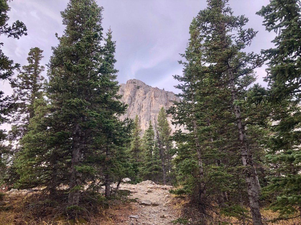
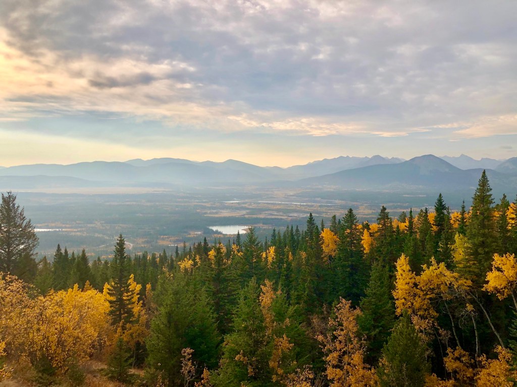
The Mount Yamnuska hike begins on a well-groomed trail, moving gradually up through the forest. After 15 minutes, stick to the right and head toward the East Ridge and Raven’s End. I was blown away by the Bow Valley’s gold-coloured aspens in October. Raven’s End is a nice lunch spot on the east shoulder of Mt. Yamnuska, where the treeline ends and the alpine terrain begins. After an hour or so, you’ll approach the first real challenge in The Chimney, which is the gap between two rock faces. Here, you’ll climb up and over wedged boulders. After this, hikers become scramblers (using hands to climb) a few more times on Yamnuska.
For most first-timers, the most intimidating challenge involves traversing a 50-foot-long rock ledge while holding chains bolted to the mountainside. Here, hikers can either carefully cross the rock ledge to reach the summit, or turn back for the parking lot. Choose the option you’re most comfortable with (have the hike that’s right for you!). After crossing the ledge, I continued up the scree slope to the top of Mount Yamnuska (2,200 metres). In the summer months, this summit can be crowded, but I found myself all alone. I considered returning the way I came, but a group of hikers convinced me to explore the West Col.
I slowly made my way down the hard-packed trail, with tiny pebbles underfoot (not my favourite…). Watch your step on this steep scree section (hiking poles are useful). Follow the blue markers and stay on the trail to avoid a hazardous section below. Between Yamnuska and Goat Mountain, the new West Col Trail descends through the forest and connects to the original path. Alberta Parks recommends avoiding the hazardous scree section beneath Mt. Yamnuska’s vertical rock face with multiple climbing routes. When I visited, the original scree descent was closed, so I crossed below the vertical rock face and down the steep West Ascent Trail. It looks like the new West Col Trail is more pleasant.
Read next: Mount Burke Hike in Kananaskis Country, Alberta


Mount Yamnuska Routes: Three Distinct Challenges

Here are the three main route challenges on the Mount Yamnuska hike and scramble:
Challenge #1 — The Chimney
The Chimney on Mount Yamnuska hike is a fairly narrow gap between two vertical rock faces, requiring hikers to use hands and feet to climb up and over boulders wedged at the base. While The Chimney is a short section, it can be a very fun and memorable part of the adventure. Don’t forget to look back to soak up the views.
Challenge #2 — The Chains
The Mount Yamnuska chains section involves crossing a rugged rock ledge with the support of heavy-duty chains bolted into the cliff. From my perspective, the chains add an exhilarating thrill to this hike, but must be approached with caution. If you’re afraid of heights, the chains may be difficult to overcome. Hikers will need careful footing and a strong grip, and can use a harness and short rope for additional support.
Challenge #3 — Backside Scree Descent to West Col
Hiking down the backside of Mt. Yamnuska involves a steep, slippery slope covered in loose rocks known as scree. Hikers must maintain balance and strong leg control to navigate the steep downslope. Be careful not to dislodge rocks and yell “rock” for hikers below if a boulder is accidentally dislodged. You will need careful footing and strong route-finding skills to safely reach the West Col.
Read next: Galatea Lakes Hike in Kananaskis Country, Alberta


What to Bring for the Mount Yamnuska Hike

Before starting your hike, make sure you have everything you need to handle the route challenges and variable conditions. I wouldn’t attempt Mount Yamnuska without sturdy hiking boots and trekking poles for the rock scree. Given the exposure to the elements, bring clothing layers like a warm jacket and a rain shell. In your day pack, remember to bring at least two litres of water (no water source on the trail) and some high-energy snacks. I would also carry a satellite communications device and a small first aid kit in case of an emergency. I can see the benefit of bringing safety gear (such as a helmet for scree or harness for the chains) to offer additional support and protection.
Read next: 10 Day Hiking Essentials: What to Bring on a Hike

Know Before You Go

Park Pass: A Kananaskis Conservation Pass is required to park your vehicle in Kananaskis and the Bow Valley, which includes Mount Yamnuska.
Parking: The Mount Yamnuska parking lot is fairly large but can fill up quickly. Arrive early to secure a spot in the peak summer months.
Toilets: Outhouse toilets are available next to the parking lot but no outhouse along the Mount Yamnuska Trail.
Trail Upgrades: As mentioned earlier, Mount Yamnuska has seen significant trail upgrades in recent years, including improving the East Ridge Trail and relocating the West Col Trail.
Challenges: The Mount Yamnuska hike and scramble involves three main route challenges: The Chimney, The Chains, and scree descent to West Col. Learn more about these route challenges above.
Safety: Mount Yamnuska sees many rescue calls each year. While this hike and scramble offers impressive views and thrilling challenges, visitors must go prepared and treat this route with respect. Assess your preparedness before you go. I recommend carrying a first aid kit and satellite communications device in case of an emergency.
Climbing Routes: There are over 150 climbing routes on Mount Yamnuska. Do not throw rocks off of the summit and proceed with caution beneath climbing routes.
Navigation: If you’re an experienced hiker, you shouldn’t have much trouble navigating the maintained trail and finding the route on the scree. Download the Mount Yamnuska Traverse and West Col Descent on AllTrails for offline use.
Wildlife: Respect wildlife in the area by maintaining an appropriate distance and never feeding wild animals. This is bear country. Hikers should carry bear spray (I use a holster) and know how and when to use it.
Hiking with Children: Bringing your children on the Mount Yamnuska hike is a personal choice, but you may want to use additional safety measures (such as a harness and rope) for the chains section and even a helmet for scree.
Mount Yamnuska Hike: Final Thoughts

Mount Yamnuska is one of my favourite hikes and scrambles in Alberta, with various unique challenges and spectacular terrain and views. Before heading out, be sure to do your research to understand what you’ll encounter on this adventure. After experiencing the Mount Yamnuska Trail solo, I would highly recommend it to any outdoor enthusiast prepared for this Rocky Mountain challenge!
Have you experienced the Mount Yamnuska hike and scramble? Have you visited since the trail upgrades? Let me know in the comments below!
Save this for later? Hover over the image to add to Pinterest 👇

Thomas Coldwell has always been fond of the outdoors. He loves hiking, paddling, and camping, and thoroughly enjoys creating outdoor adventure resources for people like you. Originally from Nova Scotia, Thomas has lived in four Canadian provinces (NS, NB, ON, AB) and has travelled in 20 countries and counting.


That is an incredible place to hike.
I couldn’t agree more!
Yam is a great hike so close to Calgary, but now that the scree looks to be closed, the trail goes right under the climbing routes, so you really have to watch for rockfall from above. Hopefully they’ll reroute the trail to avoid both the scree and the climber’s access trail.
That’s very true. The scree was closed when I was there, but I didn’t have any trouble with falling rocks. I wonder if they will reroute in the future?