Searching for a picturesque trek in Kananaskis Country? The Pocaterra Ridge hike offers a breathtaking ridge walk in Peter Lougheed Provincial Park, with panoramic views of the Rocky Mountains above the treeline. Despite a snow-covered path in the morning, the vibrant yellow larches were spectacular toward the end of September. If you’re looking for a scenic hike in Kananaskis, Pocaterra Ridge should be on your list!

Last Updated: March 27, 2024
Toward the end of September 2020, I drove out to Kananaskis from Calgary for the Pocaterra Ridge hike in Peter Lougheed Provincial Park. As a popular hike in Kananaskis, Pocaterra Ridge crossed my radar after staying a Boulton Creek Campground in the summer. I didn’t have time to hike the ridge in the summer, but I knew I had to come back. Now that I’ve crossed Pocaterra Ridge off my list, I can say it’s easily one of the best day hikes in Kananaskis Country (at least, in my humble opinion).
This post includes affiliate links. If you purchase through one of the links, I may receive a percentage of the sale at no extra cost to you. Thanks for your support!
About Pocaterra Ridge Hike

Location: Peter Lougheed Provincial Park, Kananaskis Country, Alberta
Distance: 11 km point-to-point
Difficulty: Difficult
Elevation: 746 metre elevation gain
Time: 5 – 7 hours
Dog-friendly: Yes, but dogs must remain on a leash.
Features: The Pocaterra Ridge hike offers exceptional mountain views from beginning to end, hiking along the ridge line in the heart of Kananaskis Country. If you visit toward the end of September or the beginning of October, you can witness the vibrant yellow larch trees that make this Kananaskis hike even more spectacular.

Pocaterra Ridge Trail Map
Finding the Pocaterra Ridge Parking Lot

If you’re driving from Calgary, take the Trans Canada Highway and then Exit 118 toward Kananaskis Country. Follow the Kananaskis Trail (Hwy 40) down past the turnoff for Peter Lougheed Provincial and continue to the Highwood Pass Day Use Area. You shouldn’t have any trouble finding the parking area. It’s incredibly popular in autumn with Ptarmigan Cirque starting from the same place.
You could also choose to park at Little Highwood Pass to hike Pocaterra Ridge from north to south. When I visited, I decided to leave my bike at Little Highwood Pass and then parked at Highwood Pass Day Use to start the hike. When I finished the ridge, I rode my bike back to the Highwood Pass Parking Lot. I loved hiking from south to north but the bike ride at the end was uphill (and I was tired!). If you’re hiking solo, consider leaving your bike at Highwood Pass and hiking north to south along Pocaterra Ridge. You’ll have an easier ride afterwards.
Read next: Arethusa Cirque Hike in Kananaskis Country

Pocaterra Ridge Hike — Shoulder-Season Kananaskis Hike

Starting from the Highwood Pass Parking Lot, head north toward Ptarmigan Cirque but keep left at the fork instead of crossing the highway toward Ptarmigan. Follow the braided trail through the trees and before long you’ll find yourself in the valley. After the forest section, the trail became more defined but was quite slippery when I visited. I suggest bringing micro-spikes or trail crampons if you’re planning the Pocaterra Ridge hike in September.
Keep going to to find a small pond and then continue up to Pocaterra Ridge. When hiking north to south, this initial peak is the most difficult ascent at around 400 metres. Be prepared for a few challenges on the ridge walk, including slippery snow and ice. I was glad for my mid-layer jacket and waterproof shell to shield from the blowing wind. After descending from the first peak, the hike along the ridge is fairly moderate with plenty of photos ops along the way. There are four different peaks along Pocaterra Ridge, but the first one is definitely the biggest slog (especially when it’s covered in snow).
Descending from Pocaterra Ridge to Little Highwood Pass is fairly straightforward. This trail can be a bit tricky with loose rocks and gravel — you might want those trekking poles. With a fairly steep descent, I can see why most people start from Highwood Pass. Continue on the well-defined trail through the forest and down to Highway 40. Cross the road (look both ways!) to reach the parking area.


What’s The Best Way To Hike Pocaterra Ridge?

I suggest hiking Pocaterra Ridge as a point-to-point route from south to north. That way, you can take your time on the ridgewalk and soak up the spectacular views all around. For this option, park one vehicle at Little Highwood Pass and then head south to start hiking from Highwood Pass Day Use (see above for directions).
If you’re visiting solo or don’t have two vehicles, arranging a car shuttle can be a bit of a pain. You could plan to hike as an out-and-back and turn around before the 280-metre descent to Little Highwood. Honestly, it wouldn’t be the worst thing to spend more time on this ridge. Depending on the season, start early to have enough daylight for a longer trek.
As a final option, you could do what I did. Bring a bike and lock it up at Little Highwood Parking Area. When you’ve finished the one-way hike, bike uphill about 6.5 km to Highwood Pass Parking Area. By the time I reached my vehicle, I was exhausted from the hike and the additional 6.5 km uphill bike ride — but it worked!

What To Bring — Pocaterra Ridge Hike

Being fairly new to Alberta at the time, I wasn’t expecting the winter wonderland I found in late September (rookie mistake, I know). I didn’t come prepared with trail crampons but thankfully wore hiking boots with decent tread. I wouldn’t have wanted to be out there in sneakers. In fact, many others turned back after the first peak due to slippery snow on the ridge. Be prepared for anything in the shoulder seasons. With temperatures below zero, I needed winter gear like a toque, gloves, multiple layers, and hiking boots.
Don’t forget to bring a day pack with enough water and snacks for the adventure. I like to carry at least two litres of water in this reservoir. Climbing up and down the ridge, trekking poles were helpful and I would recommend them. In the shoulder season and winter, I always have an extra down jacket for insulation just in case.
Read next: 10 Day Hiking Essentials: What to Bring on a Hike

Know Before You Go — Hiking in Kananaskis

Park Pass: Don’t forget your Kananaskis Conservation Pass. Purchase online before arriving in the park (you won’t have cell service in Kananaskis Country).
Parking: Most people park at the Highwood Pass Day Use Area. However, you could also park at Little Highwood Pass to hike north to south on Pocaterra Ridge.
Toilet: Outhouse available in the Highwood Pass Parking Lot.
Pets: Dogs are permitted but must remain on a leash. Please pick up after your pet and consider bringing a smell-proof bag to carry out full dog bags.
Seasonal Closure: Highwood Pass Day Use is inaccessible from December 1 until June 15 due to the winter gate closure.
Navigation: Pocaterra Ridge is a highly trafficked route but you should be prepared for some route finding. Bring the Gem Trek Kananaskis Lakes map for reference. You could also download Pocaterra Ridge from AllTrails for offline use.
Safety: Before heading out to Kananaskis Country, leave your trip plan with someone you trust and bring a first aid kit for minor injuries.
Wildlife: Kananaskis is grizzly bear territory and you may encounter bears on the trail. Bring bear spray and know how and when to use it. I use a bear spray holster for quick access. Talk while you’re hiking and hike in a group when possible.
Read next: King Creek Ridge Hike in Kananaskis Country

More Kananaskis Hikes For Your List

Are you looking for more Kananaskis hikes to add to your list? Here are a few options:
- The Edworthy Falls Hike in Alberta’s Kananaskis Country
- Galatea Lakes Hike in Kananaskis Country, Alberta
- Sarrail Ridge Hike in Kananaskis Country
- Mount Burke Hike in Kananaskis Country
- Upper Kananaskis Lake Trail: Family-Friendly Kananaskis Hike
- Mount Yamnuska Hike Near Canmore, Alberta

Have you hiked Pocaterra Ridge in Kananaskis Country? Tell me about your experience below. Thanks for reading!
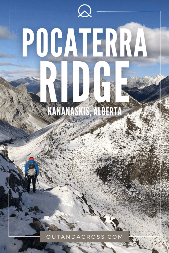
Save this for later? Hover over the image to add to Pinterest!
Thomas Coldwell has always been fond of the outdoors. He loves hiking, paddling, and camping, and thoroughly enjoys creating outdoor adventure resources for people like you. Originally from Nova Scotia, Thomas has lived in four Canadian provinces (NS, NB, ON, AB) and has travelled in 20 countries and counting.