
Are you looking for a challenging and rewarding hike in Kananaskis Country? The Sarrail Ridge hike offers spectacular views of Upper and Lower Kananaskis Lakes, but not before a very steep climb up to the ridge. When the conditions are right (not in the winter…), hike through the forest and alongside Rawson Lake before climbing up to the ridge. Don’t miss this spectacular place!
Last Updated: January 2026
Back in October 2021, before the snow arrived, I drove from Calgary to Kananaskis to finally experience the Sarrail Ridge hike. Of course, I was thrilled to check this one off my list. If you’re heading out, visit between June and October to avoid significant avalanche risk after Rawson Lake. Do not attempt Sarrail Ridge in the winter months.
This post includes affiliate links. If you purchase through one of the links, I may receive a percentage of the sale at no extra cost to you. Thanks for your support!
Sarrail Ridge via Rawson Lake Trail Map
About the Sarrail Ridge Trail (Kananaskis Country)
Location: Peter Lougheed Provincial Park, Kananaskis Country, Alberta
Distance: 11.5 km out and back
Difficulty: Difficult
Elevation: 670 metres elevation gain
Time: 4 – 5.5 hours
Dog-friendly: Yes, but dogs must be on a leash.
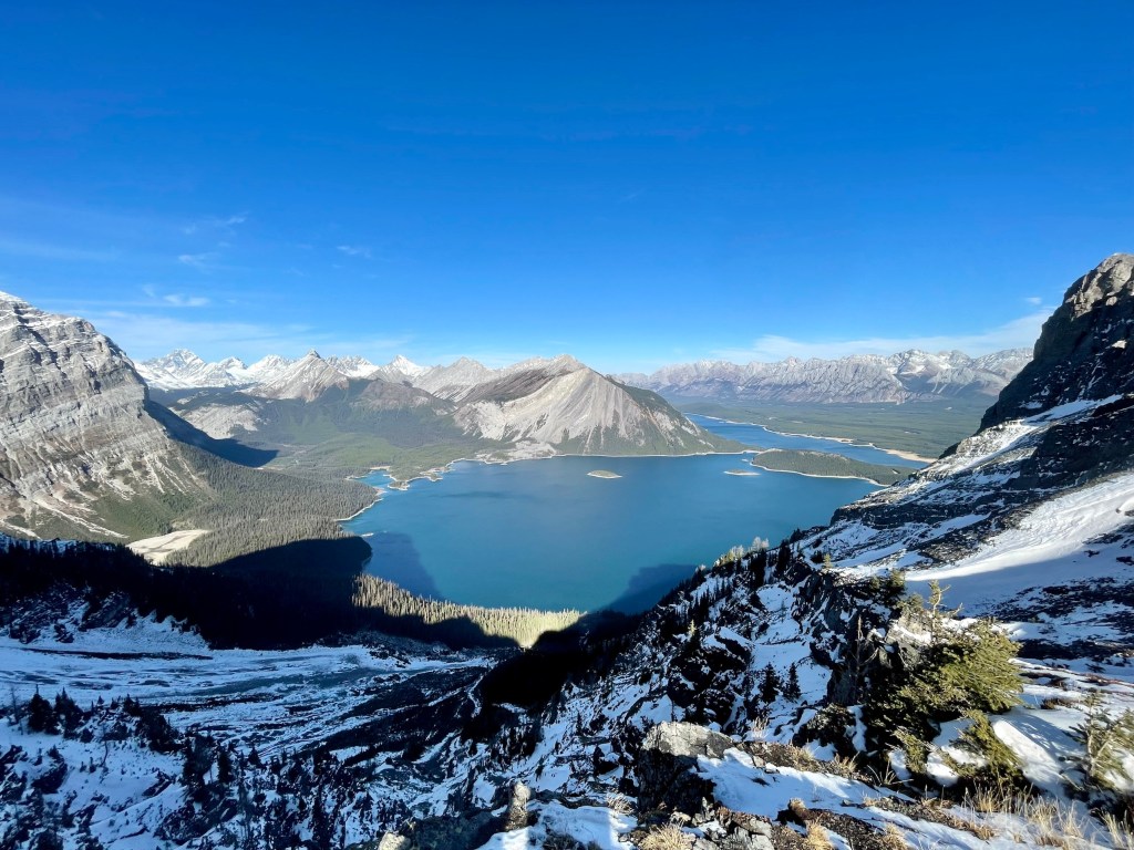
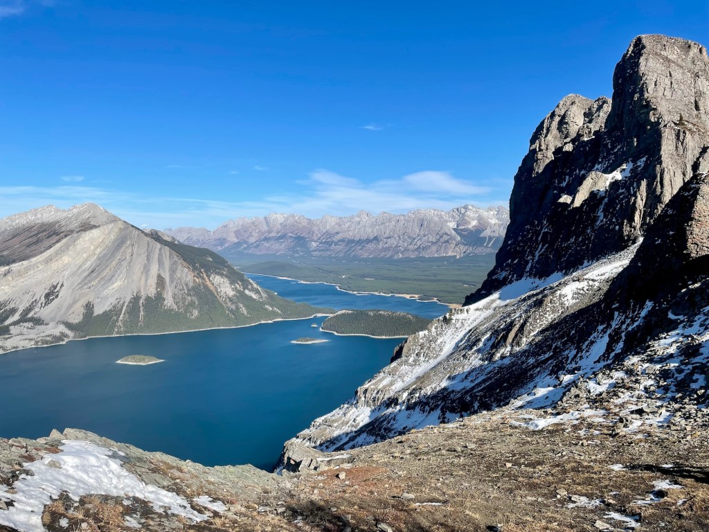
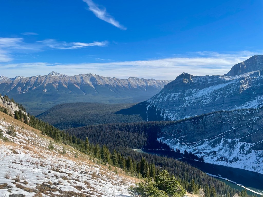
Features: The Sarrail Ridge hike starts next to Upper Kananaskis Lake before turning off onto the forested Rawson Lake Trail. Regular hikers will find the Rawson Lake route fairly easy or moderate, while others may consider this difficult. After passing Rawson Lake, there’s a steep climb up to Sarrail Ridge before you’re greeted with panoramic views of Upper and Lower Kananaskis Lakes, Mount Indefatigable, and the surrounding landscape.
Finding the Sarrail Ridge Trailhead
If you’re driving from Calgary, take the Trans Canada Highway and then Exit 118 toward Kananaskis Country. Follow Highway 40 (Kananaskis Trail) for around 50 km to Peter Lougheed Provincial Park and turn right onto Kananaskis Lakes Trail. Head over to Upper Kananaskis Lake Day Use Area for parking and access the trailhead for Sarrail Ridge. During the summer months, arrive early to find a parking spot in this popular area.
Read next: Upper Kananaskis Lake Trail: Family-Friendly Kananaskis Hike

Sarrail Ridge Hike — One of the Best Hikes in Kananaskis Country

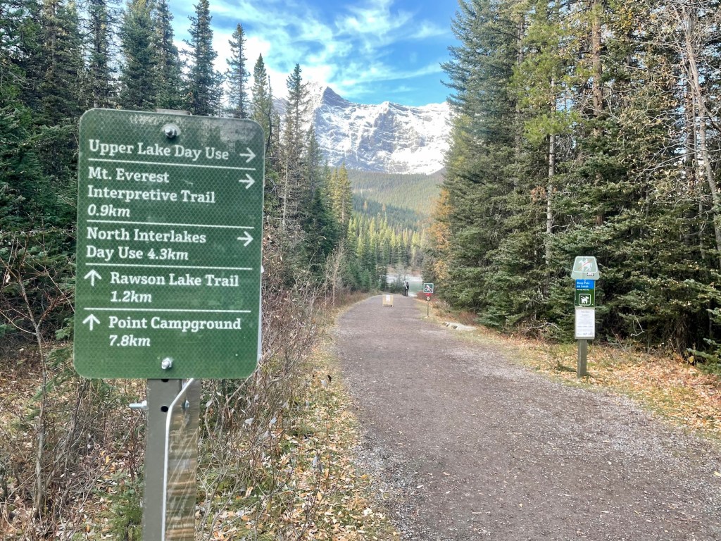
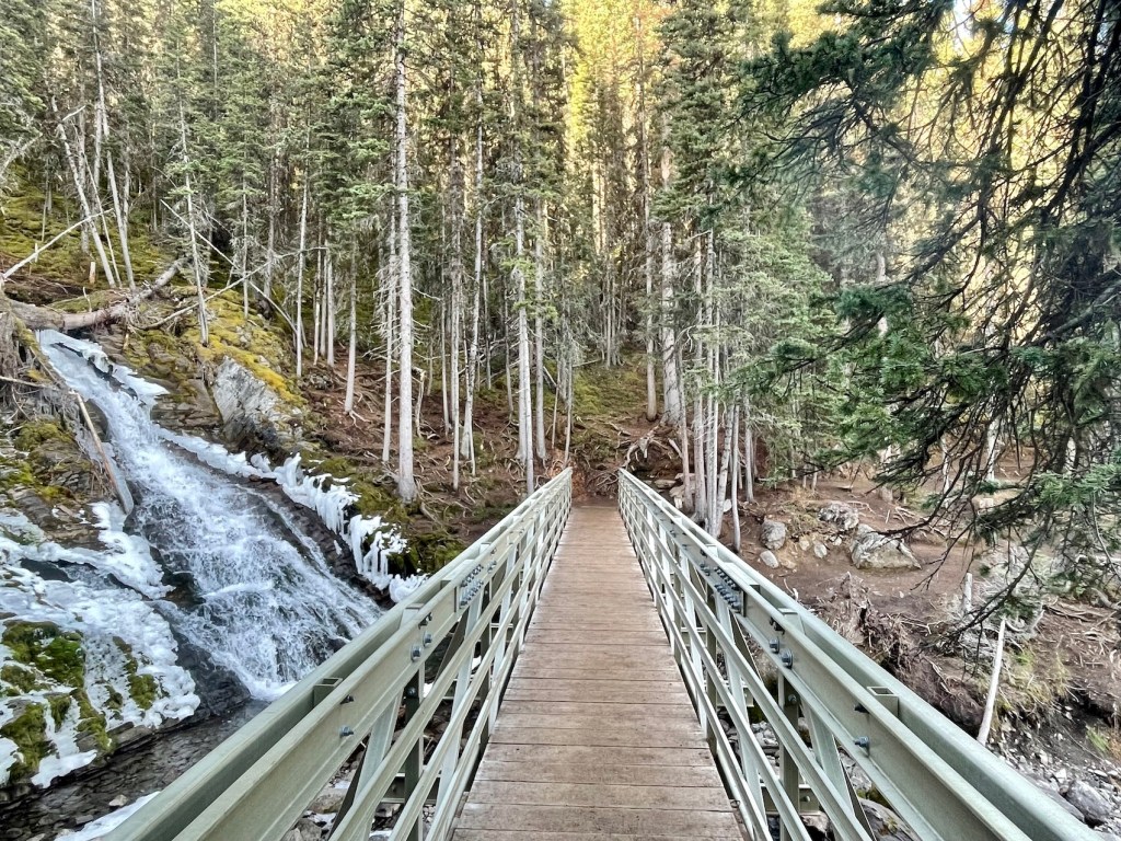
The Sarrail Ridge hike begins along the shoreline of Upper Kananaskis Lake, where many visitors enjoy the family-friendly Upper Kananaskis Lake Trail. I left the parking area and hiked along the southern shore of Upper Kananaskis, admiring the autumn views and embracing the cooler weather. After 20 minutes or so, cross over the Sarrail Creek bridge before turning left toward Rawson Lake with signs to follow. Head up toward the lake through the subalpine forest for about 2.7 km.
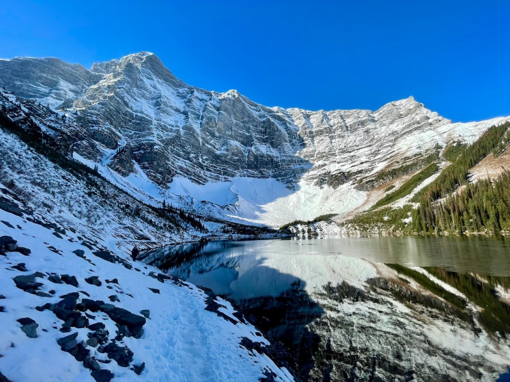
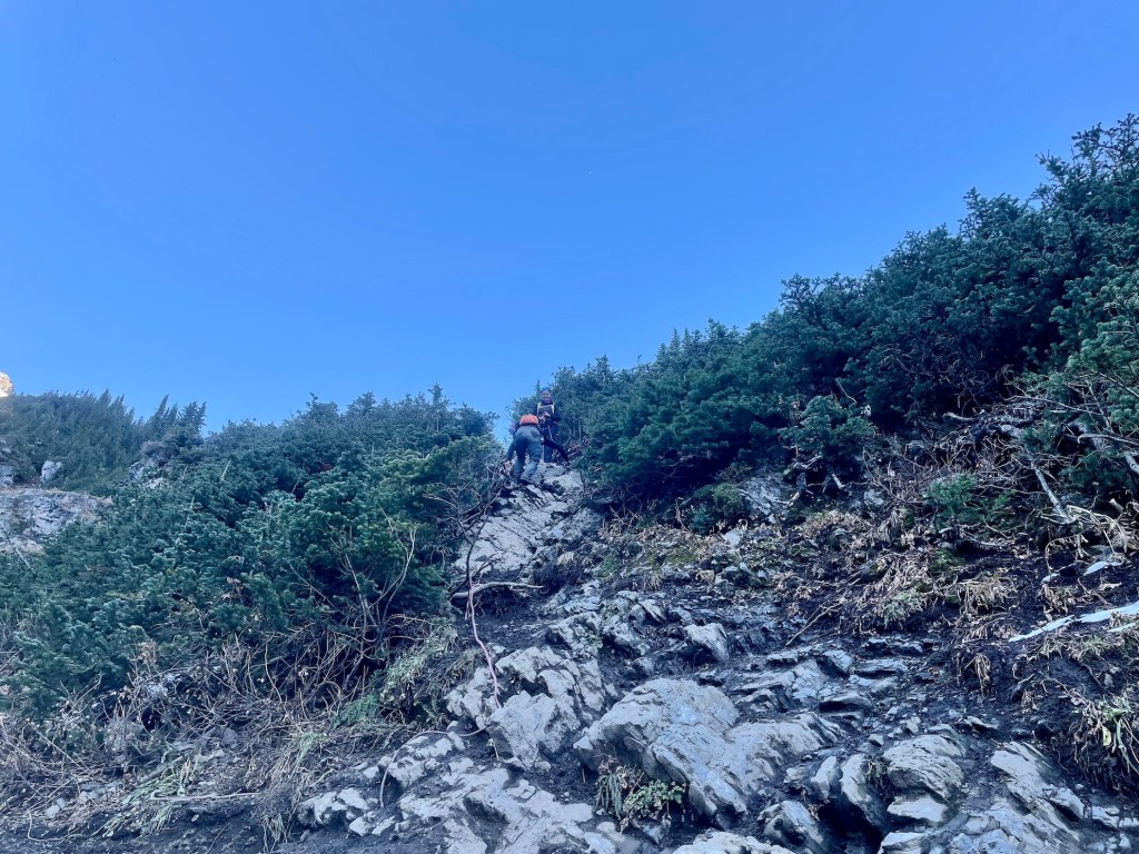
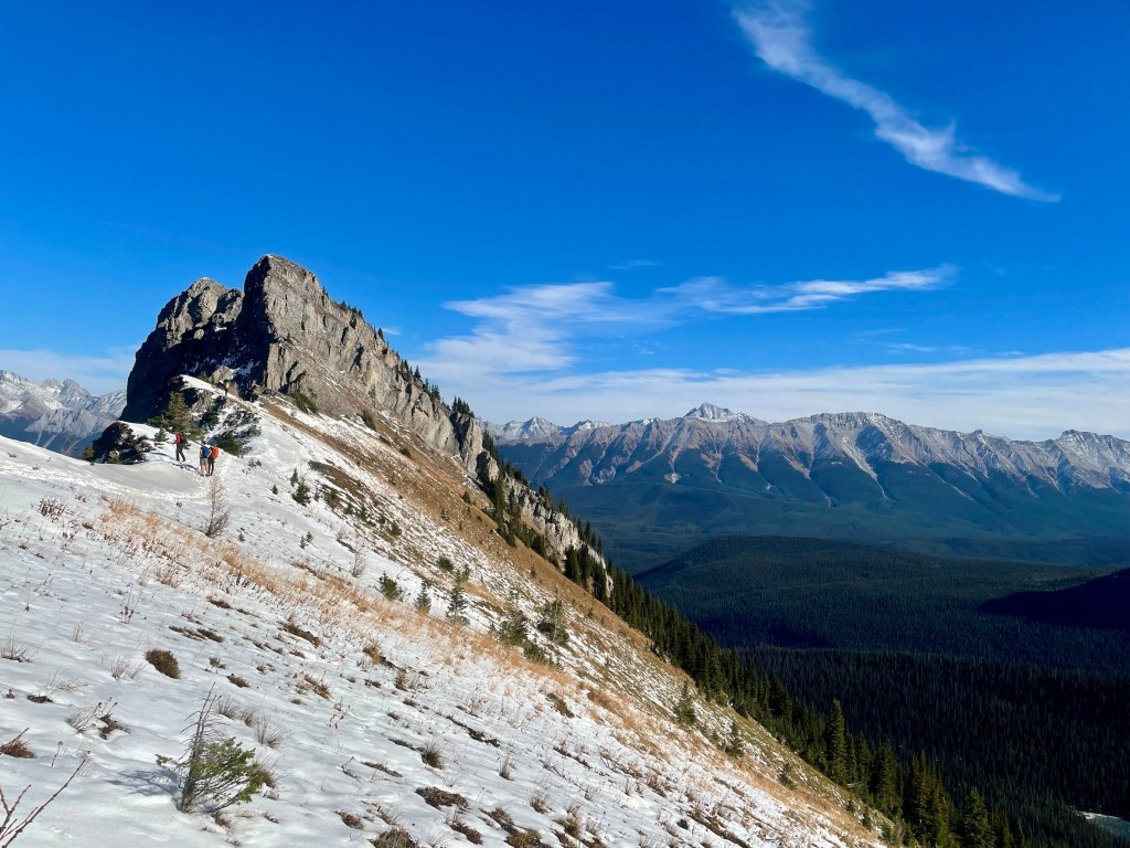
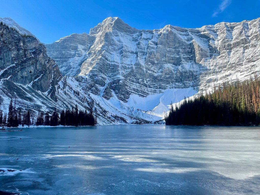
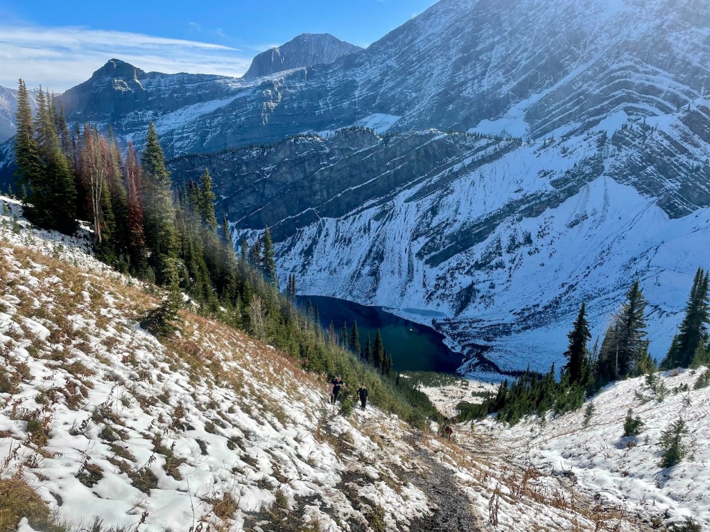
Rawson Lake is a worthy day trip in and of itself. Once you reach the lake, take a minute to admire the scenic backdrop before heading left around the lake. Follow the gentle lakeshore route before swinging right (north) toward the steepest section. At this point, I could see Sarrail Ridge up ahead. On this unofficial route, you’ll climb over 350 metres in just one kilometre (trekking poles, yes!). But don’t worry, it’s totally worth it.
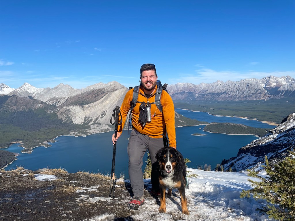
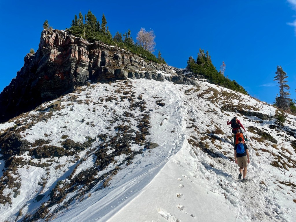
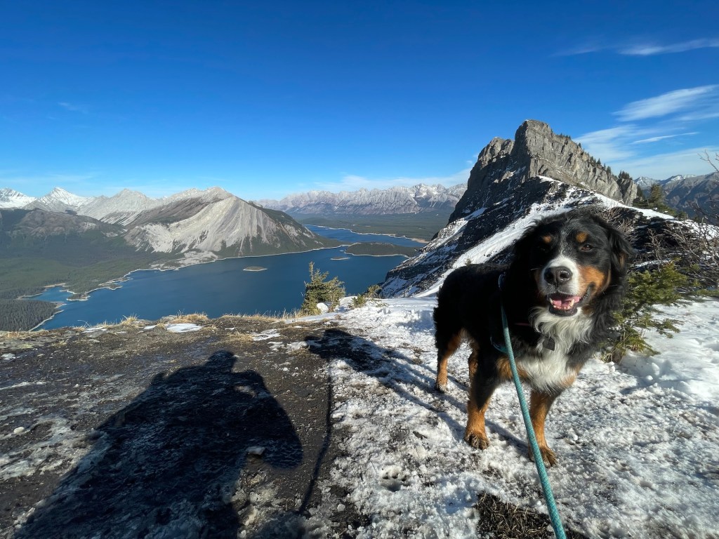
After huffing and puffing up the mountain, Bella and I found fantastic views from the col. Here, you can keep hiking along the ridge for better and better viewpoints of the Kananaskis Lakes below. It’s a rocky scramble up the final peak to the east of the ridge (we didn’t do this part). Overall, plan for 4 to 5.5 hours to complete this 11.5 km out-and-back adventure.
Note: Use caution when walking along Sarrail Ridge, especially when hiking with children. There are steep and hazardous ledges without guardrails or fences.


What to Bring for a Day Hike in Kananaskis
Sarrail Ridge is a difficult hiking route that requires preparation. Before you head out, make sure you have a day pack with essentials like water (I use this two-litre reservoir), snacks, and a lightweight first aid kit. When hiking in Kananaskis, be prepared for the weather to change on a dime. Pack a warm jacket and a waterproof jacket (even when there’s no rain in the forecast).
I suggest hiking boots for this rugged trail, and wouldn’t go without poles. If you’re new to hiking, you may want to consider some easier options like Prairie Mountain or Tunnel Mountain before Sarrail Ridge.
Read next: 10 Day Hiking Essentials: What to Bring on a Hike
Know Before You Go — Hiking in Kananaskis Country
Park Pass: Don’t forget the Kananaskis Conservation Pass before starting your hike. You can purchase at visitor centres in Kananaskis Country or online.
Parking: Visitors can park at the Upper Kananaskis Lake Day Use Area. No additional parking fee is required.
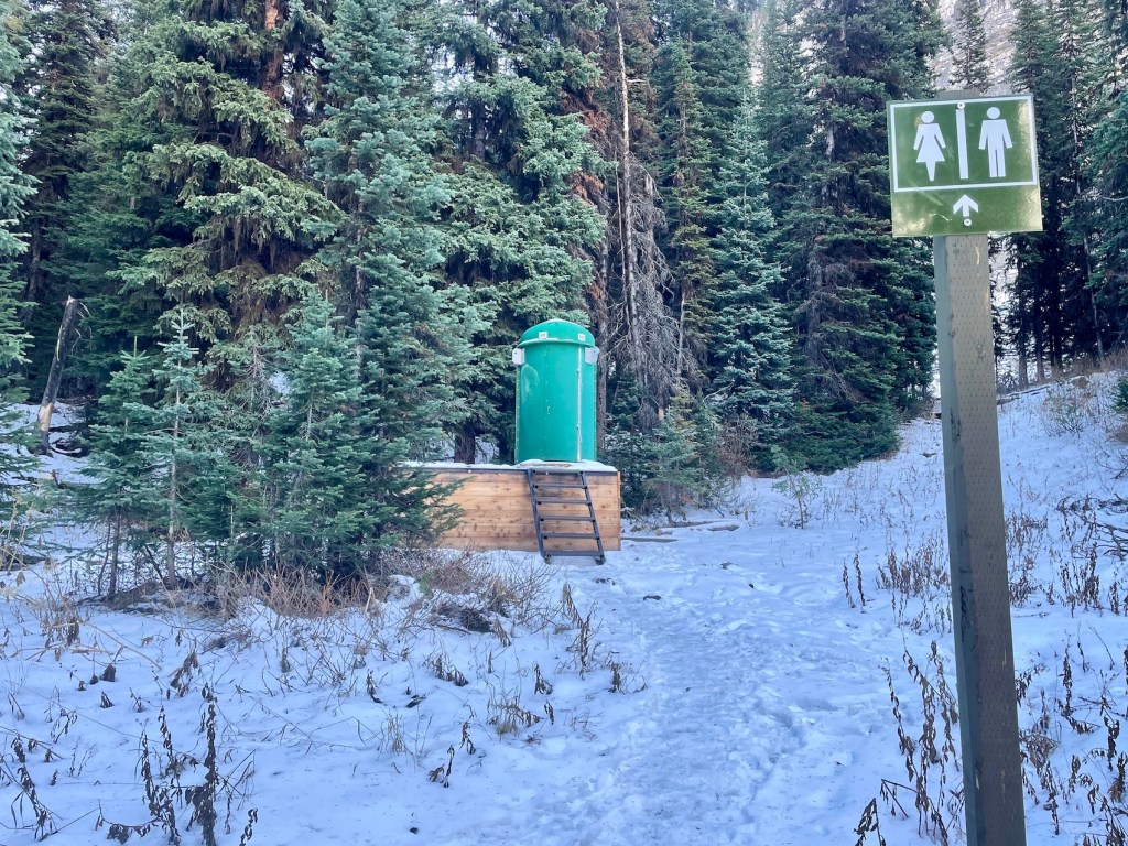
Toilet: Outhouse toilets are available next to the parking area and next to Rawson Lake.
Pets: Dogs are permitted but must remain on a leash. Remember to pick up after your pet.
Season: Plan to visit Sarrail Ridge between June and October to avoid avalanche risks.
Navigation: You shouldn’t have too much trouble finding your way. Bring a copy of the Gem Trek Kananaskis Lakes map as a reference. You can also download Sarrail Ridge via Rawson Lake Trail on AllTrails for offline use.
Wildlife: Kananaskis is home to a variety of wildlife, including bears. When hiking in bear country, practice bear safety and carry bear spray in a holster for easy access. Never feed or approach wildlife.
More Kananaskis Hikes To Try
If you’re looking for more Kananaskis hikes, you might want to add some of these to your list:
- Little Lougheed Hike in Kananaskis Country
- Tent Ridge Hike: One of the Best Hikes in Kananaskis
- Galatea Lakes Hike in Kananaskis Country, Alberta
- Yates Mountain via Prairie View Trail in Kananaskis
- King Creek Ridge Hike in Kananaskis Country
- Mount Burke Hike in Kananaskis Country
Are you planning to complete the Sarrail Ridge hike in Kananaskis? Have you visited recently? Let me know in the comments below!
Save this for later? Hover over the image to add to Pinterest 👇
Thomas Coldwell has always been fond of the outdoors. He loves hiking, paddling, and camping, and thoroughly enjoys creating outdoor adventure resources for people like you. Originally from Nova Scotia, Thomas has lived in four Canadian provinces (NS, NB, ON, AB) and has travelled in 20 countries and counting.


One thought