
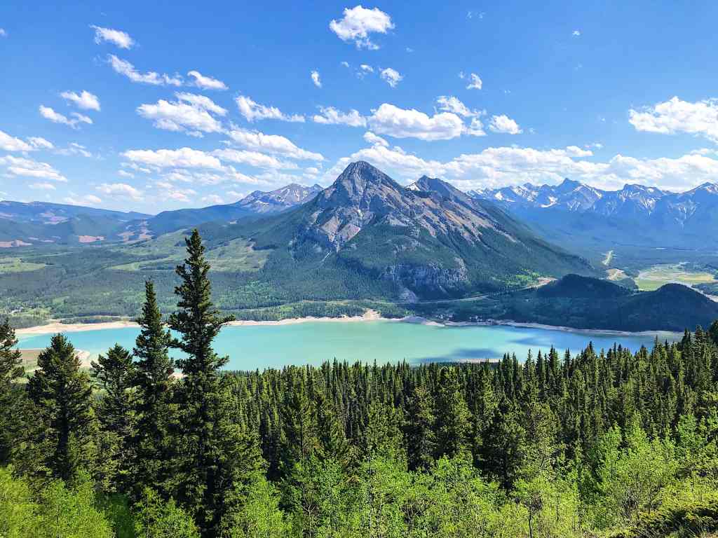
As a moderate Kananaskis hike, Yates Mountain via the Prairie View Trail (also known as the Barrier Lake Lookout) is a very popular year-round route. During the summer months, the Barrier Dam parking area often fills up quickly with day trippers. One of the closest Kananaskis hikes to Calgary, Yates Mountain rewards hikers with expansive views of Mount Baldy and the surrounding foothills, without the effort required for many other Rocky Mountain summits. To avoid the busiest times, plan to hike on a weekday or start early in the morning.
Last Updated: January 2026
Before most hikes in Kananaskis, I find myself driving down Highway 40 and passing the turnoff for Barrier Lake. If you’re trying to avoid crowds, it’s easy to write this area off altogether (it often looks too busy to bother). But in June 2021, I carved out a quiet Thursday afternoon and headed to Barrier Dam to hike Yates Mountain. Also known as the Barrier Lake Lookout, Yates Mountain via the Prairie View Trail is a fairly moderate hike that punches well above its weight. On a clear day, the views are excellent, and I was genuinely impressed by how rewarding this summit felt.
This post includes affiliate links. If you purchase through one of the links, I may receive a percentage of the sale at no extra cost to you. Thanks for your support!
Yates Mountain Trail Map (Kananaskis Country)
About Yates Mountain via the Prairie View Trail (Barrier Lake Lookout)

Location: Kananaskis Country, Alberta, Canada
Distance: 12.5 km out and back
Difficulty: Moderate
Elevation: 550 metre gain
Time: 3 – 5 hours
Dog-friendly: Yes, but must be kept on a leash.
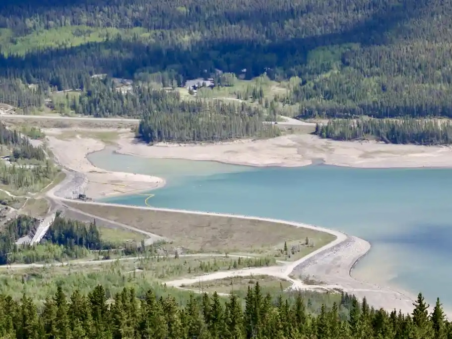
Features: Yates Mountain via the Prairie View Trail begins with a walk across the Barrier Dam before climbing steadily up an old forestry road on a series of switchbacks. The route soon opens into a clearing with sweeping views over Barrier Lake and Mount Baldy. From the main lookout, the trail narrows and becomes more rugged, with rocky sections leading toward the summit where you’ll find a small cabin, a helicopter pad, and a few picnic tables.

Directions to the Yates Mountain (Barrier Lake Lookout) Trailhead

You shouldn’t have much trouble finding this popular trailhead. The Yates Mountain hike begins on the Prairie View Trail from the Barrier Lake Day Use Area, only 2 km south of the Kananaskis Visitor Information Centre on the right-hand side. Driving from the northwest of Calgary takes just under an hour. There’s an outhouse next to the parking area.
Read next: Upper Kananaskis Lake Trail: Family-Friendly Kananaskis Hike

Yates Mountain via Prairie View Trail — A Moderate Hike in Kananaskis

After double-checking your day pack, start hiking along the dirt road on Barrier Dam toward Prairie View Trail. Continue into the woods and follow switchbacks through the forest along Prairie View Trail. This part of the hike was pretty underwhelming. Even so, I’m always glad to spend time outdoors in the fresh mountain air. When I visited, it was quite hot and sunny and I was drank plenty of water (I had a two-litre reservoir and a water bottle).
After about 5 km hiking uphill, you’ll leave the trees and find panoramic views of Barrier Lake, Mount Baldy, and the Kananaskis Valley. This first lookout isn’t too hard to reach on moderate grades and nothing overly technical. However, reaching the second lookout isn’t as easy, and the final Barrier Lake Lookout involves steeper and more challenging terrain. As a moderate Kananaskis hike, it’s manageable for most hikers (and beginners with gumption!).
Read next: Ribbon Falls Hike in Kananaskis, Alberta


Yates Mountain Summit & Barrier Lake Lookout

After the first viewpoint, there’s only about a kilometre and around 135 metres left to go for the Barrier Lake Fire Lookout. This stretch becomes steeper with large rocks to navigate up and around. I used hiking poles for this section, especially returning downhill with loose gravel. It’s a fairly straightforward route with a few orange ribbon markers.
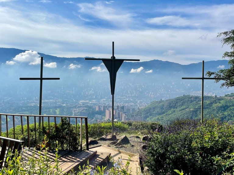
On top of Yates Mountain, you’ll see a helicopter landing pad and the fire lookout cabin (do not enter the property without permission). Please show respect to those who help maintain and preserve Kananaskis Country. This is a great place for a snack or lunch break on one of the picnic tables. If the weather cooperates, catch views of Mount Yamnuska above the Trans Canada and the Kananaskis Valley.
Give yourself 3 to 4.5 hours to hike out and back. I hiked for about 3.5 hours, including stops for photos and a snack break at the top. The total distance is around 12.5 km.
Note: Hikers can complete Yates Mountain as a loop instead of an out and back. Stay west on Prairie View Trail and connect to Jewell Pass. Budget an additional hour or so for the extra kilometres. I’ve heard Jewel Pass is a great option if you have the time and energy. Otherwise, return on the same route (that’s what I did).


What to Bring for Hiking in Kananaskis Country

Yates Mountain via Prairie View Trail is a moderate Kananaskis hike that requires hiking essentials and preparation. Before heading out, be sure to pack enough food and water for the duration. Bring a day pack with extra layers (like a rain shell) and sun protection if you’re hiking in hot weather. You can choose to wear hiking boots or trail runners, but I preferred boots for this one. Bring those trekking poles for extra stability on the descent. And maybe bring a camera or smartphone for those picturesque shots (I like to use this Anker power bank to keep things charged on the go).
Psssst. Have you heard about the 10 Hiking Essentials? If you’re new to this hiking thing, make sure you bring what you need in your day pack.
Wildlife in Kananaskis Country
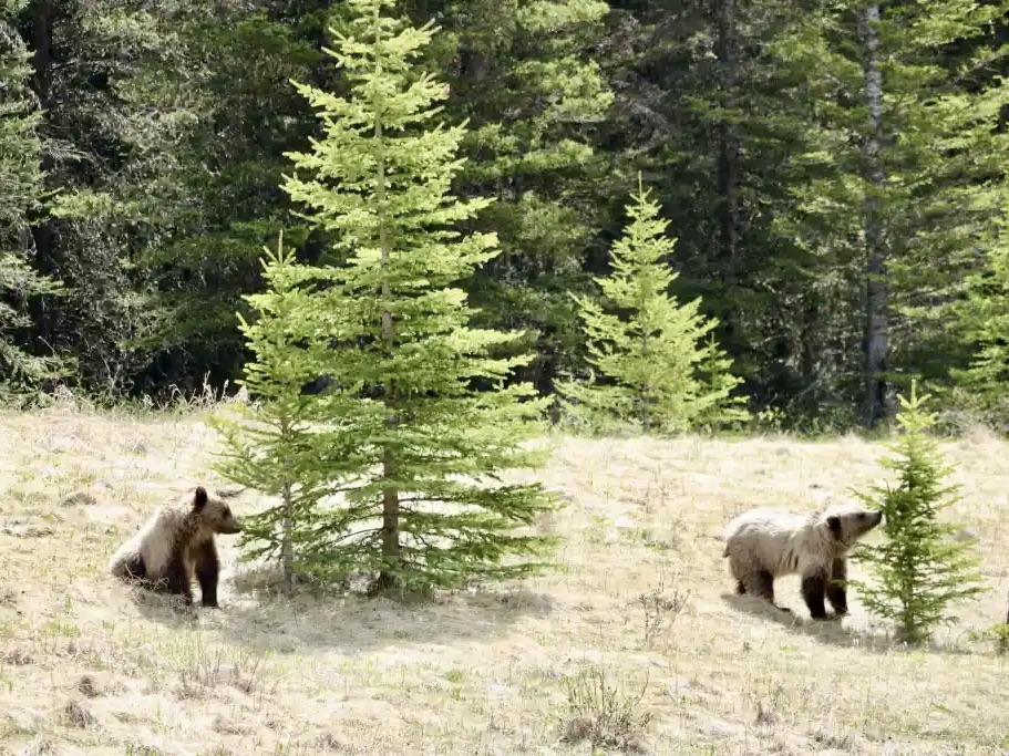
Kananaskis is prime grizzly bear territory. There are somewhere between 50 and 75 grizzlies in the area. Driving down Highway 40, remember to take your time and watch for wildlife on the roads. If you’re not familiar with grizzlies (I wasn’t until I moved to Alberta…), become bear smart before your hiking adventures. One of my favourite bear books is What Bears Teach Us, which gave me some insight into the life and behaviours of grizzlies (great coffee table read with stunning photography by John E. Marriott from Canmore).
Avoid surprising bears by talking on the trail and hiking with friends. Leave those bear bells at home, though (they don’t work…). Keep your pets on a leash. If you happen to cross paths with a bear, have your bear spray ready (in a holster, preferably).
Note: Kananaskis Country is home to a variety of wildlife, including elk, moose, big-horned sheep, wolves, cougars, and black and grizzly bears. Keep a healthy distance from wild animals, and never feed or approach wildlife. Together, we can do our part to help keep wildlife wild.

Know Before You Go — Hiking in Kananaskis Country

Park Pass: A Kananaskis Conservation Pass is required for each vehicle in K-Country. Register your license plate online (up to two vehicles per household) before arriving.
Parking: You can park in the Barrier Lake Day Use Area. The parking lot often fills up in the summer months, so arrive early to find a spot.
Toilet: Outhouses available at Barrier Lake Day Use.
Pets: Dogs are permitted on the trail but must remain on a leash. Please pick up after your pet and consider bringing a smell-proof bag.
Water Source: No water source is available near the trail. Bring at least two litres of water in a water reservoir or water bottle.
Navigation: Prairie View Trail is fairly well-trodden and marked, though you won’t find “Yates Mountain” signs. Bring the Gem Trek Canmore and Kananaskis Village map and a compass, just in case. You could also download Yates Mountain via Prairie View Trail on AllTrails for offline use.
Leave No Trace: If you pack it in, pack it out. Don’t leave any garbage or organic waste on or near the trails. Help preserve this natural area by following Leave No Trace principles.

More Kananaskis Hikes For Your List

Here are some more Kananaskis hiking trails for your list:
- Galatea Lakes Hike in Kananaskis Country, Alberta
- Upper Kananaskis Lake Trail: Family-Friendly Kananaskis Hike
- Ribbon Falls Hike in Kananaskis, Alberta
- Rawson Lake Hike in Kananaskis, Alberta
- Arethusa Cirque Hike in Kananaskis Country

Have you hiked Yates Mountain via Prairie View Trail? What was your experience like? Let me know in the comments below!
Save this for later? Hover over the image to add to Pinterest 👇
Thomas Coldwell has always been fond of the outdoors. He loves hiking, paddling, and camping, and thoroughly enjoys creating outdoor adventure resources for people like you. Originally from Nova Scotia, Thomas has lived in four Canadian provinces (NS, NB, ON, AB) and has travelled in 20 countries and counting.


Thank you for this! I just bought a book on hiking and Yates wasn’t on it, so glad I have someone’s experience before hading out.
Glad you found this helpful! Great hike — hope you enjoy it.